| Peak(s): |
"V 2" - 13,319 feet "Middle Point" - 13,266 feet South Lookout Peak - 13,420 feet "V 5" - 13,164 feet |
| Date Posted: | 08/29/2016 |
| Date Climbed: | 08/16/2016 |
| Author: | SnowAlien |
| Additional Members: | gb, mtnbikerskierchick, Grizzly Adams |
| Peak(s): |
"V 2" - 13,319 feet "Middle Point" - 13,266 feet South Lookout Peak - 13,420 feet "V 5" - 13,164 feet |
| Date Posted: | 08/29/2016 |
| Date Climbed: | 08/16/2016 |
| Author: | SnowAlien |
| Additional Members: | gb, mtnbikerskierchick, Grizzly Adams |
| Clear Lake Clean Sweep |
|---|
|
I didn't do a report on "V 2" last year, but looking back, this was one of the best days I've ever had in the mountains, so I may as well put it on paper. Please excuse the GPX spagetti monster, it is combined from 2 trips into the area. South Lookout Pk (attempt), V2 skiDate: June 18, 2015 Trailhead: 11,100 on Clear lake road Distance: ~8 miles Elevation Gain: 3,800 Vertical skied: 3,000+ Time: 8.5 hours Max speed (me): 27 mph Partners: Frank and Brittany Konsella, Josh from Crested Butte 14erskiers report (more succinct rendition of the day by Frank) After successful, but slightly scary and exhausting ski of Gladstone, Brittany and I made an exciting drive in my Subaru over Ophir pass, arriving in Silverton in time for dinner. Frank and his friend Josh from CB joined us a few hours later. There was some talk about skiing a few lines around Clear lake. In the morning, we piled up in Frank's 4-runner and started up the road. I've been on this road once before for Vermilion, but this time we kept driving. Only we didn't go that much further, as the downed trees blocked the road. Snow patches started soon thereafter. We organized the gear and hit the road in trail runners with skis on our packs around 6 am. After 12-hour Gladstone escapade, I was seriously sucking wind, while Brittany was looking fresh as a daisy, as Frank and Josh booking ahead as usual on fresh legs. I had my work cut out for me, so thank you Gu. 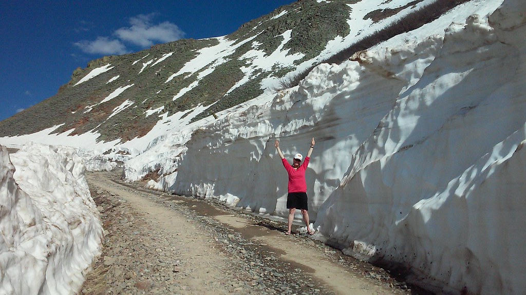 Ophir pass soon after opening - this girl gets pretty excited about snow 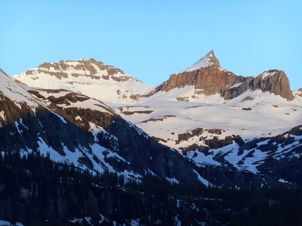 Next morning 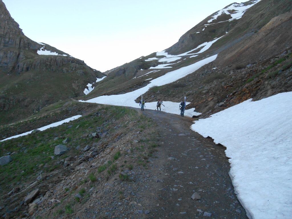 Gang plods to Clear lake Upon arrival at the lake, we discover that the intended line is gone, it's choke obliterated by recent rains. The consensus it to head for Plan B, a smooth-looking South facing line at the far end of the lake. The plot keeps changing and I have trouble keeping up. It's my first time there and I am thumbing through Gaia for orientation. The task is pretty simple though - just keep heading up. 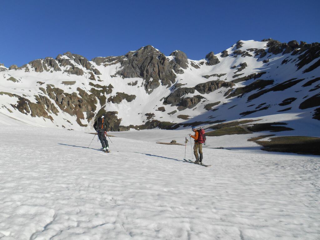 Josh and Frank at Clear lake with our line on S. Lookout in the background on the right 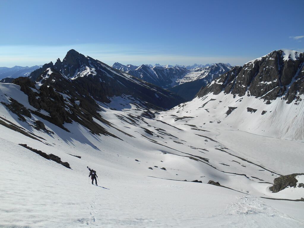  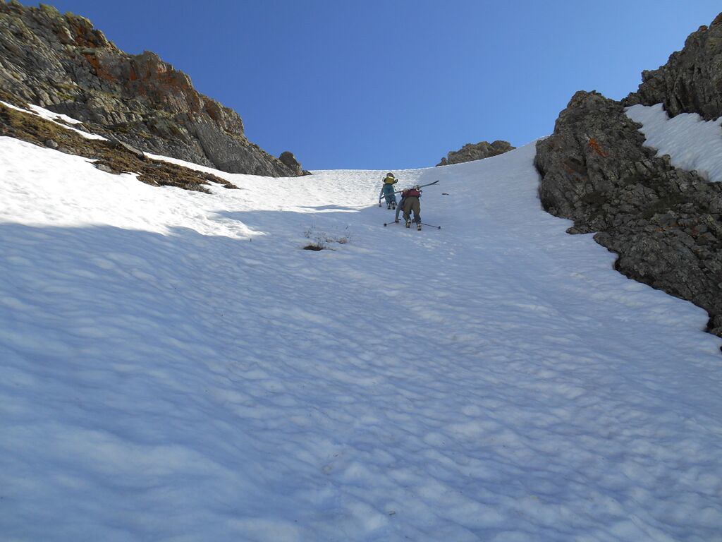 Brittany kicks steps after a huge day on Gladstone, with Frank right behind By the time we reach the high point, I've finally figured out that some 13er called "South Lookout peak" is less than 200 feet away. Frank and Josh have no interest in tagging the summit as there is no snow and are eager to ski down on ripe corn. I ask Brittany if she minds waiting 30 minutes as I try to tag the summit. Being a great partner she is, she agrees to wait. I didn't leave my trailrunners at the lake as I was afraid that marmots would get them, so I am ready. I make a quick traverse on snow, transition into trail runners from ski boots, while looking at the summit bump and... don't see an obvious route. Hmmm. Very strange. I make a valiant effort scrambling up some scary loose C5 chimney head-on hoping the difficulty would ease, but it doesn't. Very strange indeed. Clock is ticking. I realize that route finding will take me longer than I have time for. Unable to quickly solve the puzzle, I downclimb, conceit the defeat and retreat back to patiently waiting Brittany. I switch back into ski boots and a sublime ski follows.  Josh on our hight point. Contrary to what Frank says, he is not a fan of skiing rocks  Frank skiing with V5 in the background 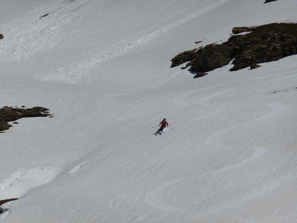 Brittany - South Lookout  Me on South Lookout Since skiing is still, ahem, glorious, the group decides to keep going and to follow the sun for another line. Now I really have to dig deep. Nothing else to do, but eat more Gu and try to hang on. 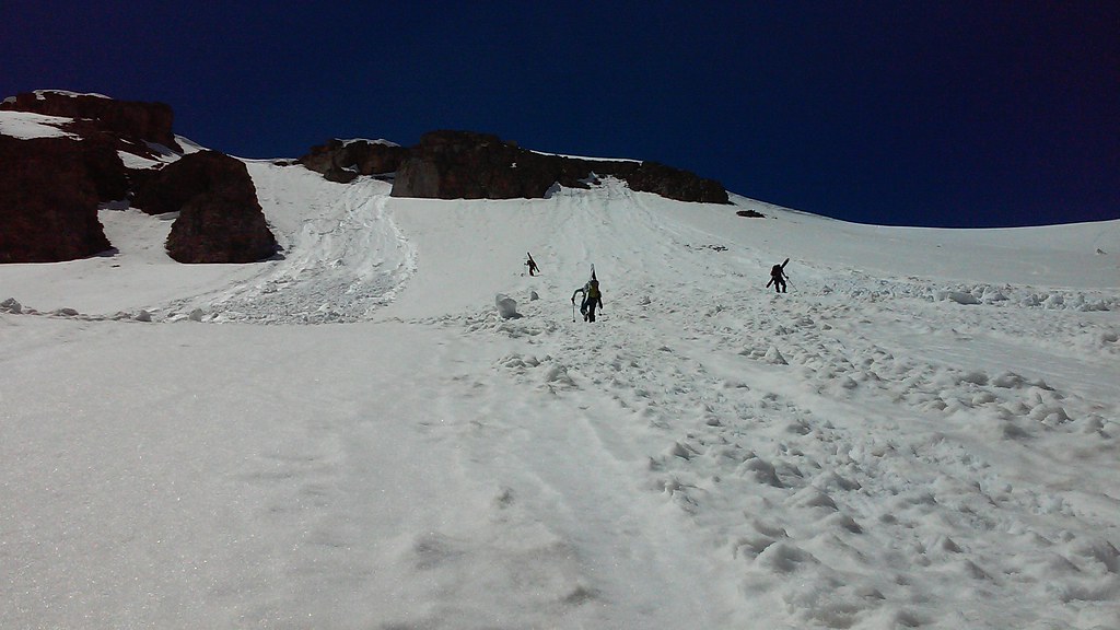 Up and up and up 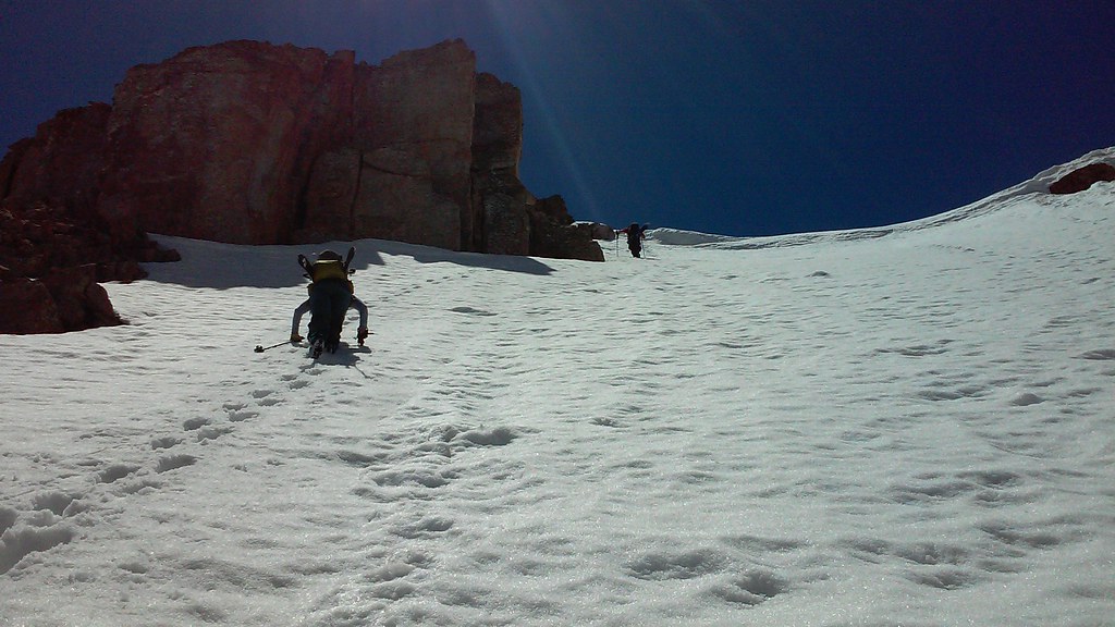 Booting up 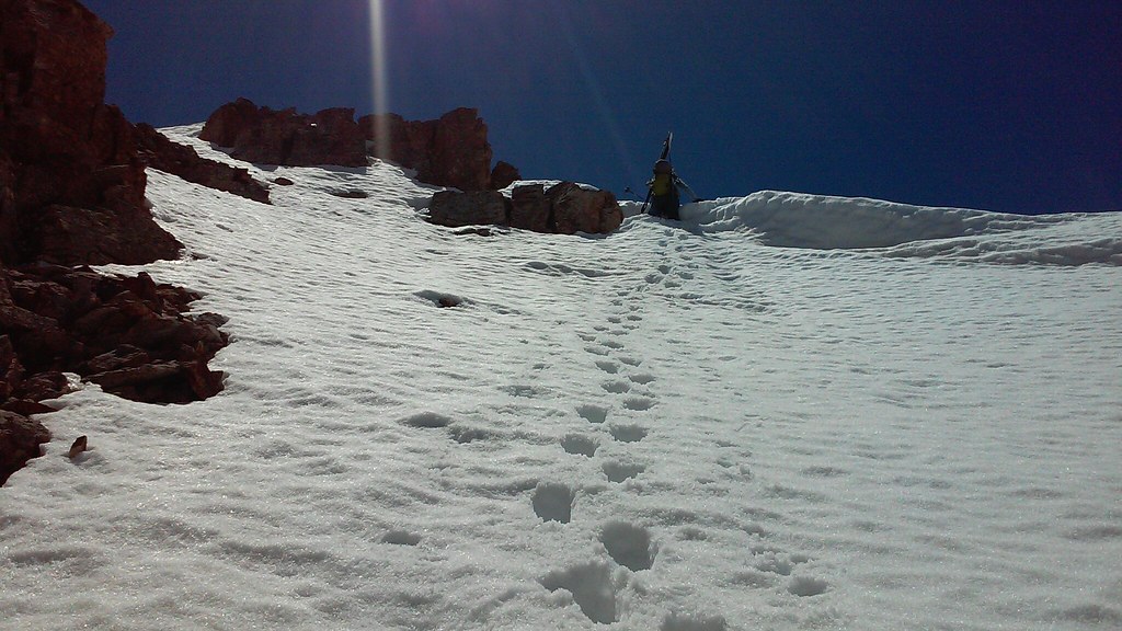 Brittany is topping out on the lip 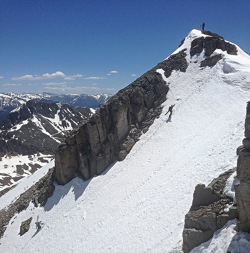 Another angle - near the summit ridge of V2 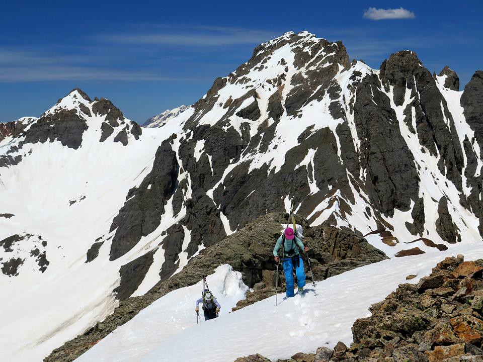 Nearing the summit of V2 (or at least the top of the ski line). Photo by Frank 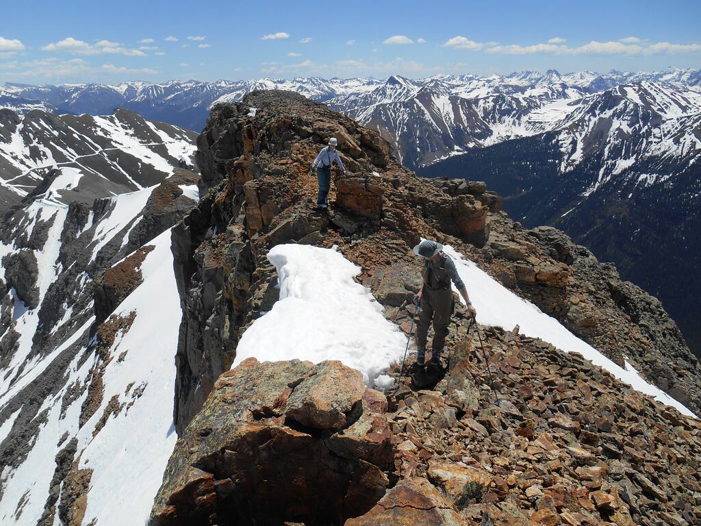 After dropping the skis we hike to the summit (since it's close) in ski boots. 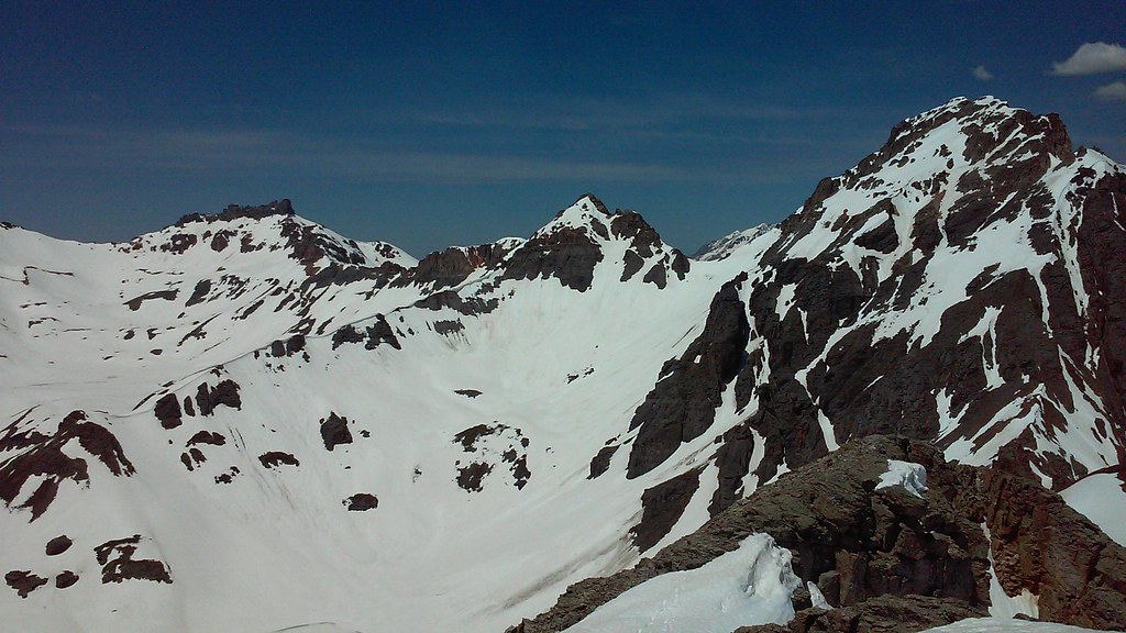 Views are somewhat ok, I guess 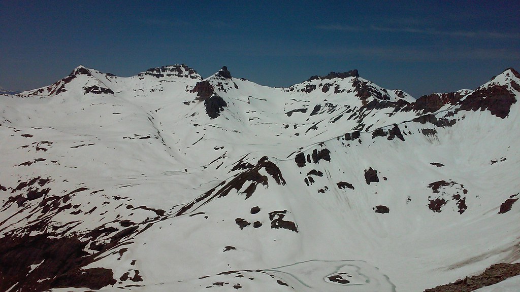 But enough of the peak-bagging silliness. We rush back to the skis as the snow is heating up. No more delays. Time for the fun stuff. 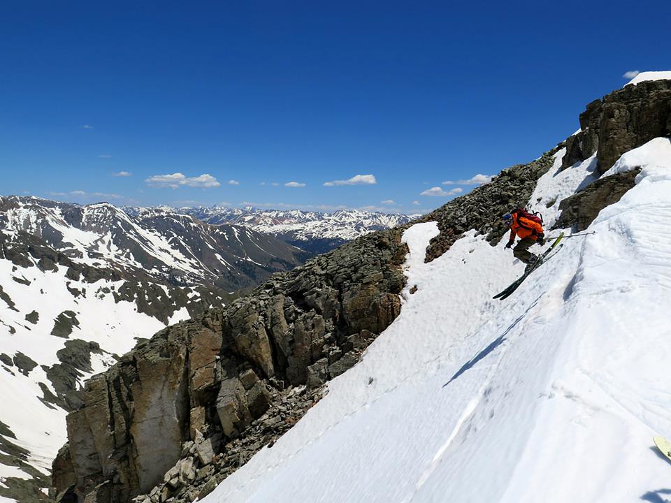 Frank goes first 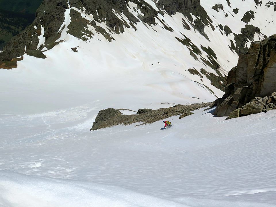 Brittany 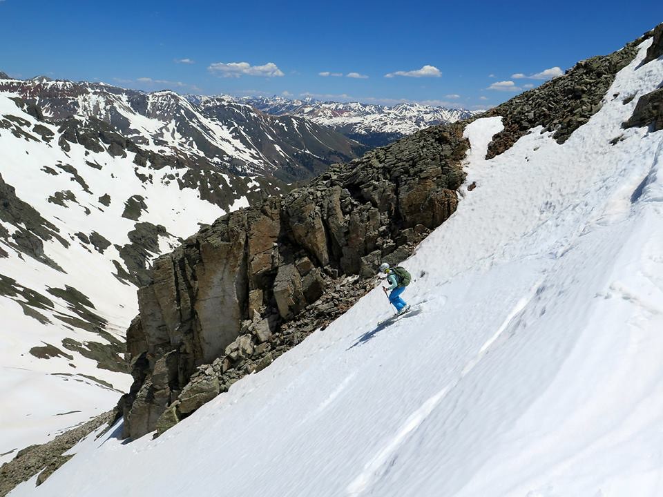 Me 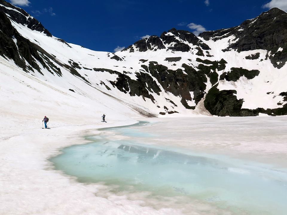 Back at the lake - what a glorious day! Back at the motel room, I fire up the internet and look up the reports on South Lookout peak. Alright then, I'll be more prepared next time! UN 13,300 E, South Lookout Pk (we think), V5Date: August 16, 2016 Trailhead: Clear lake parking lot near 12,000 ft Distance: ~4 miles Elevation Gain/Loss: 2,800 ft Time: 8 hrs 45 min Partner: Shawn (Grizzly Adams) After being pretty worked in Weminuche, we were looking for an easier and shorter day. We both had to be back at work the next day and I had a pretty long drive ahead of me. Turns out, Shawn wanted to do South Lookout for years, and I was reminded of the peak by a recent San Juan TR. We car camped at South Mineral campground and decided to get an early start due to potential weather (storms in the afternoon). We piled in the Shawn's truck at about 5 and were at the lake before 6 am. After gearing up we started in the direction of UN 13,300, just as it was getting brighter. 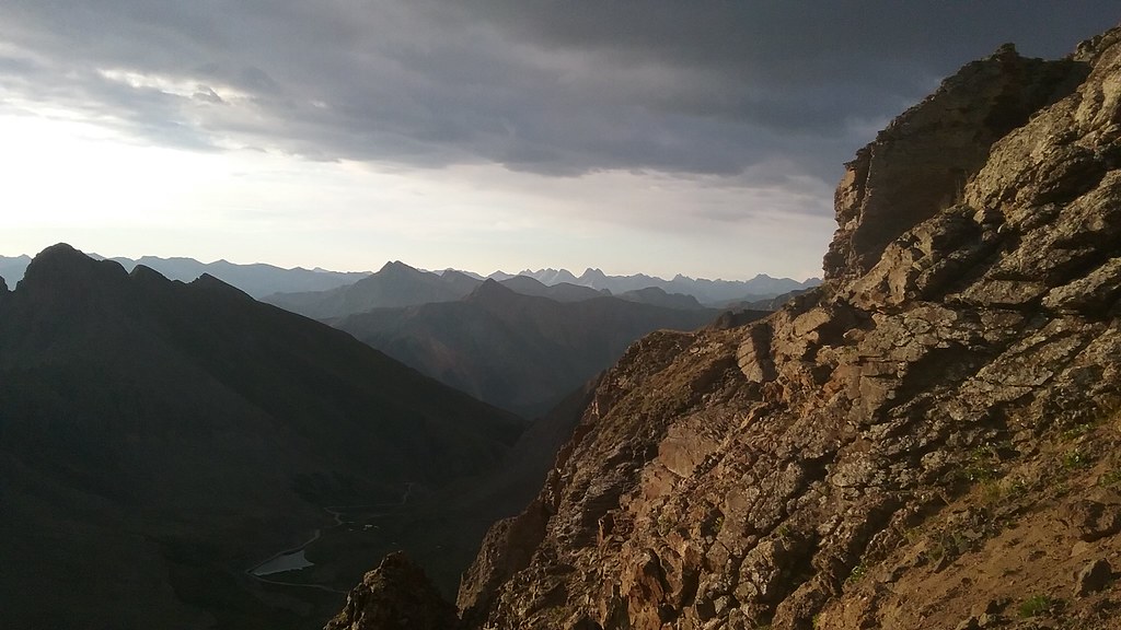 Shawn is in exploratory mood this morning and takes an alternative route. I get to UN 13,300 first and wait. Not a bad place to spend a few extra minutes. 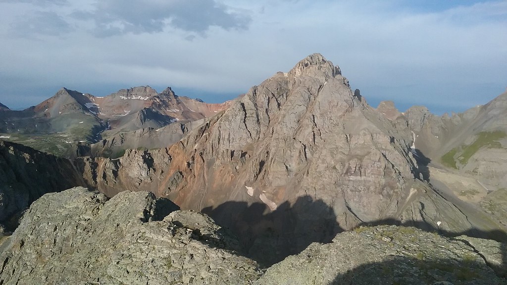 Familiar peaks without winter coat this time 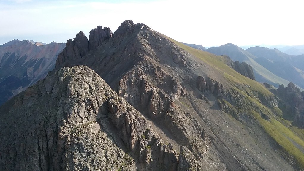 South Lookout from UN 13,300 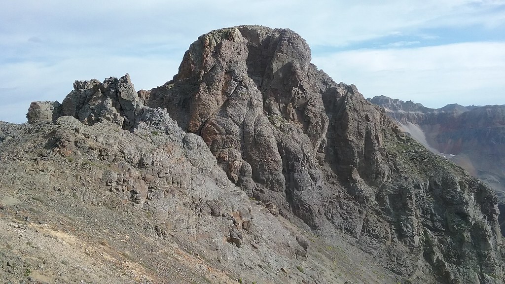 South Lookout, we are coming for you! San Juan scree is much less pleasant without snow, so the approach was tedious. With 2 sets of eyes, we identified the correct gully and headed up one by one. We brought harnesses and two 30m ropes just in case, but ended up not needing them. Training weight that probably slowed us down that day. 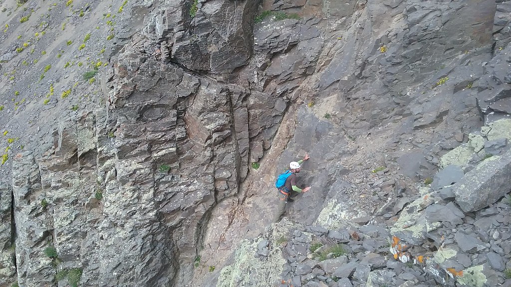 Shawn climbing the steep and loose "dark gully" 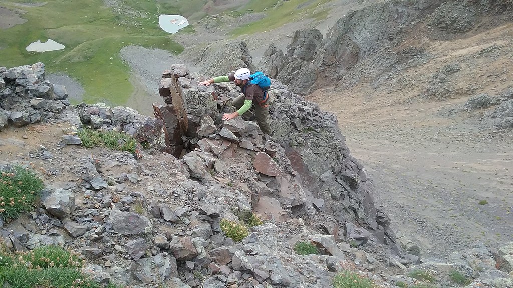 Still loose 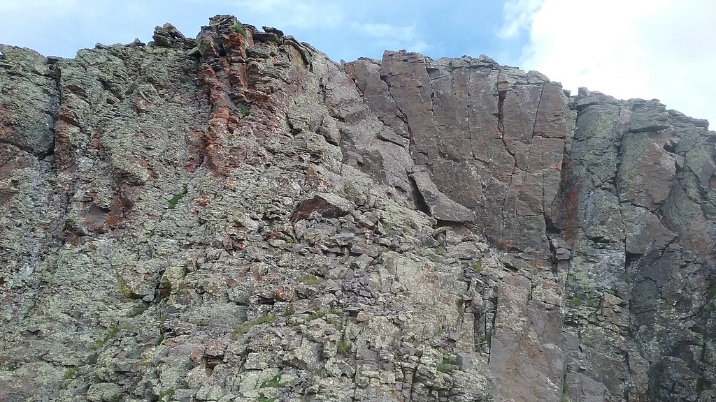 Summit block 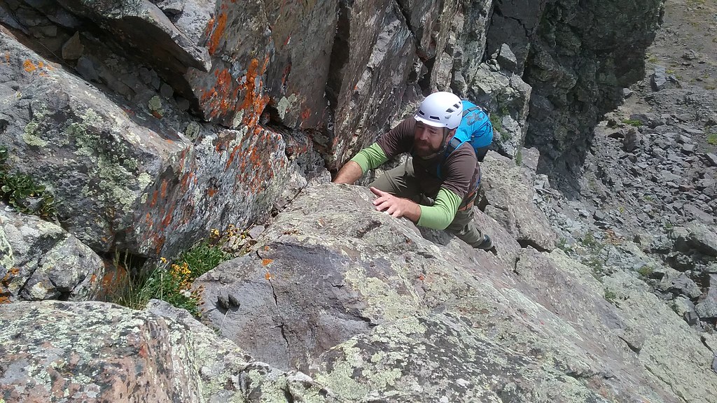 Jammin' time 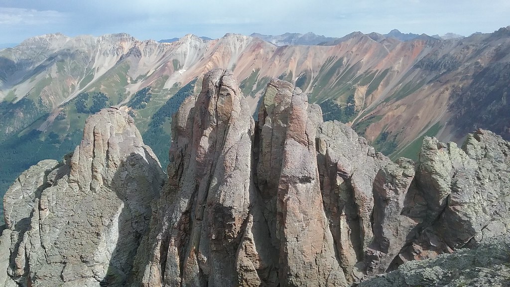 True summit or not? 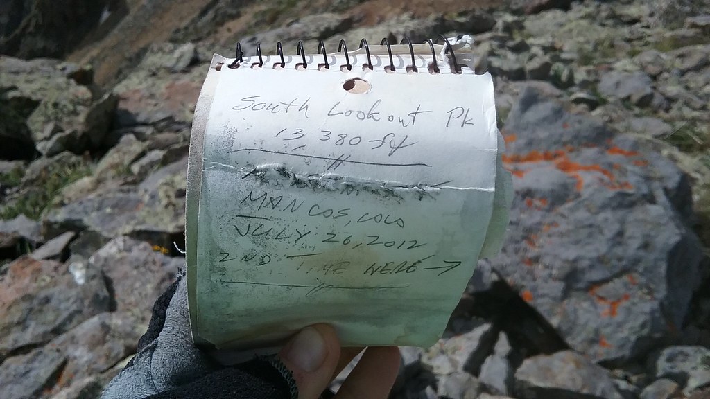 Well, at least the one we were on had a register 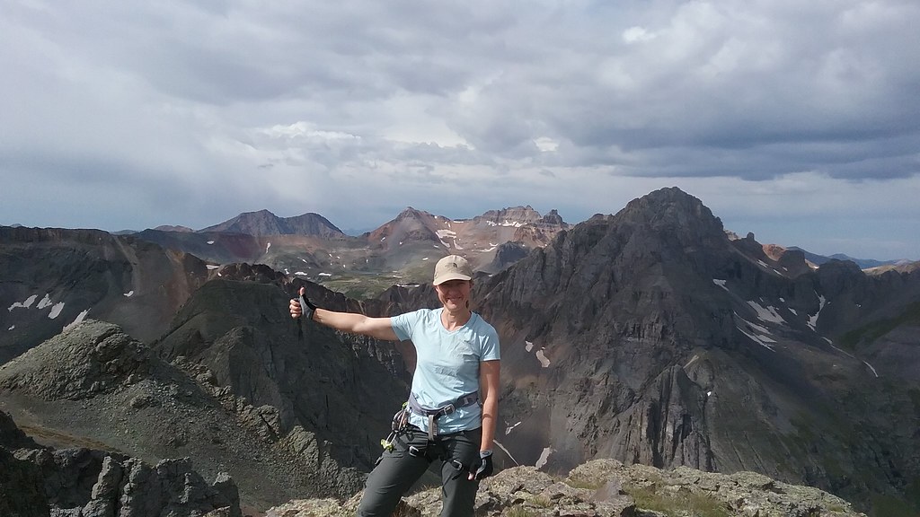 Pretty stoked to be on this peak 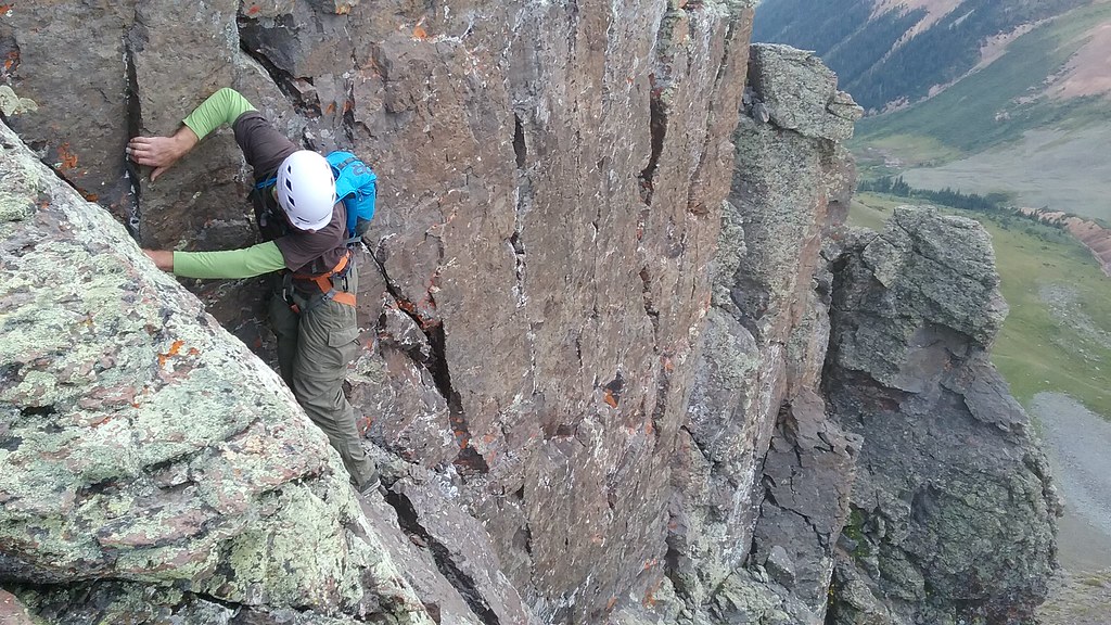 Shawn downclimbs 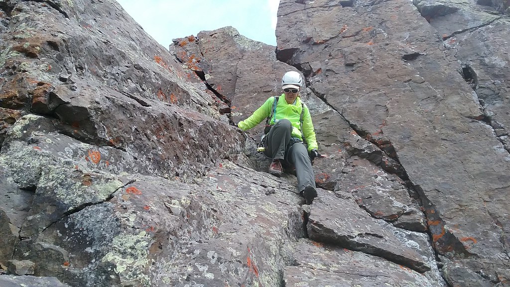 I've been getting more comfortable with facing-out, canyoneering downclimbing technique recently The crack system we found near the summit had the most solid rock of all the mountain. We felt secure going up and down it. We very carefully retraced our steps on the loose lower part. 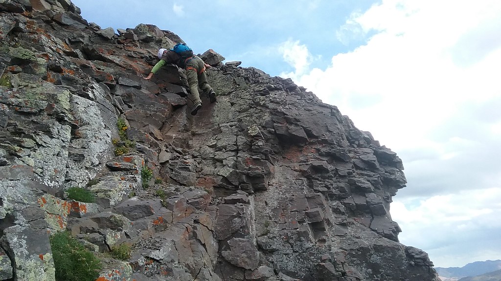 Above the gully - steep and loose 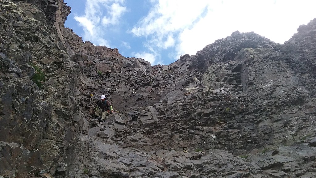 Tedious and slow downclimb in the "dark gully" After retracing steps to the S. Lookout grassy sub-summit, we began the long traverse towards 11th and last peak of our trip. Weather started to looks somewhat threatening, but not in the immediate vicinity. 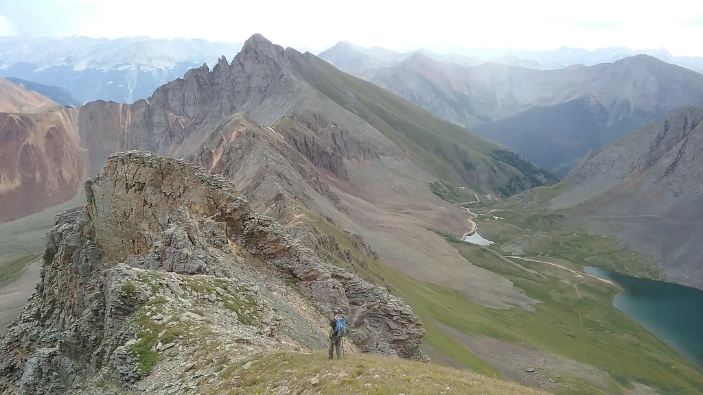 Ridge towards V5 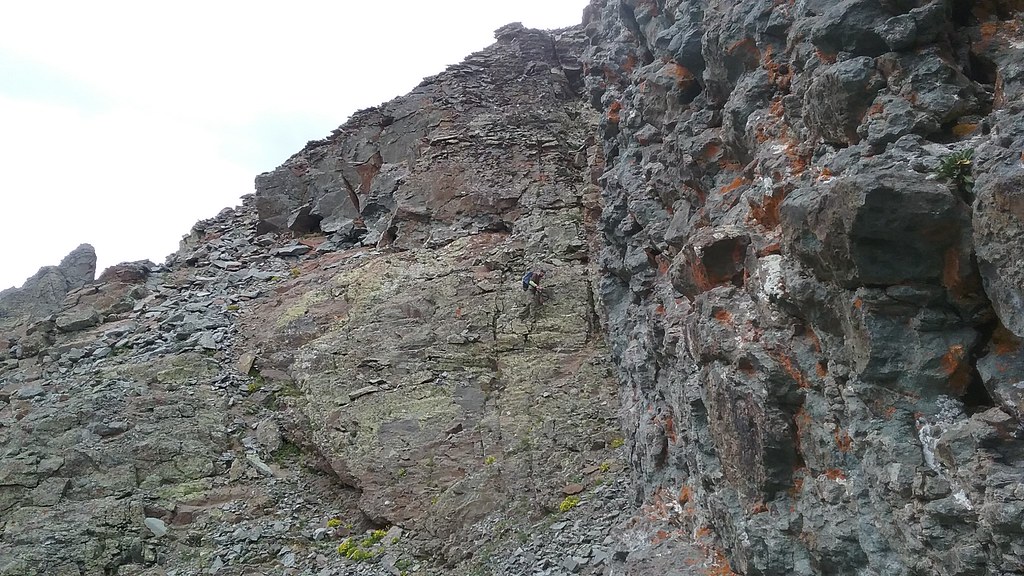 We couldn't resist getting a little more climbing in on the ridge 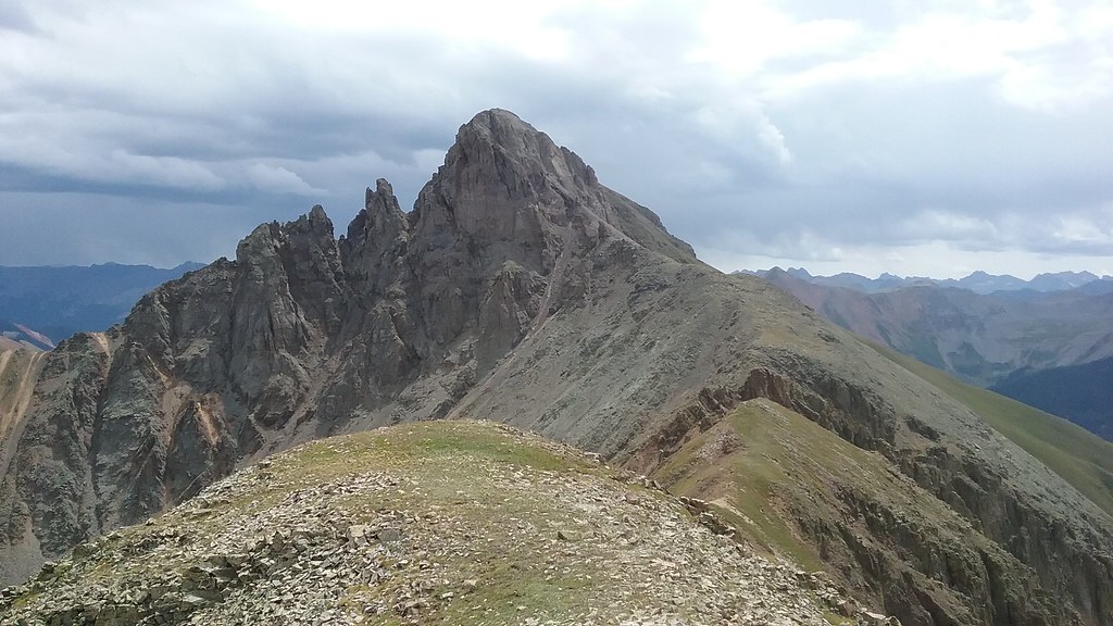 We kept wondering when we'll get rained on. But we were not quite prepared for the cold reality... Unnecessary rope and webbing was really starting to slow me down and couldn't wait to leave it at the bottom of the steep stuff. 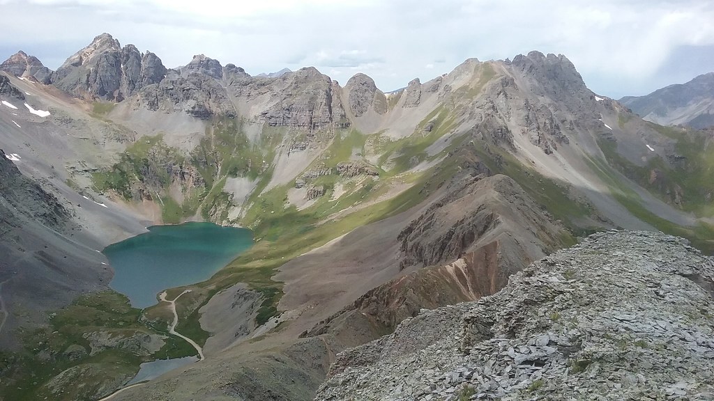 Finally 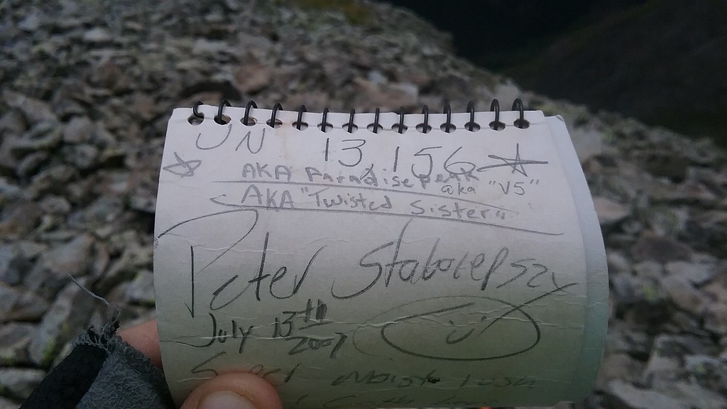 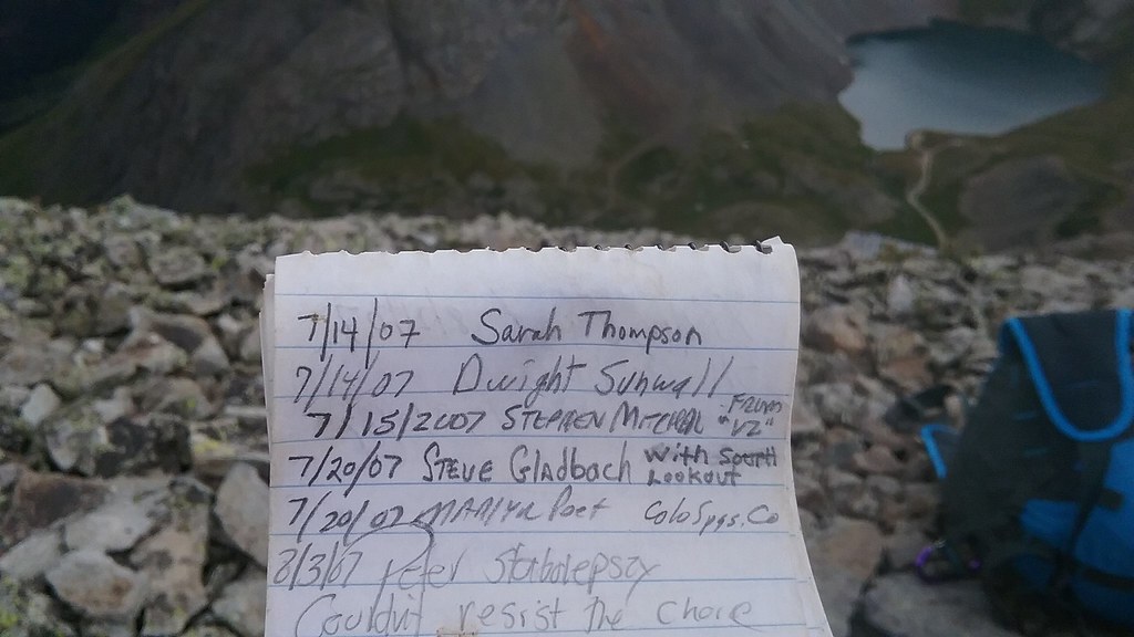 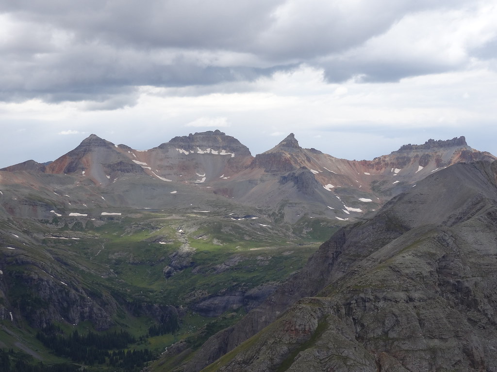 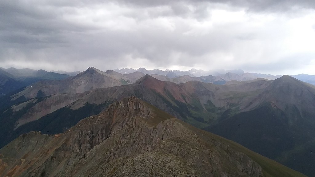 Alright, I guess we can go home now 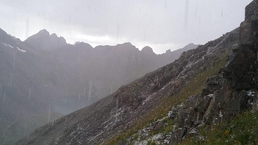 Graupel on the descent was completely uncalled for! Back at the car around 3pm or so, with just enough time to hit the Orvis Hot springs for a nice shower, Wendy's in Montrose for food, and start the drive back home. |
| Comments or Questions |
|---|
|
|
Caution: The information contained in this report may not be accurate and should not be the only resource used in preparation for your climb. Failure to have the necessary experience, physical conditioning, supplies or equipment can result in injury or death. 14ers.com and the author(s) of this report provide no warranties, either express or implied, that the information provided is accurate or reliable. By using the information provided, you agree to indemnify and hold harmless 14ers.com and the report author(s) with respect to any claims and demands against them, including any attorney fees and expenses. Please read the 14ers.com Safety and Disclaimer pages for more information.

