Download Agreement, Release, and Acknowledgement of Risk:
You (the person requesting this file download) fully understand mountain climbing ("Activity") involves risks and dangers of serious bodily injury, including permanent disability, paralysis, and death ("Risks") and you fully accept and assume all such risks and all responsibility for losses, costs, and damages you incur as a result of your participation in this Activity.
You acknowledge that information in the file you have chosen to download may not be accurate and may contain errors. You agree to assume all risks when using this information and agree to release and discharge 14ers.com, 14ers Inc. and the author(s) of such information (collectively, the "Released Parties").
You hereby discharge the Released Parties from all damages, actions, claims and liabilities of any nature, specifically including, but not limited to, damages, actions, claims and liabilities arising from or related to the negligence of the Released Parties. You further agree to indemnify, hold harmless and defend 14ers.com, 14ers Inc. and each of the other Released Parties from and against any loss, damage, liability and expense, including costs and attorney fees, incurred by 14ers.com, 14ers Inc. or any of the other Released Parties as a result of you using information provided on the 14ers.com or 14ers Inc. websites.
You have read this agreement, fully understand its terms and intend it to be a complete and unconditional release of all liability to the greatest extent allowed by law and agree that if any portion of this agreement is held to be invalid the balance, notwithstanding, shall continue in full force and effect.
By clicking "OK" you agree to these terms. If you DO NOT agree, click "Cancel"...
The annual Memorial Day weekend camping trip is always a highlight of the year for me, 16 years and counting now of camping, skiing, climbing peaks, hanging with friends, meeting new friends, new adventures, new places, old familiar places, every year it is something new and always fun. 2016 would prove to be no different, a veritable amalgamation of sights and sounds. This year it would be me and the bro along for the skiing and climbing, and Adan and Steve providing base camp support and entertainment.
We met at the park and ride at 2pm on Friday and made the drive up to the Difficult Campground just outside of Aspen. The plan was to setup camp there, drive over to Lizard Head Pass, climb and ski Mt. Wilson, drive back Saturday afternoon to camp in Aspen. Sunday would be a chill day, then we'd ski Cathedral Peak on Monday. With some minor/major variations this was essentially happened. You are more than welcome to keep on reading to get the full details.
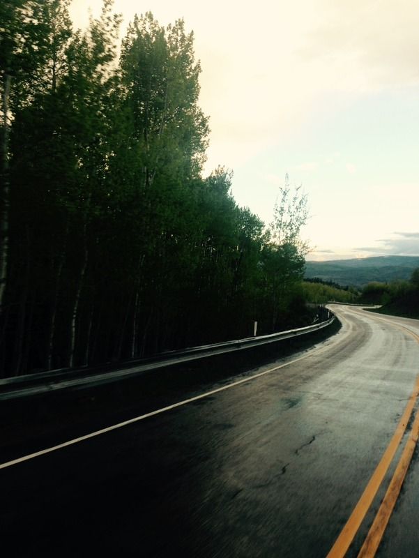
We arrived at the Difficult campground at 6pm, dropped off Adan and Steve and hit the road for the drive to Lizard Head pass. It was a long drive to the San Juans, the road over McLure Pass is long and winding, a long and winding road, sounds like a good idea for a song.
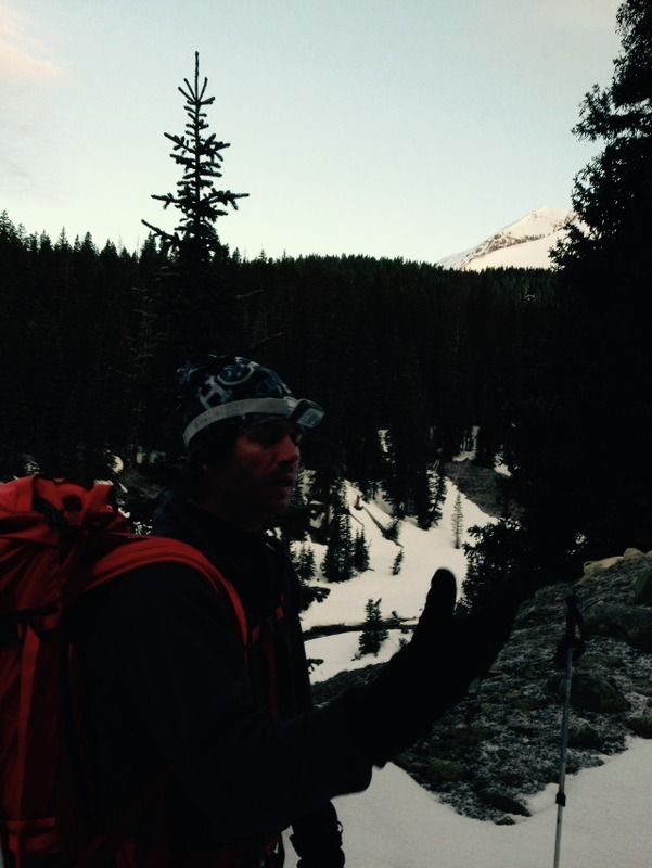
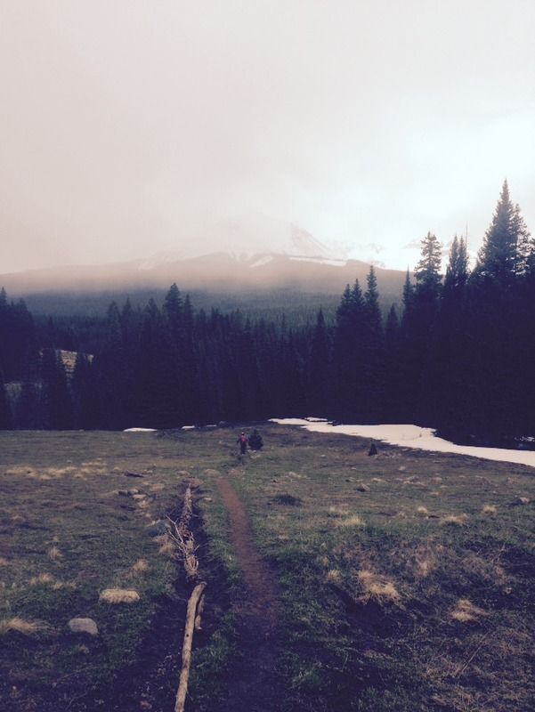
Finally at 11:30pm we found the correct trailhead, met a few other folks planning on heading up the same route the next day. Around 12am we set the alarm for 1:30am and caught a few zzzz's. At 1:30am, after about 30 minutes of sleep, we awoke to the moon rising over the ridge to the west, pleasant temperatures and lifted albeit tired spirits. Heading up the cross trail at 2am, we made quick work to the 11,000 spot on the trail where you are supposed to leave the trail and head northwesterly towards the slate creek basin. That place is a maze, tracks everywhere and a very confusing area to navigate in the dark, bring a GPS track if you have the chance. After another 3 miles and 3 hours wandering in the woods, we finally broke through a clearing and were able to see the creek.
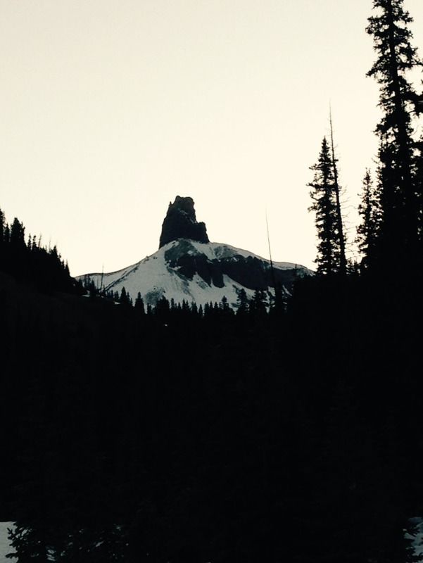
Lizard Head in the early morning light.
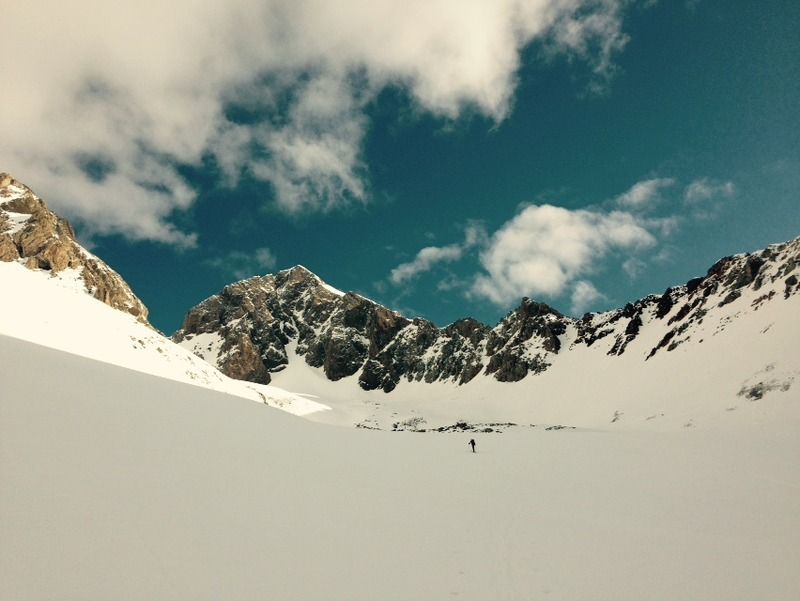
The light of the day helped buoy the spirit, and we were able to start making progress up the basin.
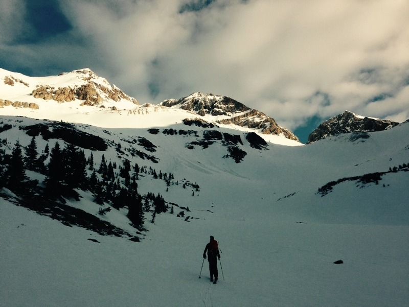
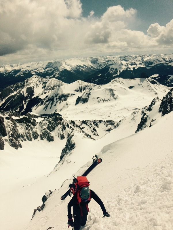
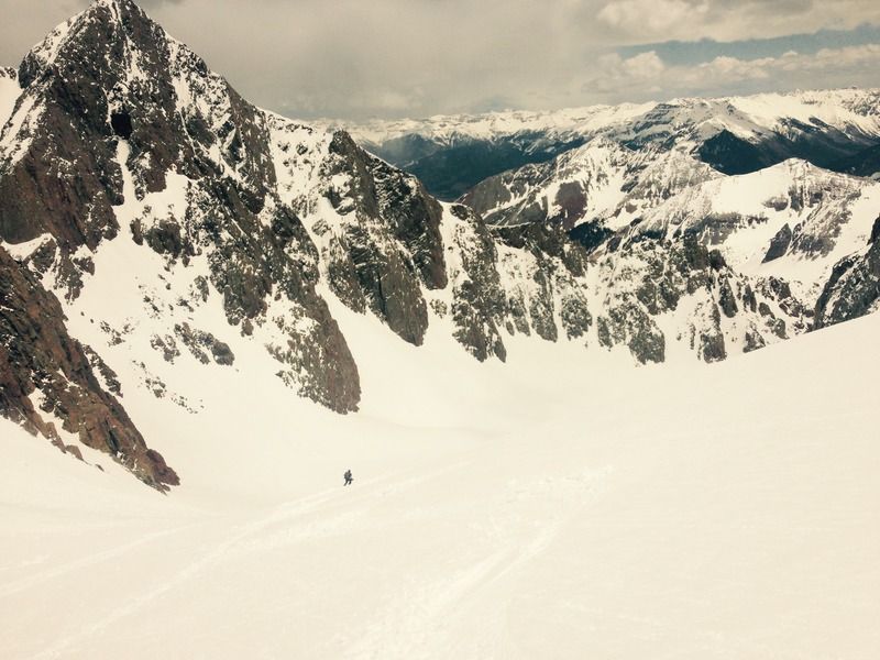
Higher still, Mike ahead putting the vastness of the surroundings in perspective.
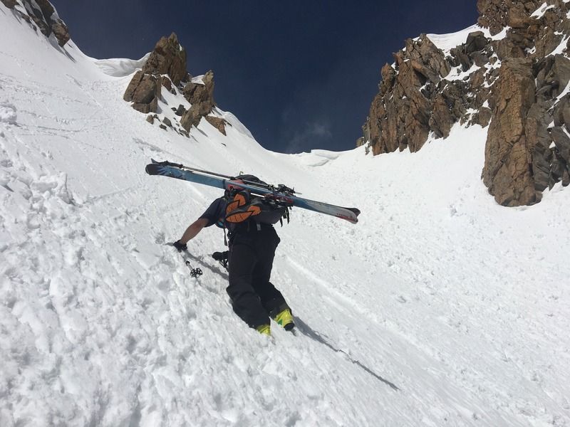
Trying to keep up with Mike.
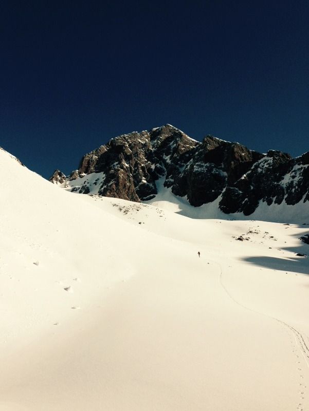
Ever since I first opened Dawson's southern guide 17 years ago I've wanted to be in that slate creek cirque, surrounded by huge peaks in a vast sea of fresh snow, and here I was today, making a dream come true. The electric blue sky was something to behold this morning.
That sky, it's so beautiful, it's so blue, it's almost black.
We were able to get to 13k by 9am, which wasn't too bad considering our 2 hour detour in the woods earlier, suns out, guns out.
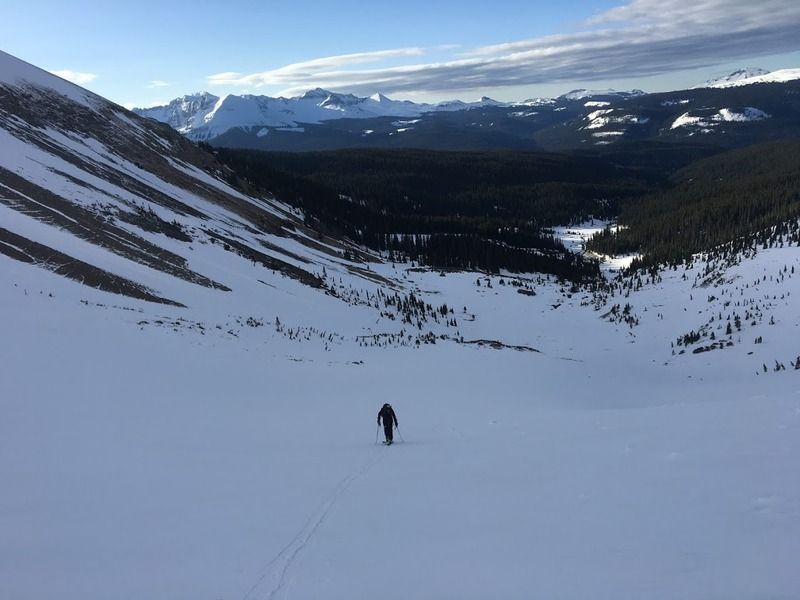
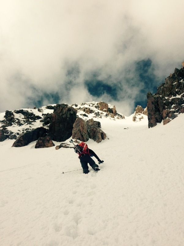
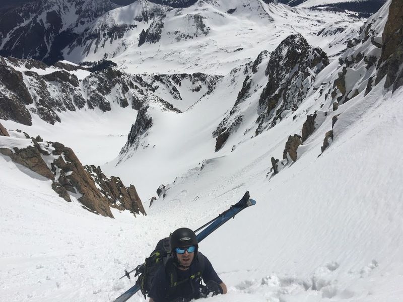
Mike put it in high gear and started booting up, breaking trail in this 6-12" of heavy new snow was wicked hard.
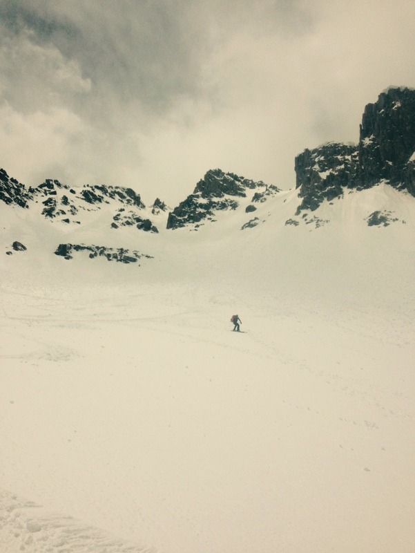
My turn to break trail, looking back at Mike, the way the views unfold on this route are something to behold.
Still me leading, climbing higher still.
Just below the saddle
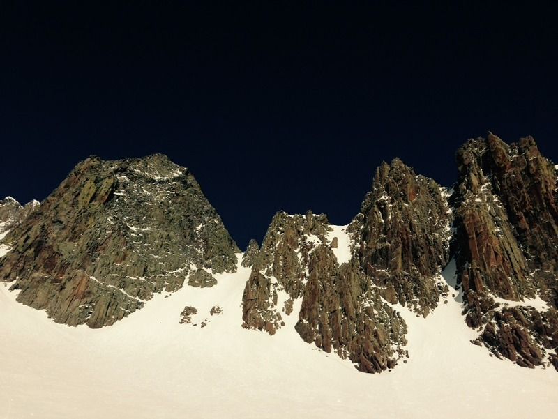
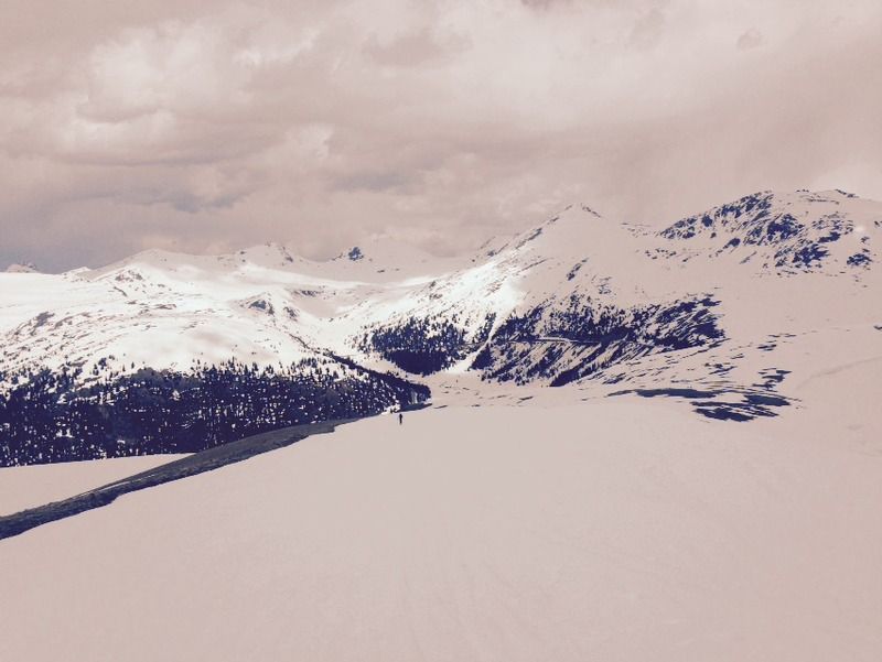
Things were heating up a bit and a decent amount of new snow was peeling on the solar aspects; however, the high clouds provided just enough cover to keep things from getting too out of control. By 10:30am we were at the saddle, we left the skis here and climbed the remaining 100 feet or so to the summit. The summit ski looked like it was doable, thin and icy in sections, but we decided to opt out and climb sans skis to the summit. The climb to the summit started out on the rocky ridge, then we traversed over to the couloir and were on top of a short while later.
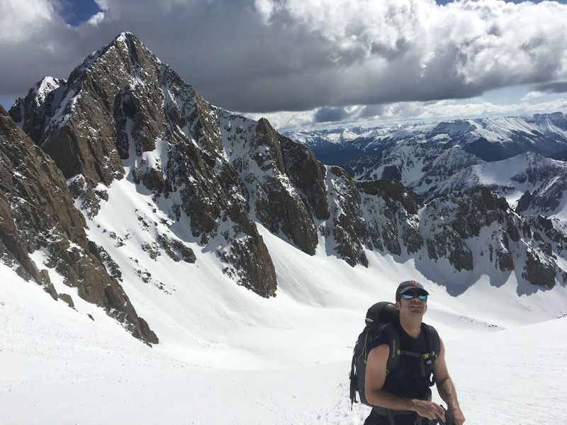
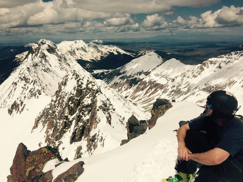
The summit of Wilson is a wild place, I took a seat and looked longingly at El Diente and the connecting ridge and north slopes snow route, sickness.
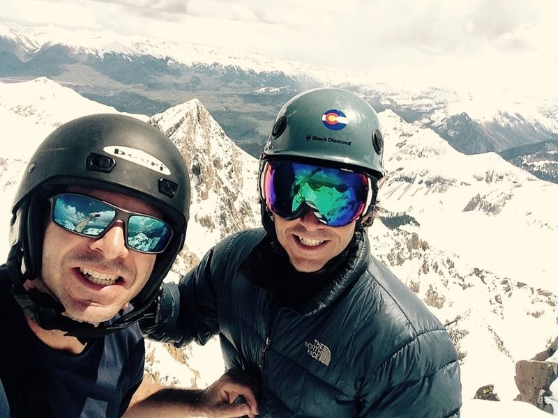
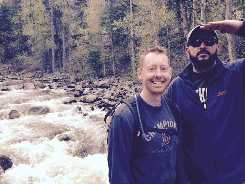
Standard summit shot of me and the bro, highest point in the San Juans, Wilson Peak in the distance. Nice goggles and glasses, looking sharp!
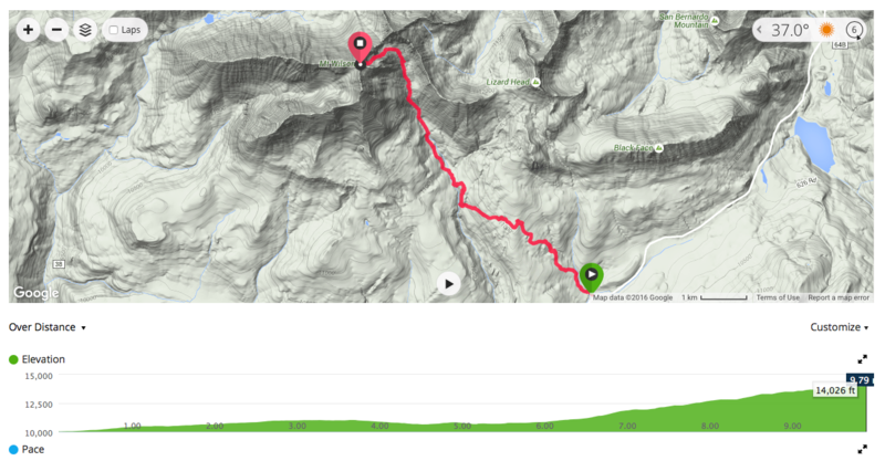
Mount Wilson from the East side the long way, 9.79 miles one way from the trailhead, no wonder we were so tired.
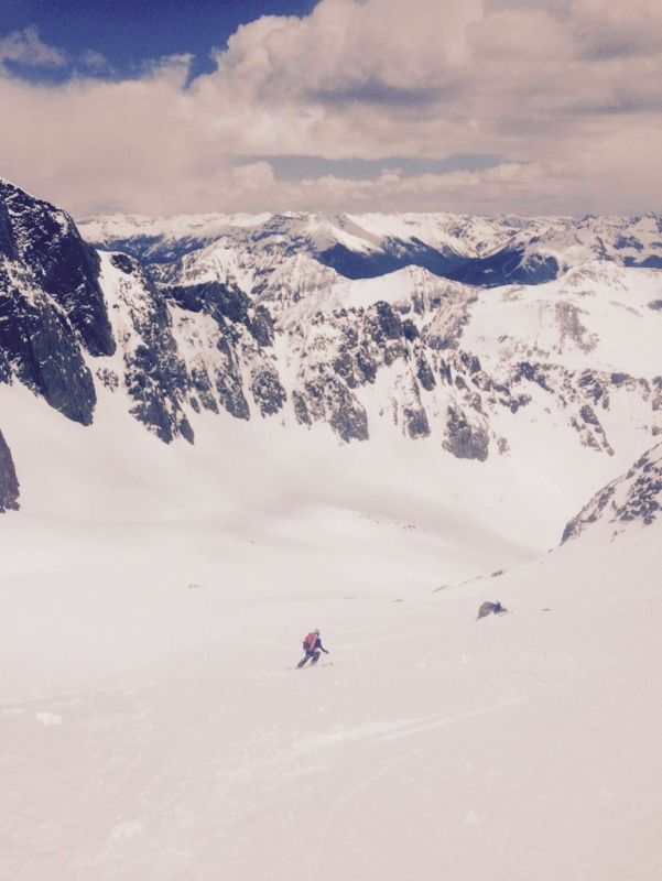
We made it back to the saddle after reversing the route and it was time to ski, there was some traffic on the route so we had to wait to drop in, no worries, it was a cool place to chill. Unfortunately Mike's camera died and mine fogged up for the top part of the ski, but either way I dropped in first and made my way down to around the 13,600 level to watch Mike ski down.
You know I'm just a regular guy who grew up with posters of people skiing 14ers on my wall and now I'm doing it, I'm standing here and I'm living proof that if you work hard enough and you want it bad enough, "dreams come true!", that's right dreams can come true, so follow them!
Mike, your dreams can come true too!
Back to the basin at 1:30pm, where you transition back to skins and climb up and through the woods and over to the cross creek trail, unfortunately the altimeter battery died, so we were left with just a map and compass. Looking back up the basin one last time before we entered the woods, our nemesis, again.
We followed a set of tracks through the woods then proceeded to get spun around in the woods and ended up way too far south, finally we came to a clearing and we realized we'd gone about 1/2 mile too far south and were about 400 feet too low. Fortunately we were able to orienteer from that spot back on a north easterly bearing and eventually intersect the main trail at 4:15pm. Conditions were partly cloudy and mostly surreal by now.
14.5 hours later we were back at the car, now we just had to do the 4 hour drive back to Aspen and our campground. We took turns driving, resting, drinking coffee, and eventually made it back to the campground at 10pm. Thoroughly exhausted, after a couple of beers we were out and didn't get up until 8:30am.
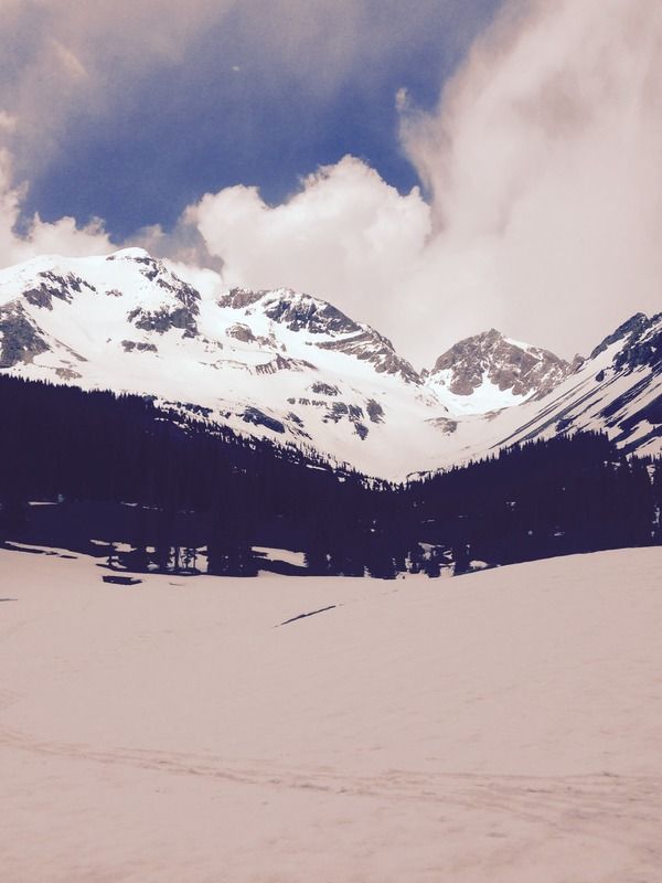
The next day was a chill day with hiking on the difficult trail with Adan and Steve, it's a beautiful trail, nice to be in some green surroundings.
On Sunday, after some serious celebrating, we decided to opt out of Cathedral Peak and just ski Indy Pass on Monday. We did the southerly point 12,812, cloudy day, but overall really good conditions.
Mike skinning up.
Mike skiing down.
Back at the switch back, we met up with Steve and Adan who were hanging otu Chris Van Dine just back from Hawaii who hadn't ridden in 2016, so we let him borrow Steve's snowboard and setup a kicker off of a snowbank, shortly after these dudes Canyon and Bo from Gunnison joined up and we had a grand old time, and we helped Chris keep his 20+ year snowboard streak intact.
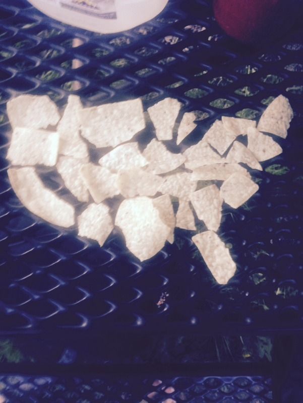
Well, all that was left was the drive back to Denver, we said goodbye to our new friends and hit the road. Another amazing Memorial Day weekend trip, we are blessed to have the freedom provided for us by the brave who paid the ultimate price, especially my Uncle Leo who died in 1969 in Vietnam, it's our duty to make sure that we enjoy it and I always feel like his spirit is close by on these trips. In honor of him and those who have served and sacrificed we made an admittedly rudimentary map of the US out of tortilla chips.
"If you want it bad enough, dreams come true!". Very true. I didn't think I'd be skiing Mt Wilson even couple years ago. Congrats on the ski. Sorry about the woods, it was probably easier in daylight. Also 1.5 hr of sleep? Ouch. You guys are real troopers.
I just got the gpx download from the bro from the trailhead to the summit, 9.79 miles one way, that's exhausting. I think it's supposed to be like 5.5 or so. We suck.
Nice work bro - we keep on moving forward. Every step is one step closer. Well not so in this case.
Caution: The information contained in this report may not be accurate and should not be the only resource used in preparation for your climb. Failure to have the necessary experience, physical conditioning, supplies or equipment can result in injury or death. 14ers.com and the author(s) of this report provide no warranties, either express or implied, that the information provided is accurate or reliable. By using the information provided, you agree to indemnify and hold harmless 14ers.com and the report author(s) with respect to any claims and demands against them, including any attorney fees and expenses. Please read the 14ers.com Safety and Disclaimer pages for more information.
Please respect private property: 14ers.com supports the rights of private landowners to determine how and by whom their land will be used. In Colorado, it is your responsibility to determine if land is private and to obtain the appropriate permission before entering the property.