Download Agreement, Release, and Acknowledgement of Risk:
You (the person requesting this file download) fully understand mountain climbing ("Activity") involves risks and dangers of serious bodily injury, including permanent disability, paralysis, and death ("Risks") and you fully accept and assume all such risks and all responsibility for losses, costs, and damages you incur as a result of your participation in this Activity.
You acknowledge that information in the file you have chosen to download may not be accurate and may contain errors. You agree to assume all risks when using this information and agree to release and discharge 14ers.com, 14ers Inc. and the author(s) of such information (collectively, the "Released Parties").
You hereby discharge the Released Parties from all damages, actions, claims and liabilities of any nature, specifically including, but not limited to, damages, actions, claims and liabilities arising from or related to the negligence of the Released Parties. You further agree to indemnify, hold harmless and defend 14ers.com, 14ers Inc. and each of the other Released Parties from and against any loss, damage, liability and expense, including costs and attorney fees, incurred by 14ers.com, 14ers Inc. or any of the other Released Parties as a result of you using information provided on the 14ers.com or 14ers Inc. websites.
You have read this agreement, fully understand its terms and intend it to be a complete and unconditional release of all liability to the greatest extent allowed by law and agree that if any portion of this agreement is held to be invalid the balance, notwithstanding, shall continue in full force and effect.
By clicking "OK" you agree to these terms. If you DO NOT agree, click "Cancel"...
Peak(s):
Little Bear Peak - 14,041 feet
"South Little Bear" - 14,028 feet
I wasn't going to write up a Trip Report since there are great ones out there already for this route. But Mark took some good photos of me dancing on the ridge and I didn't want them to be wasted bits on some hard drive. Remember to "View With Large Photos", it'll be like you were there.
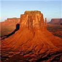
As the list of remaining Winter 14ers diminish, I am starting to run out of easy walk-ups. Okay, so no Winter 14er should be considered an easy walk-up. Even with the mild weather over the past few Winters (which makes me feel like I'm cheating), I find myself having to work hard for the summit and am left sore for a few days after. Last weekend we turned around at treeline on Massive due to winds that perhaps wouldn't have prevented a summit but would have made it a totally unenjoyable summit. With minimal wind in the forecast, I was looking forward to a nice outing on a peak with a nasty reputation. Although much shorter than the summer route via the Hourglass, with 6'000 gain in a 8 mile RT, the SW ridge was definitely going to be an exertion. The Trip Reports indicated that most groups took 12-14 hours which provides some insight on the difficulty.
Like a lot of people, I don't sleep well before these trips. I think I eeked out 2 � hours of sleep before the alarm went off at 2:30. Out of the house at 3am for the 2 hour drive to the trailhead. Traffic was light at that time of day...The directions on Summitpost were pretty good, although I wrote down the wrong distance on the diagonal street so wasn't sure we were on the correct road for the final stretch. But it was pretty obvious when we reached the 90 degree left turn (and confirming with the GPS didn't hurt). The last two roads are...rough. Just like driving up a stream bed.
On Summitpost, Lemke says the route is "quite pleasant below treeline", but I'm not sure I would agree. The bushwhacking led us on a Family Circus route through tight pinon, cactus, snow patches, and talus that would have been disconcerting in the dark if not for geojed's gpx file downloaded to my Garmin. Once we were on the far side of the creek and higher on the ridge where it narrows, things felt a little more obvious. Our route through the forest
The wind decided to ignore the forecast and was pretty strong and gusty early in the morning. I didn't want to turn around like we did on Massive and was really hoping it would die off as the day progressed. It did, but not until we were nearing Mama Bear. One big pile of rocks Out of the trees. The summit must be right around the corner... If I wasn't facing West, I'd say that was Kansas Mark sprinting ahead
I felt pretty good making progress on the ridge until around 13,000 went I hit the proverbial brick wall. Okay I guess it was more of a talus wall. But as most of these things go, just put one foot in front of the other and repeat about 21,000 times (assuming ~2 ft per step averaged out over the 8 miles...). Now it gets fun Remember to fall to the right
I was a little concerned on the difficult of the crux, hoping I wouldn't be forced to turn around 98% of the way to the summit. But with the existing conditions, the crux wasn't much of a crux. Having read all of the trip reports, I had the bypass planned out ahead of time and didn't even give myself time to consider other options. Okay... there is the obstruction on the ridge, there is the middle ledge bypass, drop down to the ledge, cross over, climb up, crux over. Piece of cake. I can see how it could be intimidating if buried by snow, but we were fortunate that it wasn't any more difficult than it would be mid-summer. We carried our ice axes and crampons but they were not needed. Das crux A window on Blanca All three in one winter Heading back to South LB Anyone up for a ridge run? Hmm, which way to go?
I started feeling a little sick on the descent after retracing our steps across the crux. Not sure if it was a little altitude sickness, or perhaps the large bowl of mussels that was dinner the prior night. Next time I think I may choose a more standard pre-hike dinner. So the hike down went slowly, but we made steady progress. Snow was softened in the heat and we frequently found ourselves in knee deep slush. Mark basking in the spring-like temperatures Cactus and pinon
I tried to use the GPS to retrace our steps through the lower section, but I couldn't find our tracks in the snow even though the GPS said we were exactly on top of them. Using the GPS, angled through the forest and ended up right at the truck just as it got dark. Happiness.
Thumbnails for uploaded photos (click to open slideshow):
Congratulations on your ascent. It is kinda fun reading TRs sitting here in the tropics.
Caution: The information contained in this report may not be accurate and should not be the only resource used in preparation for your climb. Failure to have the necessary experience, physical conditioning, supplies or equipment can result in injury or death. 14ers.com and the author(s) of this report provide no warranties, either express or implied, that the information provided is accurate or reliable. By using the information provided, you agree to indemnify and hold harmless 14ers.com and the report author(s) with respect to any claims and demands against them, including any attorney fees and expenses. Please read the 14ers.com Safety and Disclaimer pages for more information.
Please respect private property: 14ers.com supports the rights of private landowners to determine how and by whom their land will be used. In Colorado, it is your responsibility to determine if land is private and to obtain the appropriate permission before entering the property.


 Our route through the forest")
 One big pile of rocks")
 Out of the trees. The summit must be right around the corner...")
 If I wasn't facing West, I'd say that was Kansas")
")
 Mark sprinting ahead")
 Now it gets fun")
 Remember to fall to the right")
 Das crux")
 A window on Blanca")
 All three in one winter")
 Heading back to South LB")
 Anyone up for a ridge run?")
 Hmm, which way to go?")
 Mark basking in the spring-like temperatures")
 Cactus and pinon")