Download Agreement, Release, and Acknowledgement of Risk:
You (the person requesting this file download) fully understand mountain climbing ("Activity") involves risks and dangers of serious bodily injury, including permanent disability, paralysis, and death ("Risks") and you fully accept and assume all such risks and all responsibility for losses, costs, and damages you incur as a result of your participation in this Activity.
You acknowledge that information in the file you have chosen to download may not be accurate and may contain errors. You agree to assume all risks when using this information and agree to release and discharge 14ers.com, 14ers Inc. and the author(s) of such information (collectively, the "Released Parties").
You hereby discharge the Released Parties from all damages, actions, claims and liabilities of any nature, specifically including, but not limited to, damages, actions, claims and liabilities arising from or related to the negligence of the Released Parties. You further agree to indemnify, hold harmless and defend 14ers.com, 14ers Inc. and each of the other Released Parties from and against any loss, damage, liability and expense, including costs and attorney fees, incurred by 14ers.com, 14ers Inc. or any of the other Released Parties as a result of you using information provided on the 14ers.com or 14ers Inc. websites.
You have read this agreement, fully understand its terms and intend it to be a complete and unconditional release of all liability to the greatest extent allowed by law and agree that if any portion of this agreement is held to be invalid the balance, notwithstanding, shall continue in full force and effect.
By clicking "OK" you agree to these terms. If you DO NOT agree, click "Cancel"...
Original plan - Hagerman
Actual result - Belleview
Stats: ~16 miles RT, ~4.3k vertical, ~10.5 hours (with stops)
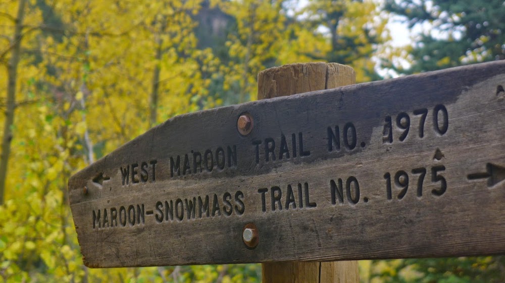
There were a couple of hiking goals this summer, one of them being the Four Pass Loop. I have perused many recent 4 pass loop reports with great interest and anticipation, but after a trip to Weminuche I was out of vacation time for another extended trip in July or August (sigh). At the same time, I wanted to climb Hagerman in the Fall, as I remember the colors were quite nice in the Lead King basin when myself and a group of others climbed the S-ridge on Snowmass back in 2012. The longer I postponed the 4 pass loop trip, the more I liked the idea of combining the two objectives. The crux of the route for me was the TH access. Lacking the 4x4 ride with high clearance, I was at the mercy of my hiking partners. After a couple of cancelations, some last minute, I tried to make a drive to Crystal Mill in my Subaru, but had to abort within a mile. It was time for Plan B. I hurried to the Maroon lake TH, snached one of the last spots in the day parking lot and set off in the direction of West Maroon Pass at a non-alpine hour of 8.20am. The trail is great, and I've never been in that basin past the standard trail on South Maroon. Here are some photos.
Just slightly too late in the day for the alpenglow and a bit too early for aspens
Sleeping Sexton
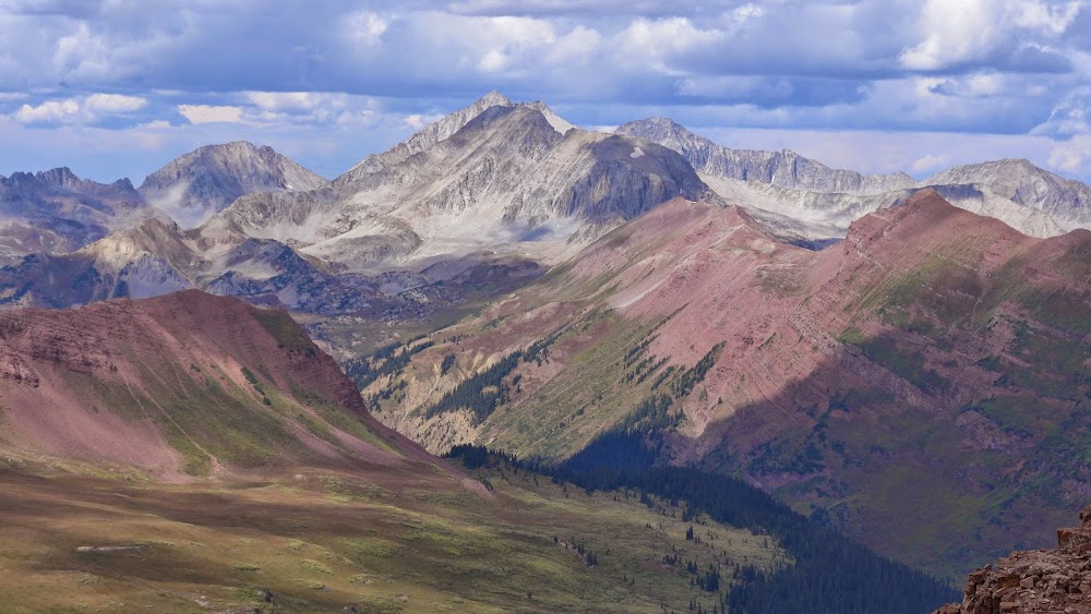
Some other nearby mountains c) Moneymike
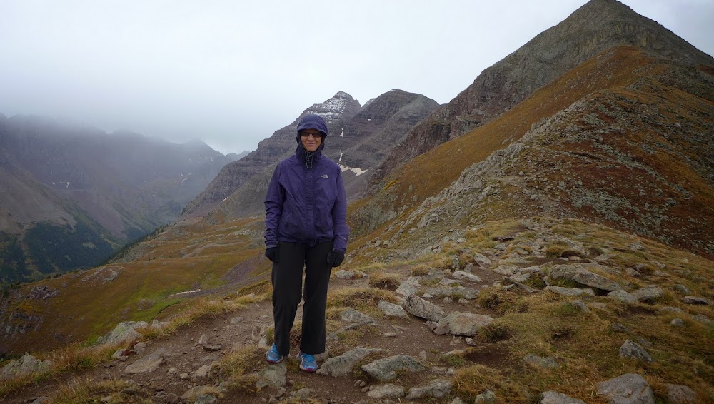
Belleview
West Maroon pass
Heading up the ridge from West Maroon pass
Hagerman and Snowmass look far across the Fravert basin
Figuring out the route in the last section ~Class 3
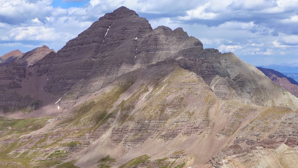
South Maroon from Belleview
Pyramidial traverse (left portion)
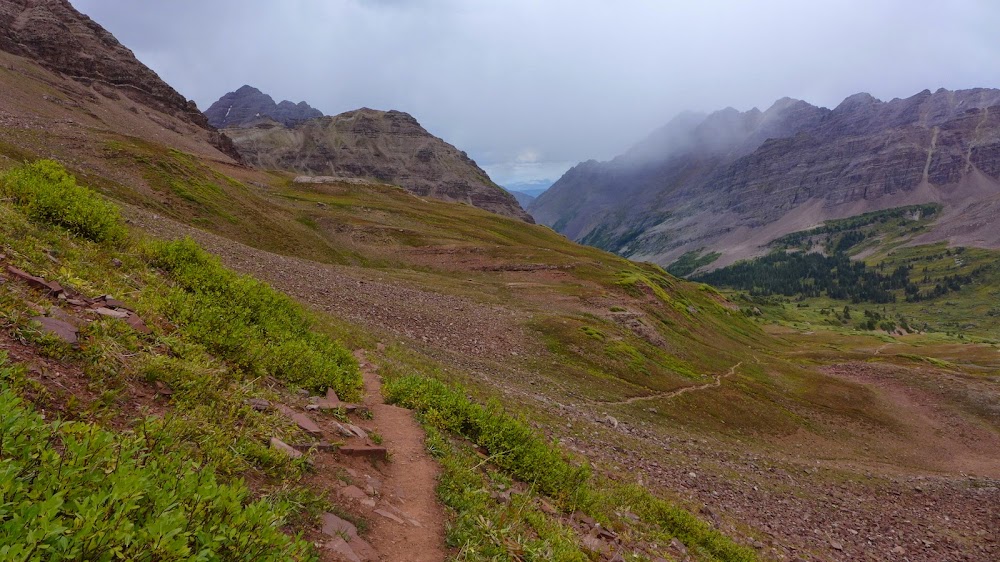
As I started my descent, the weather looked iffy, but only for a short while
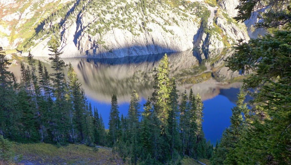
Crater lake
Attempt # 2 - weekend of 09/20-21/14 (this time for real)
Original plan - Hagerman and all nearby 13ers
Actual result - Hagerman + Buckskin BM
A week later, still lacking high clearance 4x4, I finally settled on approaching the peaks from Maroon lake TH. Obviously, this is not the most efficient way (Snowmass TH would have been less elevation gain), but it allowed me to hike a large section of 4 pass loop, and add another 13er along the way.
Delayed by road construction in Glenwood canyon and heavy in-state and out-of-state foliage-viewing traffic between Glenwood Springs and Aspen, I didn't get to the Maroon lake TH before 6.30pm on Friday night. Shouldered the overnight pack and departed the lot at 7pm, as the sun was setting. After almost 5 hours of hiking in the dark, I found a good campsite very close to Snowmass creek. It was eery to wake up next morning to the backside view of the Bells.
I set out from the camp around 7am and made a good time to the Snowmass lake (only a mile away) and a Trail Rider pass.
Good morning, Snowmass lake
Hello, Trail Rider pass
Looking back at Snowmass lake on a brilliant fall morning
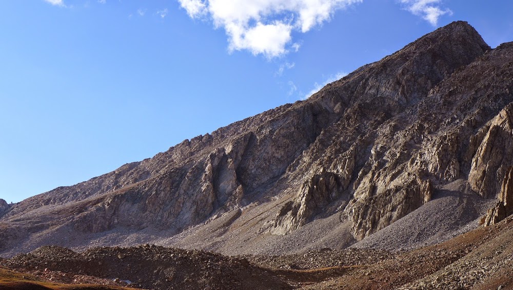
From Trail Rider pass, the trail drops down about 1k feet. View of Hagerman from 4 pass loop trail. The grassy gully on the left is the one I ascended to gain the SW ridge.
Higher up in the gully and the beginning of SW ridge
Somewhere in the gully I started feelling very sluggish, as the 10+ mile approach, 4k+ vertical and the lack of rest from the hike the night before caught up to me. But there was nothing left to do but to press on.
Looking back at the approach
I bypassed the first ridge difficulties on the right and regained the ridge near 12.8k, where the real fun began.
For the most part, I stayed on the spine of the ridge as the rock there seemed more solid.
The route felt mostly Class 2-3 with an occasional Class 4 move. There was probably an easier bypass, but I found it safer to stick with solid rock.
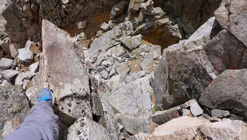
Only within the final 100-200 feet from the summit, I grew increasingly concerned about the rock quality, and had to come up with some creative route finding to avoid pulling on rocks that didn't seem to have much support.
Terrain suddenly starts to feel less secure
Snowmass and traverse from Hagerman
Snowmass lake and the Bells from Hagerman
I didn't linger on the summit for too long, as the weather was starting to look a bit iffy. The route was a bit easier to read on the way down, but still, some harder downclimbs were unavoidable. I made sure to give wide berth to rocks that didn't seem to be attached to anything.
Regaining the Trail Rider pass on the way back
SW ridge
Snowmass lake in the evening.
I toyed with the idea of adding another 13er to the day, but SW ridge took quite a bit longer than I expected and I was feeling pretty fatigued, so I just decided to head back to camp. As I was near the Snowmass lake, the skies opened up and it hailed and graupeled on me for the last mile.
Buckskin BM and the hike-out
Stats: ~10 miles, 2.7k vertical, ~7 hours
Sunday was expected to be rainy, and it was, so I decided to pack up the camp and head back to Buckskin pass.
Rainy Sunday in the Elks
Quite a few other 4-pass loop hikers were on the same schedule, so one by one we gained the pass.
It was only 9am and I felt pretty good, so I decided to stick around for another peak. Now, I don't often hike in the rain, but when I do, it is Buckskin BM from Buckskin pass! The light drizzle and clouds created an unusual backdrop. Soon I noticed a thicker white fog rolling over the ridges. It was time to hurry up if I wanted to see any views!
Thick white fog is chasing me
Snowmass and Hagerman
Snowmass in the fog
The last few hundred feet I had to hurry, as the fog was about to overcome me.
I started descending in the fog and somehow took the wrong ridge down! As soon as the clouds parted for a minute, I recognized the error and backtracted to the correct ridge. It was fairly easy to make that mistake in low visibility, but at least the terrain was very mellow.
Pyramid in the fog
From the Buckskin pass, I joined many other hikers heading down to Maroon lake. It was very scenic and I stopped to take many photos. I was glad to be able to see what I missed hiking in the dark nearly 2 days prior.
Pyramid
Although I was unable to complete all my objectives at this time, this area never disappoints. I hope to be back again next year.
My GPS Tracks on Google Maps (made from a .GPX file upload):
Hagerman is a really nice peak, and you sure made the most out of your trips. The LKB road is not easy. We actually hired an ATV to get take us up to Geneva Lake (insert joke about puny car, etc.).
Glad to see the fall foliage here! Last time I was in the area, everything was white with snow.
...that the Elks are third behind the San Juans and the Sangres. I might still be right, but damn, your photos make a strong case. Beautiful shots and nice hike, Natalie. I doubt I'll ever return to the Snowmass/Hagerman region so I'll have to live vicariously through you.
SoCool - great comment, thanks! I will be lying if I wasn't concerned about Hagerman's rock, especially in view of Rob's accident back in 2012 and another accident on Snowmass a year before. I did extensive research on the route and several people who had done the ridge said it was pretty solid. I wouldn't necessary qualify it as ”solid” per se though unless you are pretty good at route finding and identifying solid holds. I told myself that I will turn around if something didn't seem right. Except for the initial part of gaining the ridge, which wasn't solid by any measure, class 3 on very loose rock (I bypassed it on the way up in the interest of time, but downclimbed it on the way down) the rock quality overall was acceptable with careful route finding. Only about a hundred feet or so away from the summit I got more concerned about the rock quality, so I ended up climbing some slabs to avoid tilted talus I didn't trust. I honestly would be more concerned to have less experienced partners on something like that than going solo (same issue I had with the Wilsons). That said, I am still looking for competent partners for Thunder Pyramid and Gladstone!
Abe - *blushing* - do you like that ”leaves with rain drops” shot? I think I've been working on it the last three fall seasons, it finally came out the way I like That's so nice of you to say that I don't think it's possible to take bad photos in the Elks though.
Ryan - nothing to add here. Yep, the traverse looks really sketchy
Jeff - given the recent history, which is still so fresh on everybody's mind, I can't blame you, but I urge you to give the Elks another look. They are far too beautiful to be avoided. And it's hard to pick favorites, but imho, they do give Sangres a run for the money, by a big margin. Cathedral in snow wasn't that bad, huh?
Bill - thank you! Fall is a magic season in the Elks, isn't it?
Dillon - thanks - I guess if we go after Centennials, we'll end up with similar peaks? I haven't been much to Gores or RMNP this year though, but had lots of quality time in the San Juans instead. So much to explore! Elks are beautiful, in all seasons.
Joe - thanks again for the great info and the links. Without a solid 4x4, one has to be creative (or stubborn), but I really like your ATV idea! Way to do it with snow.
Mike - ”the nearby mountains” is such a classic. I am still laughing. Is it ski season yet?
Brandon - I think congratulations to you and Kristine are in order! and I can't believe you still find time to read the TRs
Caution: The information contained in this report may not be accurate and should not be the only resource used in preparation for your climb. Failure to have the necessary experience, physical conditioning, supplies or equipment can result in injury or death. 14ers.com and the author(s) of this report provide no warranties, either express or implied, that the information provided is accurate or reliable. By using the information provided, you agree to indemnify and hold harmless 14ers.com and the report author(s) with respect to any claims and demands against them, including any attorney fees and expenses. Please read the 14ers.com Safety and Disclaimer pages for more information.
Please respect private property: 14ers.com supports the rights of private landowners to determine how and by whom their land will be used. In Colorado, it is your responsibility to determine if land is private and to obtain the appropriate permission before entering the property.