Download Agreement, Release, and Acknowledgement of Risk:
You (the person requesting this file download) fully understand mountain climbing ("Activity") involves risks and dangers of serious bodily injury, including permanent disability, paralysis, and death ("Risks") and you fully accept and assume all such risks and all responsibility for losses, costs, and damages you incur as a result of your participation in this Activity.
You acknowledge that information in the file you have chosen to download may not be accurate and may contain errors. You agree to assume all risks when using this information and agree to release and discharge 14ers.com, 14ers Inc. and the author(s) of such information (collectively, the "Released Parties").
You hereby discharge the Released Parties from all damages, actions, claims and liabilities of any nature, specifically including, but not limited to, damages, actions, claims and liabilities arising from or related to the negligence of the Released Parties. You further agree to indemnify, hold harmless and defend 14ers.com, 14ers Inc. and each of the other Released Parties from and against any loss, damage, liability and expense, including costs and attorney fees, incurred by 14ers.com, 14ers Inc. or any of the other Released Parties as a result of you using information provided on the 14ers.com or 14ers Inc. websites.
You have read this agreement, fully understand its terms and intend it to be a complete and unconditional release of all liability to the greatest extent allowed by law and agree that if any portion of this agreement is held to be invalid the balance, notwithstanding, shall continue in full force and effect.
By clicking "OK" you agree to these terms. If you DO NOT agree, click "Cancel"...
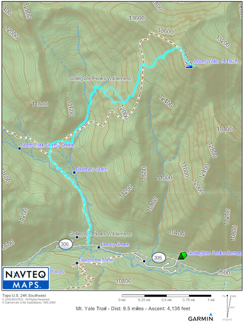
Name: Mount Yale
Max Elevation: 14,196 feet
Distance: 9.5 miles
Elevation Gain: 4,136 feet
Time: 7-9 hours
Map of the Trail
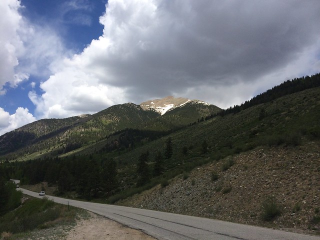
For the past couple of weeks I have been meaning to hike up Mt. Yale, but have not been able to get my time off and weather to coincide with each other. I finally had a day off where the weather looked like it was going to be good for the morning hours. So I left Colorado Springs for Buena Vista at 2:00AM and arrived at the Denny Creek trailhead by 4:30AM. As I exited Buena Vista I was surprised by what a high quality road CR 306 is. It was paved all the way to the trailhead. Not many 14er trailheads are this easy to access. Here is a picture I took later in the day of the road with Mt. Yale hovering above it:
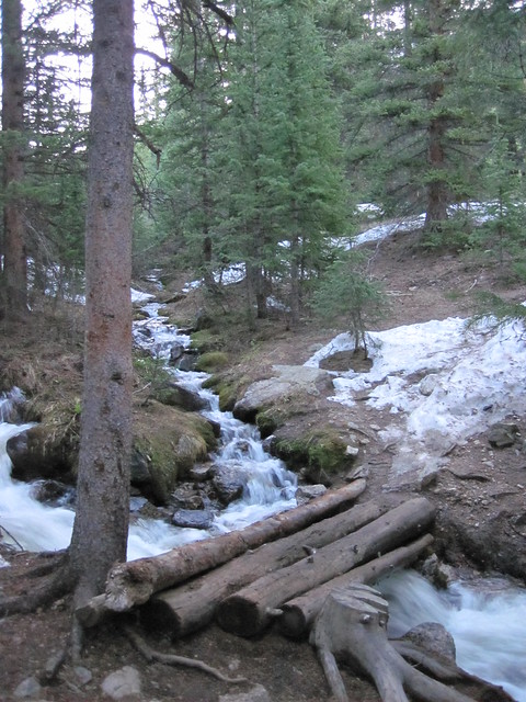
I prepped my gear and got myself ready for my hike as quietly as possible hoping not to wake anyone sleeping in their cars at the trailhead. As I set off on my hike at 4:45 AM it was pitch dark out. This hike is fairly short for being a 14er with a round-trip distance of 9.5 miles. What that means though is that the hike was going to be steep and the steepness was apparent from the start. The first mile of the hike was a steady ascent in the darkness. At the one mile mark there is a creek crossing which was a bit sketchy due to the creek's water running very high due to the early summer snow melt. The rocks typically used to cross the creek were mostly covered by fast moving water. Using my trekking poles and my headlamp to light the way I was able to get across the creek without getting my boots wet. There were more creek crossings after that in the darkness that fortunately had log bridges to cross such as this one that I took a picture of later in the morning:
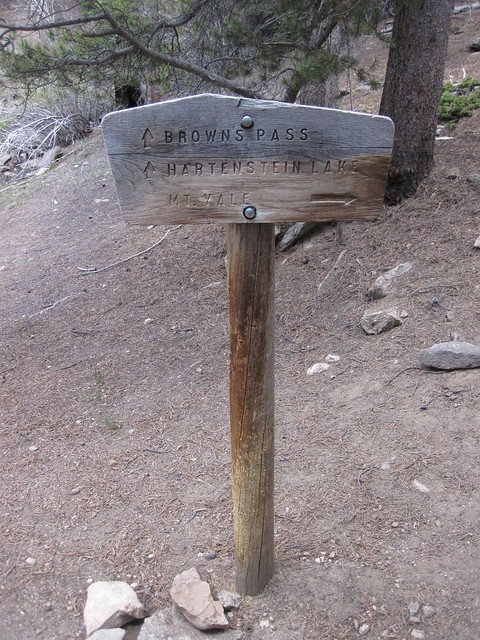
From this first stream crossing just a short distance up the trail is a critical turn. At 1.25 miles it is important to take a right at the below sign that I took a picture of later in the day:
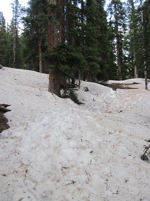
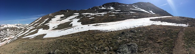
I have heard stories of people missing this sign in the darkness so for anyone thinking of hiking Mt. Yale make sure to make this turn or you could end up adding a lot of extra miles to your hike. As I made the right the trail continued its steady ascent up the mountain. Eventually the sun came up and I could see that the skies were blue and beautiful. This motivated me to keep pushing up the mountain as quickly as I could before any clouds rolled in. For the most part as I hiked up the mountain the trail as easy to follow until I came to a basin just below treeline that was covered with thick snow that had postholing footprints going in all directions:
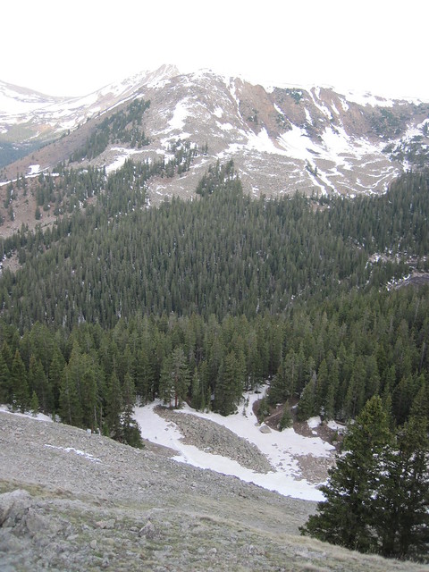
I walked around for a little while trying to find the trail, but could not find it. I looked up and I could see a hiker that passed me earlier on the hill above me. I figured maybe he found the trail so I just started hiking straight up the steep slope in his general direction. As I powered my way up this steep slope I could feel that the training I have been doing on the Manitou Incline was paying off. I kept a steady pace without stopping all the way up the slope and did not feel tired at all. Here is view looking down this steep slope back down towards the posthole basin below:
Later in the day I saw people hiking up the scree field to the north likely because they could not find the trail to gain the ridgeline. I highly recommend against doing that because I got tired just watching them in the distance struggle up the scree field. Anyway as I ascended up the hillside I eventually intersected with the trail again:
From here the trail was easy to follow with only a few sections covered in snow that was easy to skirt around. On this section of the hike I found myself continuously marveling at the view I had of the Three Apostles out in the distance:
As I approached the upper slopes of Mt. Yale I could see a few snowfields in front me. I wondered if I would actually be able to use the snowshoes that I brought with me?:
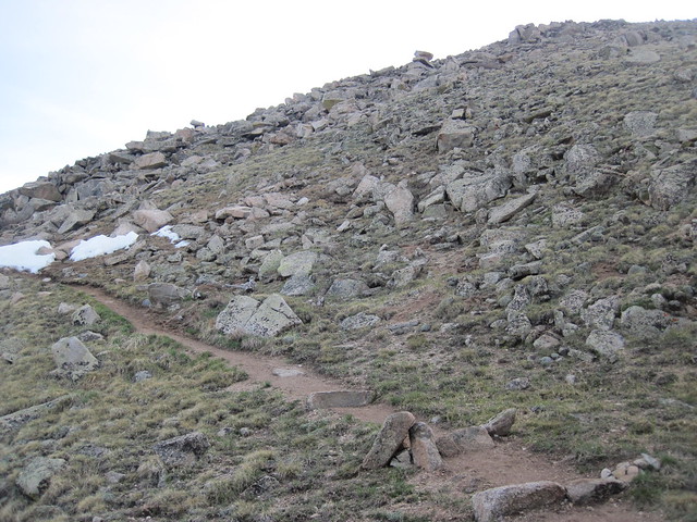
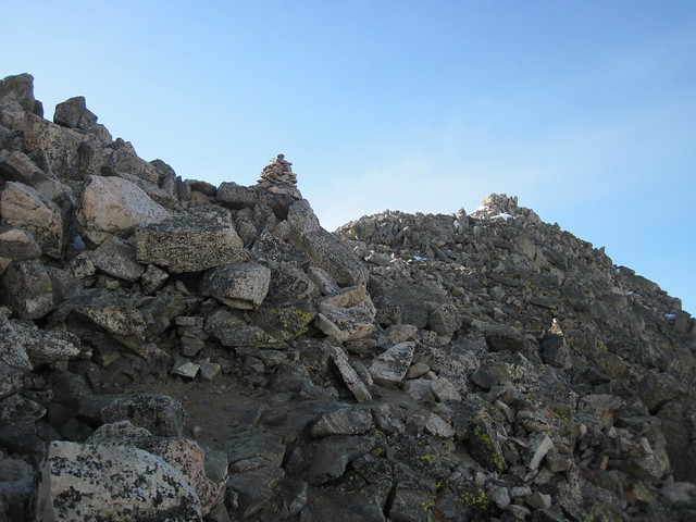
I was able to cross the frozen solid snowfields without the use of snowshoes and I decided to stash them at just above 13,000 feet since it was clear there was no more possible snowfields to cross. This lightened my load quite a bit and I was able to quickly power up the steep hillside to gain the saddle on the ridgeline. Once on the saddle I then had to negotiate a Class 2 traverse through a rocky ridgeline to the summit:
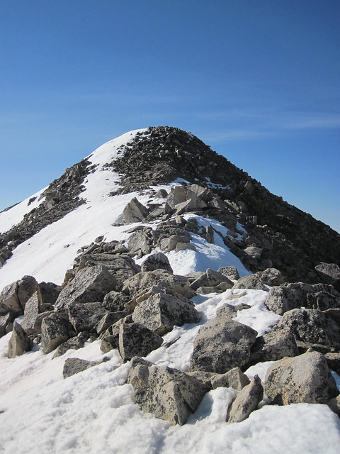
The traverse had a few icy areas, but with care I was able to cross it without the use of microspikes. Soon enough the final summit approach was in front of me:
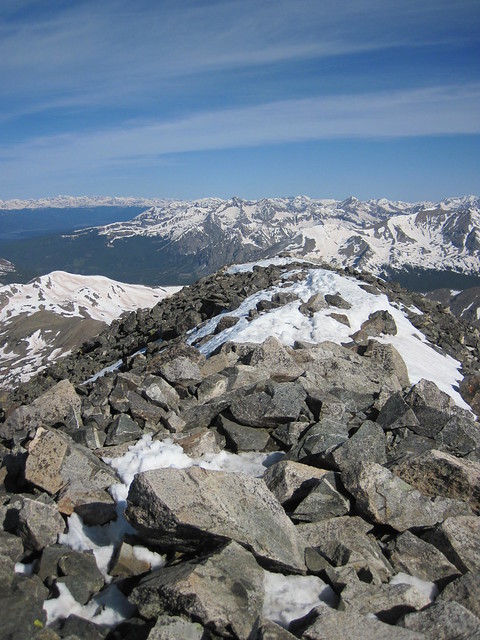
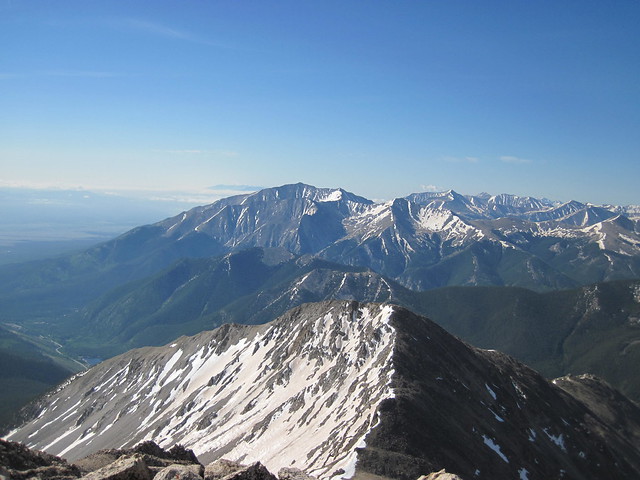
I ended up reaching the summit at 8:45 AM in the morning which meant I hiked up the mountain in 4 hours. The true summit of Mt. Yale is actually hard to find because it is just a long ridgeline. So I walked over to what appeared to be the biggest pile of rocks and stood on it. Here is a view from this pile of rocks looking to the West:
Here is the view looking South directly towards the 14,197 foot Mt. Princeton and other high peaks in the southern Sawatch Range:
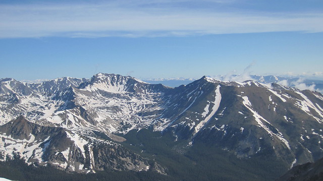
To me it appeared that the southern Sawatch was holding much less snow than the northern Sawatch. Here is a view looking north towards Mt. Harvard and Mt. Columbia which were still holding a lot of snow:
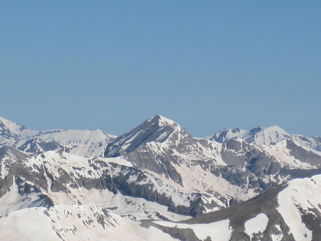
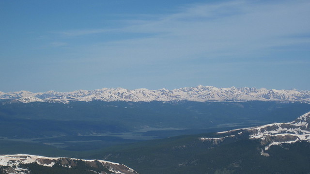
Here is the view looking West into the heart of the Sawatch Range:
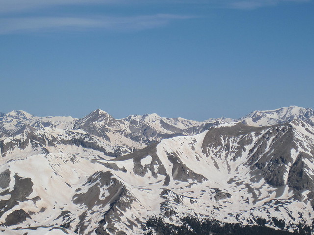
I was surprised to see how noticeable Huron Peak was in the mighty Sawatch Range considering it is only 14,003 feet:
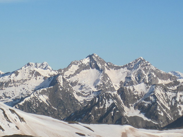
The Elk Range looked particularly impressive out in the distance with all the snow it was still holding:
In total I spent about 30 minutes on the summit enjoying the views of many more 14ers and other great mountains before starting my descent. It had took me 4 hours to get up the mountain and my descent took 2 hours and 50 minutes. With the 30 minutes on the summit, I had a round-trip hiking time of 7 hours and 20 minutes. I saw a total of about 10 people all day on Mt. Yale and the few people I spoke to were very cool. Maybe it is just me, but on 14ers I never seem to run into jerks; everyone is always upbeat and just genuinely good people to meet. All in all I ended up having a "Yale" of day in the Sawatch and I recommend to people looking to get an early summer ascent of a 14er in to check out Mt. Yale.
Thanks for the report, I'm heading up there tomorrow and was wondering about the basin before the tree line. I'll follow your advise and hopefully avoid the scree field!
Thanks for the report! Conditions look great Good to know about the route finding on the snow field... im heading up there tomorrow too Medic13, see you there!
I appreciate the comments. Hopefully the wind wasn't too bad for everyone hiking up Mt. Yale this weekend. I hiked up Shavano and Tabeguache on Saturday (14JUN) and it was extremely windy.
Caution: The information contained in this report may not be accurate and should not be the only resource used in preparation for your climb. Failure to have the necessary experience, physical conditioning, supplies or equipment can result in injury or death. 14ers.com and the author(s) of this report provide no warranties, either express or implied, that the information provided is accurate or reliable. By using the information provided, you agree to indemnify and hold harmless 14ers.com and the report author(s) with respect to any claims and demands against them, including any attorney fees and expenses. Please read the 14ers.com Safety and Disclaimer pages for more information.
Please respect private property: 14ers.com supports the rights of private landowners to determine how and by whom their land will be used. In Colorado, it is your responsibility to determine if land is private and to obtain the appropriate permission before entering the property.