Download Agreement, Release, and Acknowledgement of Risk:
You (the person requesting this file download) fully understand mountain climbing ("Activity") involves risks and dangers of serious bodily injury, including permanent disability, paralysis, and death ("Risks") and you fully accept and assume all such risks and all responsibility for losses, costs, and damages you incur as a result of your participation in this Activity.
You acknowledge that information in the file you have chosen to download may not be accurate and may contain errors. You agree to assume all risks when using this information and agree to release and discharge 14ers.com, 14ers Inc. and the author(s) of such information (collectively, the "Released Parties").
You hereby discharge the Released Parties from all damages, actions, claims and liabilities of any nature, specifically including, but not limited to, damages, actions, claims and liabilities arising from or related to the negligence of the Released Parties. You further agree to indemnify, hold harmless and defend 14ers.com, 14ers Inc. and each of the other Released Parties from and against any loss, damage, liability and expense, including costs and attorney fees, incurred by 14ers.com, 14ers Inc. or any of the other Released Parties as a result of you using information provided on the 14ers.com or 14ers Inc. websites.
You have read this agreement, fully understand its terms and intend it to be a complete and unconditional release of all liability to the greatest extent allowed by law and agree that if any portion of this agreement is held to be invalid the balance, notwithstanding, shall continue in full force and effect.
By clicking "OK" you agree to these terms. If you DO NOT agree, click "Cancel"...
12.26.13
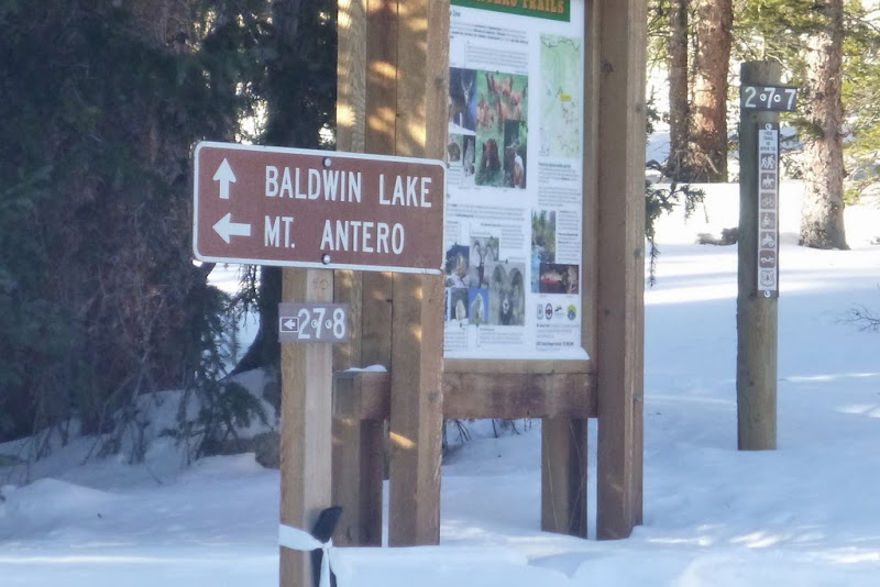
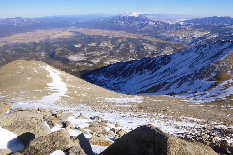
Route: Winter variation from Baldwin Gulch TH
RT Distance: ~11.5 miles
RT Gain: ~5,000 ft
RT Time: 8 hrs 45 min (7.30am to 4.15pm)
Party: solo
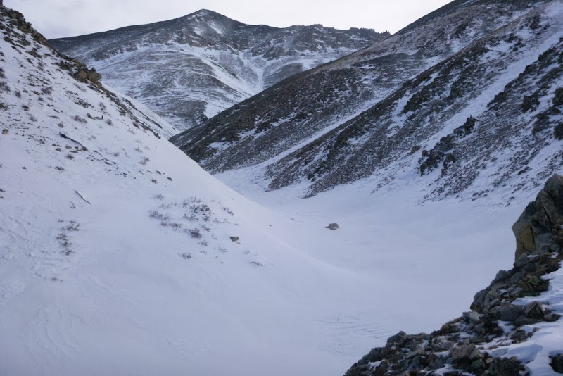
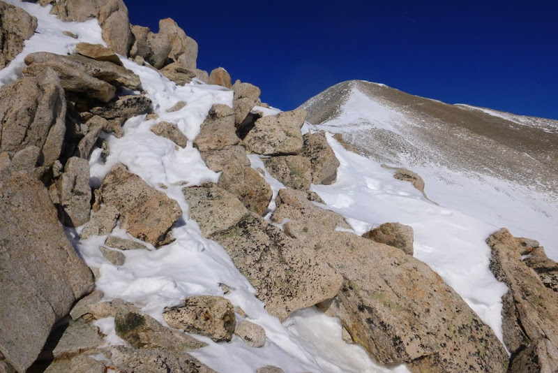
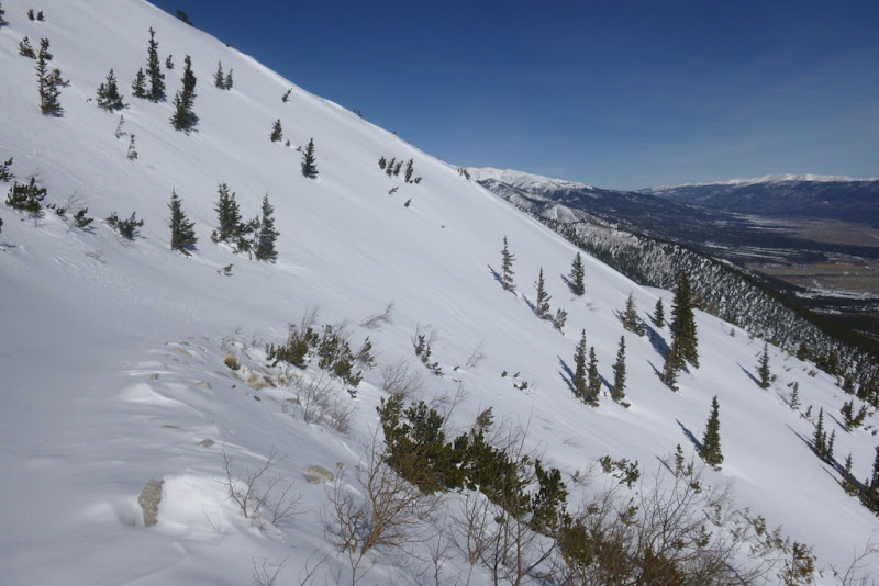
Snow gully looks suspect, so I took the rib
Switchbacks are sort of a nuisance
Cronin steals the show
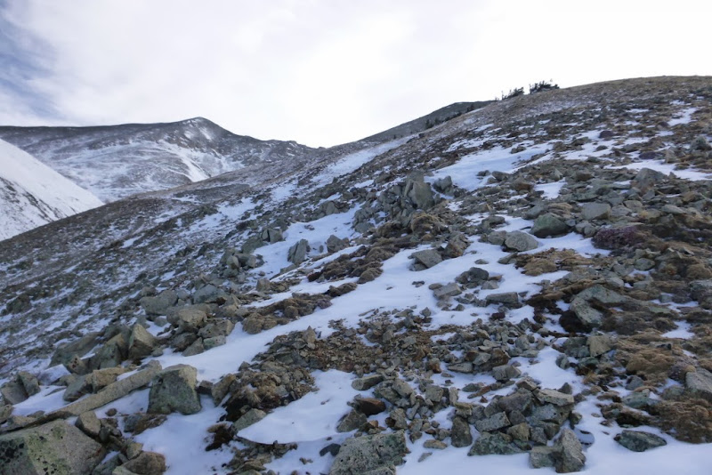
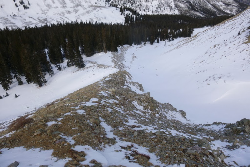
Staying on the dry rock-rib
Snow(y) shoulder
Traversing over to the saddle
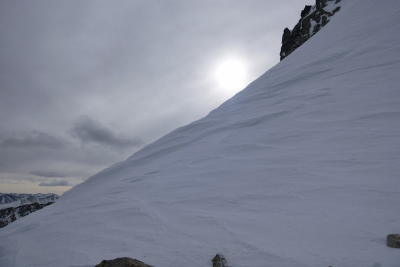
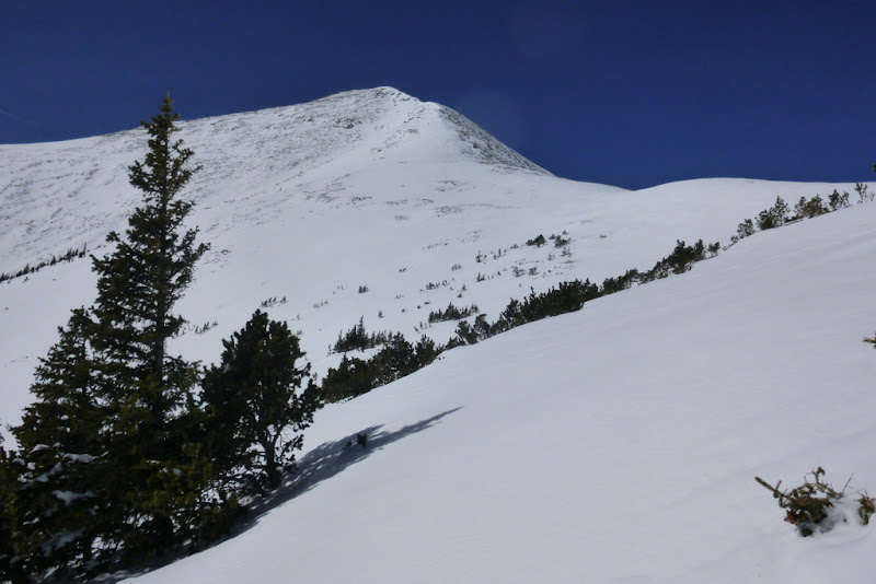
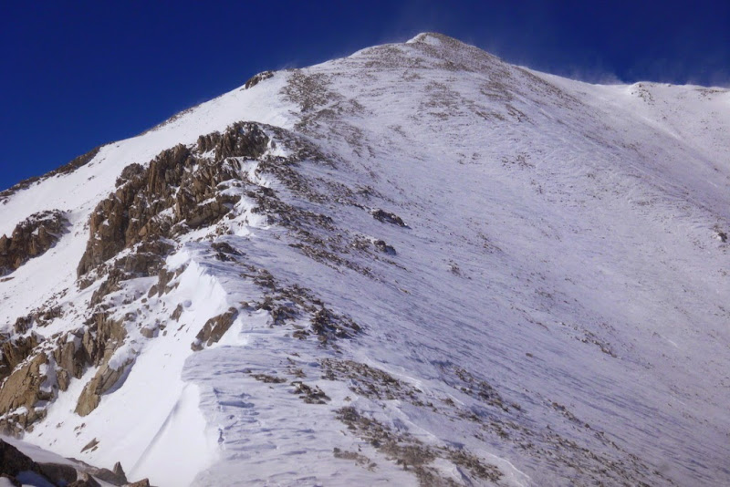
First look at the summit ridge
Not too tricky despite the snow
Cronin with Uncompahgre behind
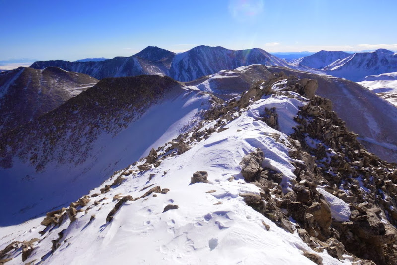
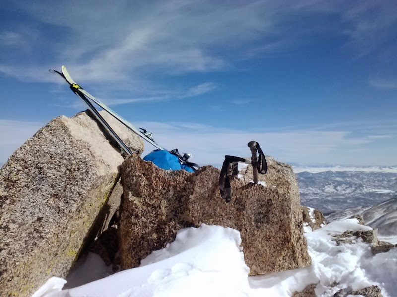
Summit - looking north
Summit - looking west
Summit - looking south (Sangres)
Shavano & Tabegauche (on the descent)
Since I liked my ascent route, I took the same route on the descent
Last good look at the mountain ~3pm
Antero on the drive-out
Mt. Yale
12.28.13
Route: East Ridge from Avalanche Gulch TH
RT Distance: ~10.5 miles
RT Gain: ~5,000 ft
RT Time: 9hrs 45 min (8am to 5.45pm)
Party: Krista and Taylor (Lemmiwinks)
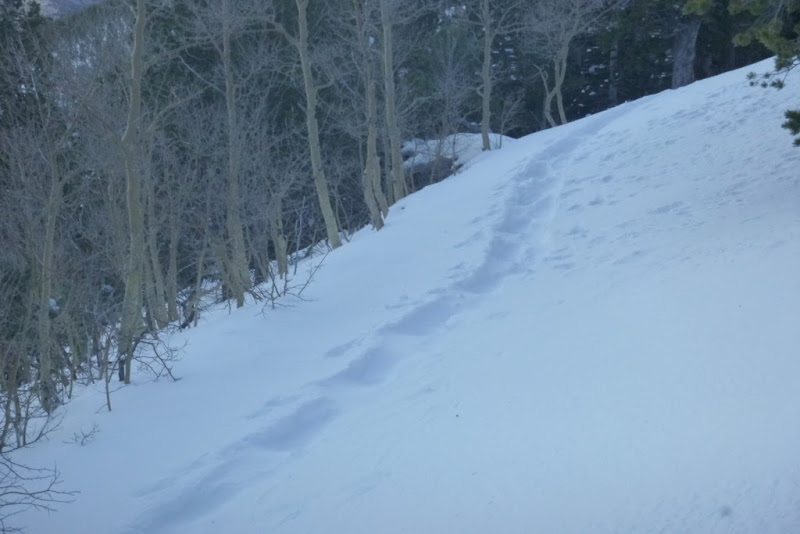
A glorious trench
Gaining the ridge
First look at the East Ridge - and it is just the false summit @13.2k
Navigating the obstacles on the ridge
Generally up and over
Taylor is charging ahead
Even finding some snow
the rocky section
First look at the actual summit - the ridge looks a bit more snowy
Taylor approaches the snowy headwall
Krista on the headwall
Final steps
The summit team - Natalie, Taylor, Krista
Harvard & Columbia
Clouds starting to build - the winter storm is in the forecast later that day
Short, but steep snow section
Harvard
Hello, snowshoes ~4pm
We turn on afterburners and fly back to the TH, finishing the last mile in the dark. All in, a good winter day - although cloudy, not too cold or windy.
Mt. Harvard
Route/approach: Frenchman Creek TH
Dates: February 16-17
Mileage: ~19 miles (5.5 + 13.5)
Elevation: ~6.5k (3k + 3.5k)
Time: 16 hr 45 min over 2 days (5.45 hr + 11 hr - exludes time spent packing the camp)
Mode of transportation: AT skis
Party: Will
Day 1: Approach and camp at 11,400k
With considerable snowfall in early February and high avy danger on most aspects it was time to pick the route that's relatively avy safe. Harvard from Frenchman creek seemed to fit the bill. Initially, my partner and I were planning on Harvard as a day trip. With weather deteriorating and winds increasing, I was feeling less and less confident that it can be pulled off as a day trip. President's day forecast looked better, so I decided to make it a two-day camping trip. On skis.
Early on the approach - I am still smiling
The snowmobiles packed the road for the first mile. We were fully expecting to start breaking the trail after that, but a pleasant surprise awaited. A local couple went snowshoeing and put a trench to about 10.5k. It was a bit tough to use a snowshoe trench for skinning, but I wasn't complaining. My partner seemed to enjoy having the track as well. After 3 miles, 2k and 3 hours, we came to the end of the trench. My partner had to work on Monday, so he headed down. From there, I was on my own. Skinning is a surprisingly efficient way to break trail (depending on the snow conditions, of course). And in this particular case, with heavy, wet snow, I was able mostly to stay afloat. The trail was hard to see and only by pure luck I was able to notice a creek crossing - I almost went right past it.
Creek crossing
Staying on track
Pretty sure it's the correct drainage
After over 5 miles and 5+ hours, it was time to look for a campsite. My goal was to set up camp near treeline at 11.3k and I tried to find a good secluded camping spot since the winds were forecasted to gust up to 60 mph overnight. Initially I was planning to build tall walls around the tent (Denali style), but discovered it wasn't needed. As soon as I found a flat spot and got off skis, I sunk thigh deep. That gave me a clue to start digging. The camp site ended up looking like a grave - with 4+ feet walls surrounding the tent on all sides with only the very tippy top exposed to the wind. It took me about an hour to excavate the site, melt snow and eat dinner. I got into the tent by 5pm, but before passing out I still had to take care of a few things. Boot liners, skins, gloves, etc needed to be dried off for tomorrow. I also discovered that the valve on my sleeping pad was malfunctioning and was not keeping air in. At least I had the closed cell foam pad. I put all my clothes on top of it, including the down jacket and it helped. I slept pretty soundly from 6pm to 2am, about 8 hours.
Day 2 - Summit and ski out
Next morning, I was on the trail around 6.30am. With the light pack, moving was much easier. I reached the treeline in about 15 or 20 minutes only to discover punishing winds. The wind forecast called for manageable winds to untill noon, and 50-60mph gusts thereafter. I knew I had to hurry.
Columbia soon after sunrise
Skinning
Pretty deep snow
Finally, Harvard appears in the distance
In a few spots, it got pretty windy, but it was nothing compared to what it will be later
As soon as I got into the upper basin, the winds subsided. I am guessing, I got protection from the Harvard-Columbia connecting ridge. It got almost balmy for a few hours! Carrying skis was starting to take a toll on me though and my pace slowded down.
Lots of options for the ascent route, looking benign from the avy standpoint
The Rabbits
Heavy skis
Mostly I was skinning, but in a few places I had to take skis off.
Summit ridge looked pretty rocky and I should have left my skis at the 13.8k saddle. Instead, I stubbornly carried them to the summit
I reached the summit near 1pm. Didn't linger for long.
I skied a few short sections (including just off the summit), but the continuous ski descent started at 13.8k. The camera battery died so below are a few photos taken by the phone camera.
The start of the continuous ski line ~13.8k
A few powdery turns
Since it was already past 2pm, the winds really picked up and basically sent me back to my campsite which I reached around 3.30pm. Skiing wasn't always great, but it was still skiing, not walking.
Sastrugi ski
Hard pack ski
After quickly packing up the campsite, I was on the move at 4.15pm and reached the car 2 hours later. Ski conditions were highly variable - deep powder in the trees to about 10k, and then the "luge track" all the way to the car as the snow developed a suncrust which later refroze.
Mt. Princeton
Route/approach/TH: East Slopes, Mt. Princeton road from 8,900 ft
Date: March 9
Mileage: ~12.3 miles
Elevation: ~5.9k
Time: ~13 hr 30 min
Mode of transportation: snowshoes
Party: Will
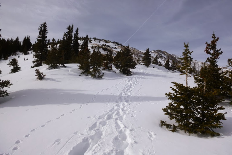
The mountains had gotten a good amount of new snow in the prior week, but with the weather forecast looking almost perfect - sunny and very little wind - we decided to give Mt. Princeton a try.
There were no new tracks, so we broke the trail from the parking lot
There was definitely more snow than either of us was expecting
We made a reasonably good time to the radio towers, but then...
Deep snow became our companion for a while and our pace slowed
We also entered the avalanche terrain, so we made sure to travel under the sketchy terrain one at a time.
Breaking trail in knee-deep snow - approaching 11k
Near 11.6k we came to the end of the road. My evaluation showed that the road traversed under the avalanche terrain (twice) and I wasn't comfortable following the summer route. Instead, we scrambled up mostly on rocks on steep terrain to reach the switchback a hundred feet or so above us.
The end of the summer route (for us)
But everybody's comfort level is different. Somebody caught up to us right at that juncture and proceeded to follow the summer route burried under the snow. We hanged around long enough to make sure the person is ok, but then continued - we had more trailbreaking to do.
The road continues
Tigger finally appears
We stopped to regroup at 12.2k saddle and to stash our snowshoes. My partner told me that he was running on fumes, but gave me carte blanche to go ahead. On the other hand, I was feeling pretty good that day, so I pulled ahead.
Princeton is covered in a coat of white
The ridge to Tigger
Looking at Princeton from Tigger - still quite a ways to go
The ridge got windy in a couple of spots, but it was still manageable
The remaining route to Princeton
The shadows were gettiing longer...
the summit was attained at 2.45pm
Three Apostles and Huron
Ridge to Tigger on the way back
The cornice
Antero
The winds grew stronger and the day went on, and by the time I reached Tigger, the winds were gale force - and it was not in the forecast.
Descending Tigger in high winds
The descent off Tigger in limited visibility due to the blowing snow took almost an hour. I couldn't believe when I saw my partner waiting for me under such conditions. He wanted to make sure I found my snowshoes. As soon as I caught up to him, we basically ran for the protection of the treeline. The winds were strong even there and our morning tracks were almost covered already. So instead of re-breaking the trench, we decided to cut a few switchbacks on the way down.
There was some wallowing in the willows, but at least it was on the downhill.
Lower on the road we discovered that a lot of snow had already melted out earlier that day. We could barely recognize the road below 10k. We reached the TH shortly after 8pm.
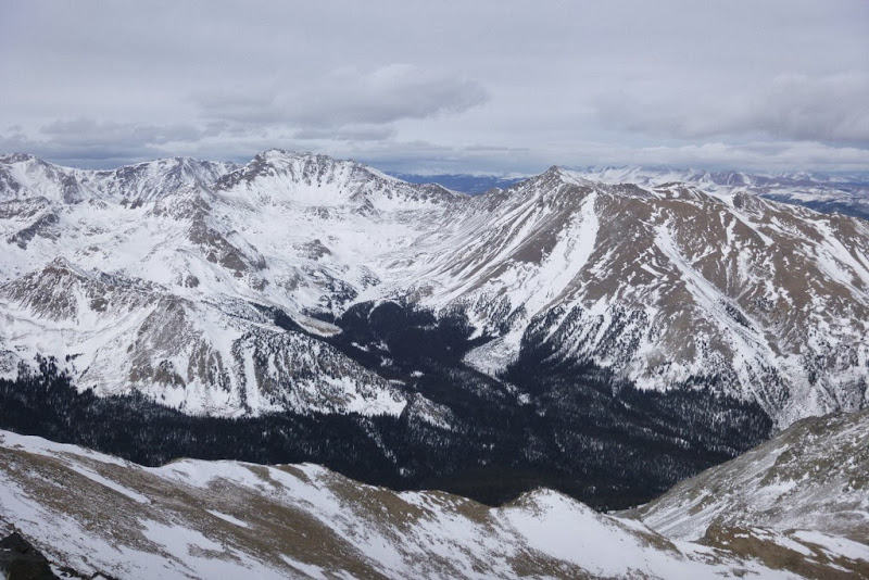
Shavano, Tabegauche and UN 13,712
Route/approach/TH: East Slopes up, Angel (glissade) - down; Angel of Shavano TH
Date: March 16
Mileage: ~15.4 miles
Elevation: ~7.1k
Time: 14 hours 17 min
Mode of transportation: snowshoes
Party: solo
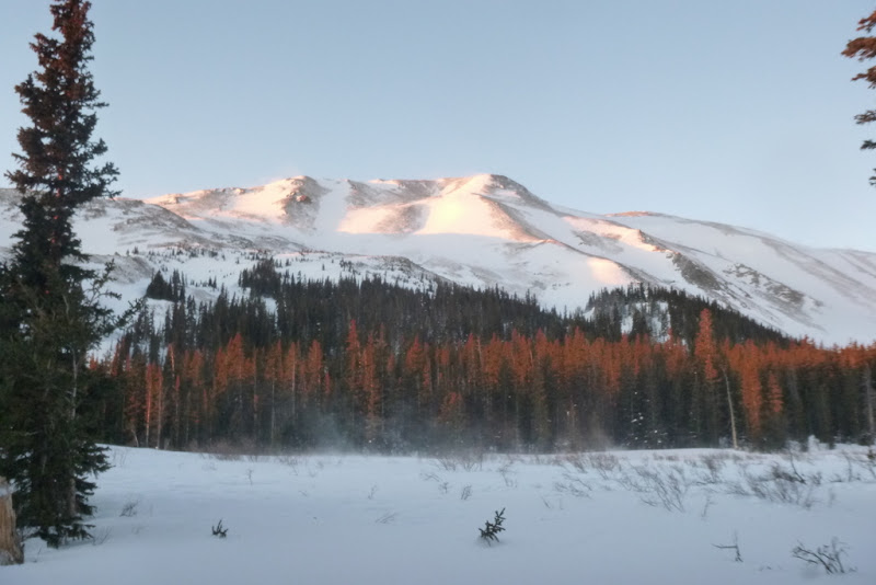
After spending hours analyzing and agonizing over which winter-appropriate route to take, I was presented with this view the evening before the climb. After staring at the mountain for a while, I came to the conclusion that the summer route would likely be the most viable option.
Next morning, I got a start around 6.10am from Angel of Shavano TH, which is less than 2 miles away from Blank Gulch TH. I followed Colorado Trail for a while, but in less than a mile, the tracks petered out. I discovered though that after a solid overnight freeze, I was able to stay afload and trailbraiking was not needed - for the first time this winter.
Colorado trail on the approach
Frozen forest
I followed some random tracks here and there but quickly decided to stick with the waypoints on my GPS - the tracks looked to be all over the place, and not necessarily in the direction I was headed.
Encouraged by the firm snow conditions I encountered on the approach, I decided to tackle the summer route heads on. It is probably steep enough to slide in poor snow conditions but today it provided a reasonably safe passage.
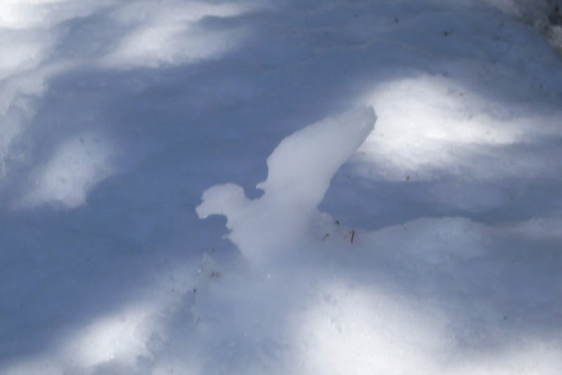
I even encountered a snow bird or an angel.
Snowsculpture
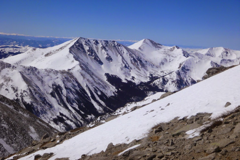
Mt. Ouray on the approach
Gaining the ridge
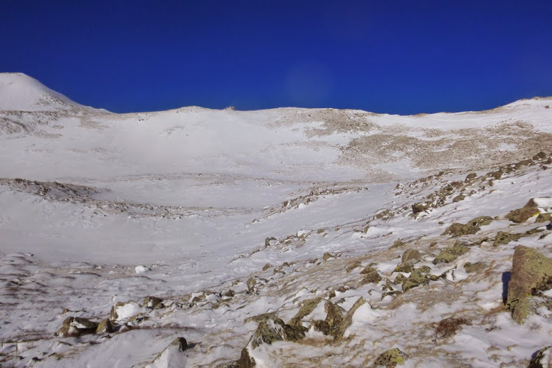
At the end of the treeline, the snow effectively ended. I carried snowshoes for another 1k feet, and then parked them at 13.3k near Shavano saddle.
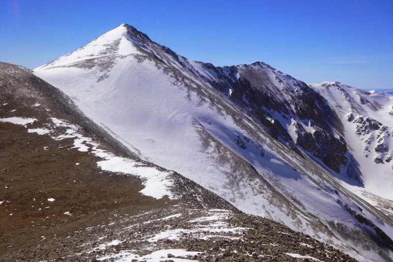
Following the summer route
Remaining ridge to Shavano
Bicentennials Taylor and Aetna from the ridge
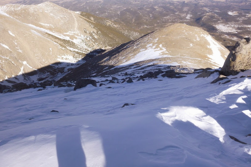
I reached the summit somewhere around 1.20pm. My fatigue was exacerbated by a cold, but I didn't want to go through this excercise again to get to Tabegauche. So I proceeded.
Tabegauche always looks further than expected from Shavano
I also wanted to tag UN 13,712 (unnamed, but ranked 13er) since I reazoned it won't be that far off route and it looked like snowshoes won't be needed. Some half an hour later I was staring at the ridge. I estimated the detour cost me about 1.5 hour.
Ridge up UN 13,712
Summit of UN13,712 looking at Antero
It also provided a great overview of Tabegauche
Heading up Tab
Summit of Tab at 4pm
Heading back to Shavano - thankfully, the ridge from the saddle is mostly dry
Made it back to Shavano by 5pm
Sangres from the summit of Shavano
Some barely skiable line off Shavano - very rocky. We found better skiing conditions last May.
Given the stable snow conditions encountered all day, I long ago decided that my descent line will be the Angel.
I stumbled down to pick up my snowshoes and on the snow I go
Instead of an ice ax, I carry a whippet, but it serves just fine. Angel makes for a very fast descent and I am back at 12k by 6pm.
Looking at the Angel after the glissade
I say good-bye to the Angel. I climbed it, I skied it, I glissaded it (twice). It's been very good to me.
Snow is no longer firm, so I posthole on the way down. Still, I am able to reach the summer TH shortly after 7pm, just 2 hours after departing summit of Shavano.
But I still have almost 2 miles to go.
I reached the car at 8.30 pm after hiking in the dark which seemed to have lasted a long time.
After this season, I have 3 Sawatch peaks left in winter - Missouri, Massive and Holy Cross.
My GPS Tracks on Google Maps (made from a .GPX file upload):
Some really beautiful shots you got! Especially loved the 3 Apostles/Huron and your last shot! That looks like an oil painting!! Thanks for the trip to the Sawatch!
Natalie,
I hope you saw my post regarding the new GPX file upload stuff on 14ers.com maps. I had to remove the option from trip reports because it's confusing since there's already a GPX upload process for TRs. Also, you might notice that I made a few changes to the TR GPX file display so each track is individual and has it's own info window on the map. Looks much better.
And GREAT job on getting these peaks and enjoying the snow!
Doug - thanks a lot. Sawatch is definitely gets more scenic with snow. Let me know when you make it to Colorado again this summer - maybe our schedules will align for a hike or two.
cftbq - whippet is a crossover between a hiking pole and an ice ax - google ”whippet ski pole”. I just realized I haven't used a standard ice ax on any of the peaks this winter. On more technical peaks, I used a hybrid ice ax/tool, and on more hikeable ones I use a whippet. Hybrids all the way!
Bill - I saw the changes and just posted in the other thread thanking you for the upgrades. Much cleaner look for the .gps files - yay! And - thanks
p.s. jmanner - you probably could have made it as far as the radio towers! 8)
Caution: The information contained in this report may not be accurate and should not be the only resource used in preparation for your climb. Failure to have the necessary experience, physical conditioning, supplies or equipment can result in injury or death. 14ers.com and the author(s) of this report provide no warranties, either express or implied, that the information provided is accurate or reliable. By using the information provided, you agree to indemnify and hold harmless 14ers.com and the report author(s) with respect to any claims and demands against them, including any attorney fees and expenses. Please read the 14ers.com Safety and Disclaimer pages for more information.
Please respect private property: 14ers.com supports the rights of private landowners to determine how and by whom their land will be used. In Colorado, it is your responsibility to determine if land is private and to obtain the appropriate permission before entering the property.