| Peak(s): |
Mt. Bierstadt - 14,066 feet Mt. Blue Sky - 14,268 feet The Sawtooth - 13,780 feet |
| Date Posted: | 11/10/2013 |
| Modified: | 11/14/2013 |
| Date Climbed: | 09/07/2013 |
| Author: | DeTour |
| Additional Members: | Lucky, SikYou |
| Peak(s): |
Mt. Bierstadt - 14,066 feet Mt. Blue Sky - 14,268 feet The Sawtooth - 13,780 feet |
| Date Posted: | 11/10/2013 |
| Modified: | 11/14/2013 |
| Date Climbed: | 09/07/2013 |
| Author: | DeTour |
| Additional Members: | Lucky, SikYou |
| Tour d'Abyss |
|---|
|
Tour d'Abyss has been on our radar for at least three years. We kept putting at the end of our planned climbs for our weeklong 14er trips, due to its proximity to Denver. And because we're always overly ambitious in our planning, this route kept getting bumped to "next year." This year, "next year" finally arrived. We rolled into Idaho Springs on a Friday evening, rested up from an awesome climb of the S Ridge on Snowmass the previous day. We settled in to a dumpy motel run by an old guy with spikey white hair and a crazed look in his eyes. It seems like every one of our annual trips produces some unexpected drama. We thought we'd used up this year's allotment with a flat tire at 11,000 feet in Montezuma Basin the weekend before, but it turns out there was more. Chatting with a couple gals staying next door, we learned that the Mount Evans Road was closed to vehicles at Summit Lake. For all the pre-trip research we always do, we had not learned that the Park Service closes the road at that spot every Labor Day. The road closure looked like a huge setback at first. I had estimated the total distance of the hike/climb at 6+ miles, based on departing from the first major switchback on the Mt. Evans Road. The closed gate at Summit Lake appeared to add 4-5 miles to that. The S Ridge, a relatively short route, had taken everything we had, and we didn't think we were up to a 10-mile-plus round trip, with the difficulties of Bierstadt's East Ridge and the Sawtooth traverse sandwiched in the middle. The closure news set us on a mad scramble to research alternatives, complicated by the fact that the motel's wireless network only seemed to work if you stood within about two feet of the router, located in cramped lobby reeking of some strange incense. Eventually we figured out that the total mileage didn't have to be nearly as daunting as we had first made it out to be. The key was descending the northeast face of Evans, cutting out most of the road hike back to the lake. Turned out I had overestimated the mileage of our original plan, so the round trip was more like 6+ miles total, the first two being a "warm-up walk" on a paved road up a gentle incline. The only real adjustment we had to make was starting earlier, to walk the initial road section pre-dawn.  Our group consisted of five this day - our usual brothers/daughter/boyfriend foursome, plus Mark's stepson, Brian (Sikyou on this site). It turned out we could have started a little earlier than we did, as dawn began to break over the east-facing slopes of the Front Range at around 6 a.m. By 6:30 we were witnesses to a spectacular sunrise.  As we neared the Evans-Epaulet saddle, our walking approach prompted us to take a variation from the typical pre-Labor Day approach. The road rises and bends to the right a little below the first switchback. If you drive and park at the switchback, you hike south and down toward the saddle from there. On foot, we left the road where it bends to the east at around 13,200 feet, and headed southwest across a high plain directly toward the saddle.  We knew the general advice was to bypass the "first" gully if you're coming down from the road switchback, and drop into a gully at "the low point in the saddle." Coming overland from the northeast muddled that picture a bit. The low point was not obvious from that direction, and we spent some time at the saddle trying to determine which gully to take. One looked promising initially, but a climb out on a rocky outcropping to get a better look down it revealed water-washed cliffs about halfway down - definitely not the way to go. While we pondered our choices, a lone climber dropped into a gully further left (south). His choice didn't look anything like the gully recommended in the 14ers.com route description or TRs, but it certainly went. The only drawback appeared to be that it dropped into the valley a little lower and further south than one would prefer. We chose to follow that way. I felt a bit uneasy about intentionally dropping into what I knew was not the "correct" gully. But we didn't want to waste any more time hiking back north to find the recommended descent when we had a perfectly good route down right in front of us. It turned out to be a good call. The ease of the terrain compensated for the less than ideal location. It was grassy pretty much all the way down, with nicely placed rock outcroppings and mini-ledges making for a really easy descent. Soon we were at the bottom, working our way east and regaining the little extra elevation we'd sacrificed.   As we approached Scott Gomer Creek, we could see the tale of the gullies behind us. The one we used was definitely the easiest terrain. The next one north, which had looked good at first to us, had almost sheer water-washed cliffs, nothing you would descend without a rappel. The next gully northward was the "correct" one recommended in the route description, and another one north of that was the one some climbers reported using, a steeper and looser but passable descent.  Our route across the valley ascended parallel to the creek a little way. Mark crossed the creek at the first opportunity, and Brian and I followed across soon after. But Dennis and Maryjane got caught on the wrong side of a willow thicket that lined the creek a little higher. After 20-plus 14er summits, I'm still surprised and a little chagrined at some of the elementary things we have yet to learn. Such as, cross the creek at the first decent opportunity, because the choices might get worse further on; and, willows love water, so around creeks and lakes, if you value dry boots, it's best to avoid willows. I could easily have wandered into the willow trap along with Dennis and Maryjane, had I not followed Mark's urging to cross. Maryjane and Dennis managed to backtrack with some careful probing to stay dry, and soon caught up with us old-timers as we ascended Bierstadt's East Ridge. No harm, no foul, dry boots, lesson learned. We picked up the ridge about as close to its southeast terminus as practical, ascending through talus at the base of the ridge before returning to its grassy slopes. Getting up that ridge to its crest is definitely a grunt, but the magnificent views all around helped sustain us. Our destination route encircled us for 180 degrees to our right: first the East Ridge of Bierstadt, dominated by Point 13,641; then Bierstadt's summit, the Sawtooth, and behind us, Mount Evans. Below to our right lay the scenic valley with Abyss Lake as a jewel of a centerpiece.  The crest of the ridge makes a perfect place for a rest and food break, before we donned helmets and headed for the scrambling ahead. I had a near-catastrophe with my water when some careless movement putting my backpack on pulled the nozzle to my water hose off. I could have easily lost much or all of my water, but discovered the problem almost immediately. I found the nozzle in the grass and Dear Daughter and I executed a quick field repair, complete with a pink duct tape attachment to keep the nozzle from coming off again. I suspect I'll be looking at that duct tape with some fondness on every climb for the next several years. We also met a young couple from Boulder, Dan and Laurel, who show in some of the photos. Young, slim of build and lightly equipped, they could move much faster than us when they wanted to. We hung with them a little while on the ridge, and would see them again on the Sawtooth, far ahead of us.  As many others have noted, the first bump on the East Ridge is small, providing an easy warm-up to moving over the rock that comprises the ridge. It's beautiful, grippy, rounded rock, fractured enough to provide many extra convenient holds, but not so much as to make it loose or unreliable. The quality of the rock exceeded only by Crestone Conglomerate in my limited experience in terms of being climber-friendly. It makes this route an extraordinarily fun, easy, and frankly, safe scramble. I would recommend the East Ridge of Bierstadt as a great first class 3 for those who have reservations about moving up from class 2 to class 3. The next bump on the ridge is a little larger, with multiple ascent options, all very appealing. You can kind of choose your difficulty level and to some extent, exposure. The ridge didn't seem to me to have big exposure, but you can definitely catch some air if you like that sort of thing. And for the most part, our group does. When you top out on the second bump, the star of the first act comes into view: Point 13,641. I had ogled probably dozens of photos of this point. It looked like a blast to climb in every photo. When we got to the real thing, it looked exactly like the photos. Funny how that works. And yes, it was indeed a blast.  After you cross an airy rock bridge between the second bump and Point 13,641, you start up the ridge a little ways then veer right to avoid what's described as a class 5 stretch on the crest of the ridge. That stretch didn't look that hard in photos, nor in real life from a distance, but I believed the testimony of others that it was more than I wanted to tackle up close. We strung out along ledges on the right side of the ridge, with big air to our right, but generally not you-slip-it's-over exposure. To our left rose a wall of rock, which we surveyed for ascent paths within our tolerance.  This stretch is a bit of an exercise in patience. I spotted a ramp back to the left which looked to lead to the ridge. I was near the end of our line when I saw it, and kept moving forward along the ledge path rather than ascending back to the left. Later I realized ascending that leftward ramp would have put us back on the ridge too soon, still below the class 5 section. Even after you've climbed two dozen of them, the mountain still tends to be bigger than you think. Mark and Brian took to the lead along here, looking back to both confirm the rest of the group was following, and to check for an ascent route. Eventually they spotted a narrow mossy ramp which looked like a good way to regain the ridge, and called back to the three of us suggesting we take that ramp. One steep class 5-ish move, which could have been avoided by working around an obstacle, gained the ramp. It was narrow and airy, but really just an easy walk up back to the ridge crest.    We were above the class 5 ridge section, but as the route description notes, plenty of scrambling remained to surmount the point. This was a really fun section. Preparing this TR drove home two things about names on this route that have been bothering me. First, Point 13,641 is way too bland a name. I get that it's a point on a ridge, far short of the prominence needed to be considered a separate peak, but still. The thing has some zing to it. It deserves a name that does justice to its beauty and climbing challenge. Second, Mount Evans is a bogus name in a sense. The peak was originally named by famous painter Albert Bierstadt after his wife, Rosalie. I think he'd earned the right to do so with his paintings which helped spread public appreciation of Colorado peaks. But 30 years later a bunch of politicians decided it should be renamed after John Evans, Colorado's second territorial governor. I'm sure Mr. Evans was a fine man, credited with founding University of Denver and Northwestern University in Evanston, IL. But taking a mountain name away from a guy's wife is a low blow IMO. I thought I had a clever solution to both indignities: renaming Point 13,641 to Point Rosalie. But then a minimal amount of research educated me to the fact that the politicians who renamed Mt. Evans gave the name of Rosalie to another peak in the Evans massif, three miles southeast of what we now know as Mt. Evans. So I lack any further inspiration as to what name should be given to Point 13,641. But I remain convinced it needs a name, not a number. Suggestions are welcomed.    We crested the point without much fanfare. A lot of ridge still lay between us and the summit of Bierstadt, but we knew the bulk of the scrambling was done until we got over to the vicinity of the Sawtooth. I had read some accounts of a boulder providing some challenge as you begin the descent off Point 13,641. We pass two large boulders which might have fit the description, but neither seemed to put up much resistance. The second one had an easy walk-around to the right; I don't remember exactly how we passed the first, but it wasn't any big obstacle. The ridge following Point 13,641 includes some grassy/mossy sections which provide some relief to the feet and legs after the scrambling. Maryjane got some of us rock-hopping one section, playing "don't fall in the lava" like a bunch of 12-year-olds. I'm proud to report I survived unscathed.    As you get closer to the summit of Bierstadt, the rubble takes over. You can see the summit, and its hordes of people, from quite a long distance off. It doesn't look that far away, but you can tell getting there is going to take a significant amount of time and energy. Viewing that challenge in addition to the two-plus miles from Bierstadt's summit to Evans, all spread out before you in a massive arc, was discouraging to Mark. He began to question his stamina to complete all that, and started making noise about potential bail-out options. Maryjane didn't take well to talk of bailing. "We're here to do Tour d'Abyss, not tour de-puss-puss," she muttered to Dennis. That comment was plenty to get Mark to shut up about bailing out and focus on motoring ahead.  That anticipation of the Sawtooth-Evans challenge caused us to virtually ignore the achievement of summiting Bierstadt when we did get there. We stood on the summit, along with a hundred or more other people, but we neither sought the summit marker nor took any photos. We moved immediately to the northeast side of the summit to rest, eat and peer down over the Sawtooth. Our decision to go for it was really a brief formality. The weather was holding, and while we were fatigued, we weren't exhausted. And the route before us was intoxicating. The jagged Bierstadt-Sawtooth ridge alternated pinnacles and saddles, all dropping precipitously downward on the west side. The crossover route along the cliffs of the west side of the Sawtooth was clearly visible from the summit of Bierstadt. Above it, the summit of the Sawtooth jutted eastward, its upper reaches cantilevering outward so the drop from the summit was beyond vertical. Beyond that, more points and saddles paraded toward Mount Evans, although we knew the back side of that section sloped gently downward so that an easy class 2 trail wound through it. Further east stretched the west ridge of Mount Evans. It was a long route - more than two miles to the summit of Evans. We dropped off the summit of Bierstadt to start this next leg of our adventure a little before 11:30 a.m. We were highly aware of the need to make good time descending from Bierstadt, being unsure of how much the climbing difficulties around the Sawtooth would slow us and how long the weather would hold. There are several trail variations along this stretch, some higher, some lower. We wanted to stay as high as we could while sticking to a trail that we could make decent time on. Maryjane took the lead and did a great job of setting the pace and spotting the route. It didn't seem to take much time or effort to reach the first saddle where we could peer over the sheer cliffs that comprise virtually all of the west side of the Bierstadt-Sawtooth ridge. Somewhere along here Mark decided an appropriate response to the appeal of this route was to bellow "Sawwwwtooooooth" in the most guttural voice his vocal chords could produce. The rest of us picked up on this cue. It comes out like a primitive growl, and as a result, it just felt right to also curl the fingers in a claw-like shape when you did it. It wasn't entirely rational, but then climbing mountains isn't a particularly rational thing to do, is it? So the curled fingers and pained looking facial expressions in some of our photos are evidence of this phenomenon, which I decided to name "Sawtooth fever."  The trail continues to skirt below the highest difficulties of the ridge as you head toward the low point between the two mountains. Before we reached that lowest saddle, however, the lure of the scramble took over. The trail bypasses the largest gendarme to the right, but Maryjane headed up, and we followed. It was a high and exhilarating climb. Brian and I peeled off before reaching the peak of the gendarme, avoiding a short section coming off the top that looked sketchy, but Maryjane, Mark and Dennis went right up and over it.  From the true Bierstadt-Sawtooth saddle, I was surprised - shocked actually - at how high we had to climb to reach the notch where you cross to the west side. It's spelled out clearly in the route description, but it still just hadn't sunk in to me. "Where is he going?" I asked pointing to Dan, far above us. Mark's reply was to the point: "Same place we're going. That's the route." And indeed it was. The stretch from the saddle to the crossover is the most substantial climb of the Sawtooth traverse. I don't know the exact elevation gain of either, but it seemed comparable to the climb of Point 13,641. We took a slightly lower, easier course here, swinging around some of the tallest towers instead of going right up them - a concession to time and energy levels. We reached the crossover around 12:45. Looking through the notch, we saw the last of Dan and Laurel, tiny silhouettes against the sky as they exited the west side traverse and turned out of our sight onto the north slope of the Sawtooth. They're visible in the photo below. (That reddish line descending to the right of them in the photo is the "high road" that we took on the back side of the Sawtooth traverse.)  I think all of us had looked forward to experiencing the narrow trail on the west side of the Sawtooth. I had read all about how it's not nearly as intimidating in person as it appears in photos, but it's just hard to convince yourself of that as long as you're looking at those photos. I was thinking this initial narrow section on the west side of the Sawtooth might be comparable to the Narrows on Longs Peak, only longer. After all, the Narrows aren't nearly as bad in person as they look in photos. Well, that anticipation proved to be way off. The Sawtooth trail is a cakewalk compared to the Narrows. Much of the trail is indeed narrow, with big air to the left, but the drop isn't sheer. For almost the entire stretch, a short distance below the trail there are secondary ledges which negate the pucker factor. Basically, you have a "safety net." Below those ledges lie the sheer cliffs that dominate the photos, but the objective hazard as you walk the trail is negligible. There was only one short section, maybe three or four steps, where the safety net disappeared and the trail narrowed. I remember thinking, okay, time to slow down and grab the holds to my right, because a slip here would be your last.  Sawtooth Fever takes ahold of Dennis.   The second half of the traverse, after a dog-leg turn left, holds a different concern: a loose slope up a modest incline, with those sheer cliffs beneath the slope. As you cross the first section and look to your left, you're looking directly at that slope, making the angle of the incline appear steeper than it really is. I was well aware of this fact, and I also thought the slope looked to me like more sand than rubble. All in all, I thought the objective danger of that second stretch was negligible.  But Maryjane wanted nothing to do with that slope. She kept eyeing the "high route" above it, atop a large slabby section, saying "I think that's do-able." I knew there was a reasonable path for that high route, having read a recent thread about the choice on 14ers.com. But I also thought it was adding a risk factor which didn't exist with the low route, because it clearly was narrow, and a slip down the slab section could be deadly. I tried several times to reassure her that the lower route was safe. Dear Daughter would not be deterred. "Let's just get closer and check it out," she said of the higher route. I couldn't argue with that logic, especially since she had led the entire way from the summit of Bierstadt, and done a great job of it.  At essentially the point where the trail dog-legs left, we turned right to ascend a small rubble slope to eye up the higher route. This spot was actually the most risky part of the traverse, as the rubble was large enough and steep enough to demand caution against starting a rockslide. Hugging cliffs to our right kept most of our group on relatively solid ground, but a couple of us wandered left onto the loose slope a bit, only to retreat quickly back to the right when we realized how sketchy that loose slope was. Up a little higher, the loose debris field narrowed and the angle relented a bit, making for an easy cross to the left toward the slabs where the high route began. Above us here was a shallow but steep gully leading up toward the summit of the Sawtooth. I thought it looked like there might be a reasonable climbing path straight up that gully from there, but kept the thought to myself, as this was no place or time to go exploring for a new route. We went instead for the narrow ledge above the slabs. Dear Daughter was right in that, once we got to that point, we could see a reasonable route. It was much narrower than the first section of the traverse, which looks so intimidating in photos. I think we all made ample use of holds to our right to negate the risk of slipping down the slabs to our left. But nowhere did the path shrink into anything sketchy or unpleasant.   After passing above the slabs, and above the loose lower slope, the higher route dips a bit and presents an opportunity to merge back into the lower route. But, another crack provides an alternative to once again stay higher, and continue along a narrow ledge all the way to the point where the traverse turns right and empties into the gentle north slope of the Sawtooth. Once again, we stuck with the higher route, and were glad. After completing it, our group was unanimous about the higher-vs.-lower choice: take the high road. A rocky outcropping just below the final corner provided a perfect spot to take a break, absorb spectacular views, and revel in what we had just experienced. The entire stretch from Bierstadt's summit to that point is a fabulous mountain route, and it seemed like we were all able to really take it in and embrace the experience in its fullness. We were absolutely giddy. Maryjane walked out on the point to get some great photos and feel the air. At the risk of sounding like an obnoxiously proud father, I have to say Dear Daughter rocked this route big time.    We exited the excitement of the traverse onto the mellow north slope of the Sawtooth about two hours after leaving the summit of Bierstadt. Maryjane, Dennis and I opted to walk up to the summit of the Sawtooth. It was a superb vantage point for admiring the entire Abyss Lake drainage, the route we had taken thus far, and the distance we had yet to travel.    The mile-plus from Sawtooth to the summit of Evans is a long haul at that point, after many hours at elevation and with more than a few miles on our legs. Not far into it, I wanted to ascend a point that I thought was "West Evans." Mark and Brian easily convinced me that was not the best idea, pointing to rain clouds visible in the immediate vicinity. I was especially appreciative of their influence later when I saw that point was not West Evans, but just a bump on the Spalding-Evans ridge. We stuck to the trail, which meandered along the south side of the ridge, well below the crest of the ridge but still near or above 14,000 feet most of the way. As the afternoon hours ticked by and we pushed ahead, we were yet again fortunate with the weather. Rain was clearly falling to our north and to our south, but we experienced only a few splatters. After what seemed like an extremely long traverse, we finally spotted the summit a little before 3 p.m. It had taken us about nine hours to make the circle from Summit Lake to Bierstadt and back to the summit of Evans.   One nice thing about doing this route after the road closure was avoiding the hordes of tourists at the summit. Other summit visitors were few, but two stood out as inspiring. One elderly man - he had to be well into his 70s - told us how he had summited Bierstadt earlier in the day, driven around to the Summit Lake parking lot and ascended to the summit of Evans. Not long after that another man, no youngster himself, came hobbling up the trail to the summit on crutches, having walked the road all 5.5 miles from Summit Lake. I really wish I'd gotten a photo with those two.  Our Evans summit stay was definitely the most relaxed of this year's trip, and triumphant. We were done climbing for the year, with only a short, easy descent to the Summit Lake parking lot where our vehicles waited. After a relaxed stay and some chatting with the few others on the summit, we headed down to the summit parking lot and from there, down the northeast face of Evans. That route is comprised mostly of a loose trail, which eventually peters out onto a grassy slope. It deposits you onto the Mount Evans Road about a half-mile from the parking lot.  I had half expected that final stretch of road to be an exercise in misery on burned-out legs, as the final stretch of the Longs Peak trail has been for us every time we have experienced it. It turned out to be just the opposite. Walking down the paved road on legs which still had some life in them was an enjoyable stroll. We reveled in the experiences of this day, and the spectacular route we had just completed. It was almost as if we reached the parking lot too soon, being as it meant the end of our week of climbing in the Rockies. Fortunately, there was cold water and beer awaiting us in the vehicles to soothe any regrets we might have been feeling. Thumbnails for uploaded photos (click to open slideshow):  Sunrise over Denver")
 Approaching the saddle in the alpenglow")
 The gully we took, an easy descent: Above, looking down it; next photo, looking back up the same gully from further down.")
 A spectacular view of Point 13,641. Summit of Bierstadt is in the distance at far right.")
 Looking down from partway up the initial ascent of the east ridge. Stay away from those willows around the tarn!")
 First taste of scrambling on the ridge.")
 Approaching Point 13,641. I get that it's a point on the ridge, not a separate mountain, but it still needs a better name")
 Some exposure along the side of the ridge.")
 Above, we ascended the ramp going straight up the center of the photo. Below, Brian comes back toward the ramp.")
 Nice air on this sub-peak.")
 Mark scramblng with the rugged ribs and gullies of Evans' southeast slopes behind him. This is where we turned left to re")
 Great scrambling awaits on the upper slopes of Point 13,641.")
 Hard not to get excited on this route.")
 Sawtooth towers over Abyss Lake and guards the northeast end of the basin like a fortress.")
 A long and pretty tame hike awaits to reach Bierstadt's summit. Hordes of adoring fans await Brian there.")
 Awesomeness ahead, in the form of the Sawtooth.")
 Coming down the largest gendarme on the Bierstadt-Sawtooth ridge. Saddle is just out of the photo to the lower right.")
 First look at the west side of the Sawtooth. Laurel and Dan are silhouetted against the white cloud at the horizon.")
 West side traverse nearing the left turn that marks the roughly halfway point across the traverse. To the left is the loose s")
 Starting up the \"high road\" on the back side of the traverse. We stayed with this ledge system all the way to the h")
 Gotta have one shoe shot, looking west toward Guanella Pass.")
 Looking back down the \"high road.\" Dennis' expression captures what a blast this route was.")
 Looking back from just before the point the west side traverse empties onto the gentle north slope of the Sawtooth.")
 Maryjane is loving her Rocky Mountain High.")
 Dennis at the Sawtooth summit. Our day started at the plateau in the center background.")
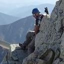
 Me on the Sawtooth summit, with Bierstadt and that awesome connecting ridge behind.")
 Most of our traverse along the west ridge of Evans looked like this. We chose the traverse over the crest of the ridge due to")
 Evans summit. Those clouds were beyond us to the south and east, but they still underscored how fortunate we were with the we")
 The day dawns full of promise.")
|
| Comments or Questions | |||||||||||||||||||||
|---|---|---|---|---|---|---|---|---|---|---|---|---|---|---|---|---|---|---|---|---|---|
|
Caution: The information contained in this report may not be accurate and should not be the only resource used in preparation for your climb. Failure to have the necessary experience, physical conditioning, supplies or equipment can result in injury or death. 14ers.com and the author(s) of this report provide no warranties, either express or implied, that the information provided is accurate or reliable. By using the information provided, you agree to indemnify and hold harmless 14ers.com and the report author(s) with respect to any claims and demands against them, including any attorney fees and expenses. Please read the 14ers.com Safety and Disclaimer pages for more information.