Download Agreement, Release, and Acknowledgement of Risk:
You (the person requesting this file download) fully understand mountain climbing ("Activity") involves risks and dangers of serious bodily injury, including permanent disability, paralysis, and death ("Risks") and you fully accept and assume all such risks and all responsibility for losses, costs, and damages you incur as a result of your participation in this Activity.
You acknowledge that information in the file you have chosen to download may not be accurate and may contain errors. You agree to assume all risks when using this information and agree to release and discharge 14ers.com, 14ers Inc. and the author(s) of such information (collectively, the "Released Parties").
You hereby discharge the Released Parties from all damages, actions, claims and liabilities of any nature, specifically including, but not limited to, damages, actions, claims and liabilities arising from or related to the negligence of the Released Parties. You further agree to indemnify, hold harmless and defend 14ers.com, 14ers Inc. and each of the other Released Parties from and against any loss, damage, liability and expense, including costs and attorney fees, incurred by 14ers.com, 14ers Inc. or any of the other Released Parties as a result of you using information provided on the 14ers.com or 14ers Inc. websites.
You have read this agreement, fully understand its terms and intend it to be a complete and unconditional release of all liability to the greatest extent allowed by law and agree that if any portion of this agreement is held to be invalid the balance, notwithstanding, shall continue in full force and effect.
By clicking "OK" you agree to these terms. If you DO NOT agree, click "Cancel"...
This trip started out on a sour note. After leaving work on Friday afternoon and heading east on I-70, I got stopped in traffic because of flooding near Parachute. After waiting for over an hour, the state patrol turned us around near De Beque and said that the highway would be closed for about six hours. At this point my options were to cancel the trip or take a different route into the mountains and not arrive until much later at night than I had hoped. I didn't want to cancel the trip, so I drove back to the Grand Valley and then took US 50 through Delta, Montrose and Gunnison.
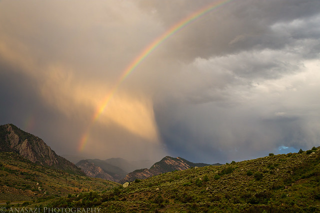
After descending from the Cerro Summit I pulled over to take a photo of this short-lived rainbow just before sunset.
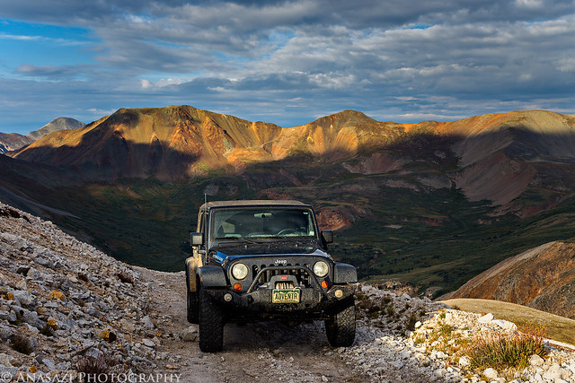
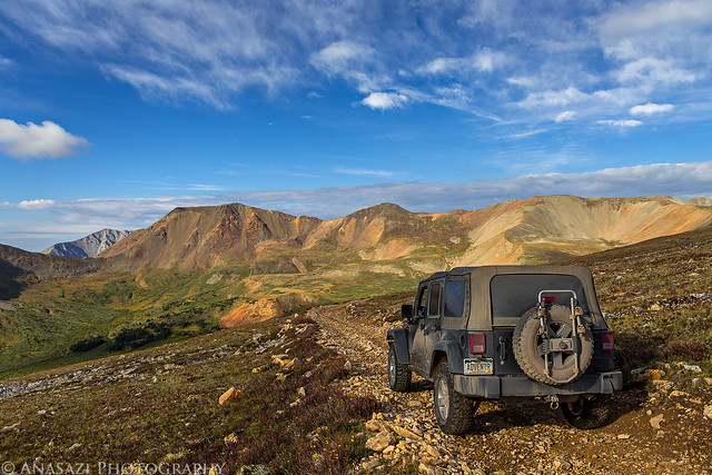
I didn't realize that US 50 was under construction shortly before the Blue Mesa Reservoir. The road was completely torn up and and the driving surface was temporarily a gravel road. This slowed down my progress even more. I made a quick stop at the Subway in Gunnison for a late dinner and then finished the drive over Monarch Pass. I was planning on hiking to the summit of Mount Antero in the morning and wanted to camp near the trailhead. I took the Chalk Creek Road towards St. Elmo and turned off on the rougher road the climbs up Mount Antero. I passed a few campsites along the lower road, but I wanted to camp much higher near the upper trailhead. Ascending the narrow road and switchbacks up the mountain usually doesn't bother me, but I'll admit it was a little nerve-wracking driving up them in the darkness of night. Before reaching the upper trailhead, I took a side road that descended to Browns Gulch, which is where I setup my camp for the night. I had hoped to get to bed this evening around 9:00pm for an early Saturday start, but I didn't end up getting to bed until 12:30am. It was a long and frustrating evening!
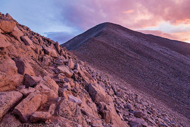
Instead of setting my alarm for 4:00am like I was originally planning, I decided to get a little more sleep and woke up at 5:30am instead. I was close enough to the trailhead that it only took me about 20 minutes to reach from my campsite. I was on the trail a little after 6:00am.
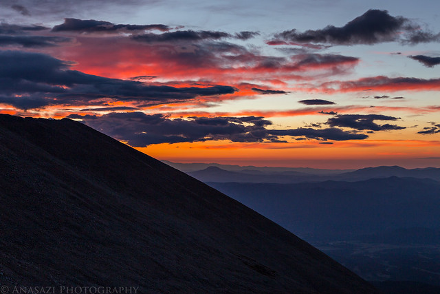
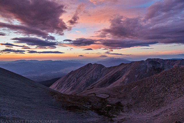
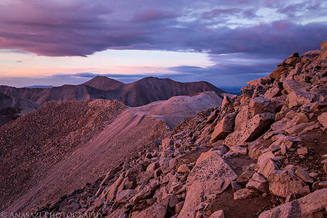
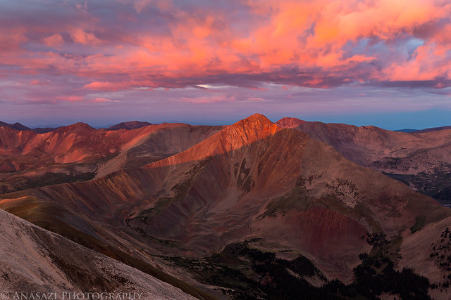
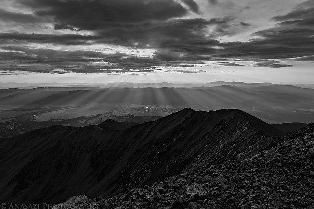
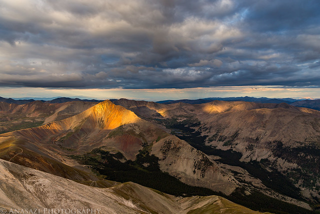
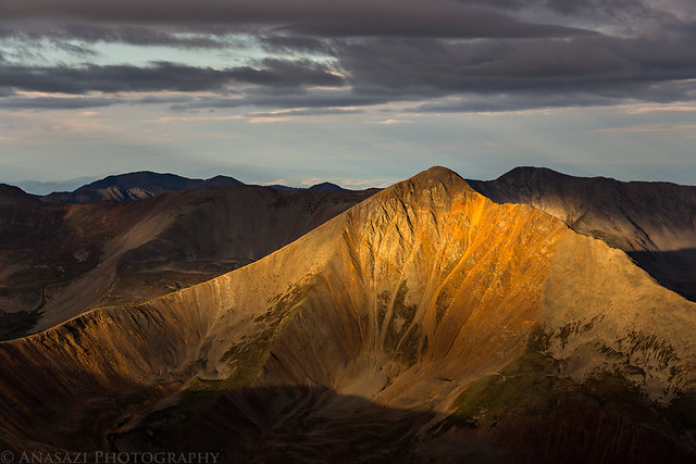
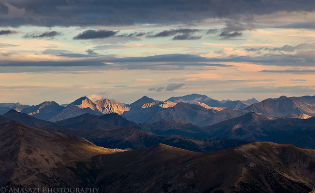
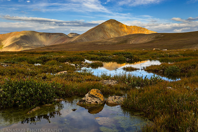
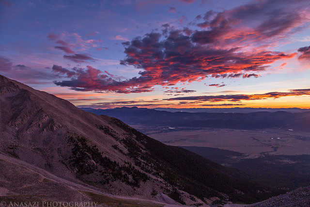
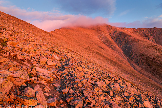
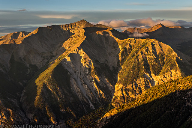
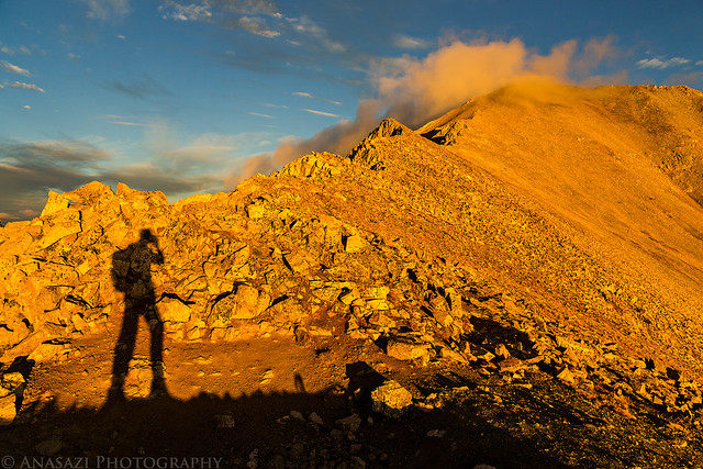
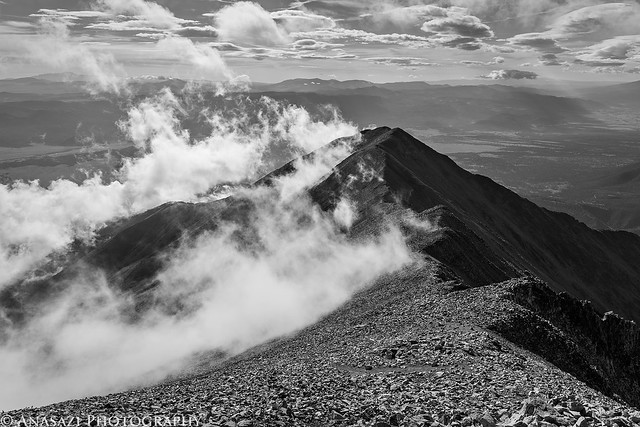
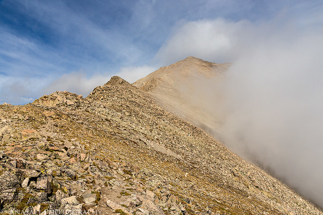
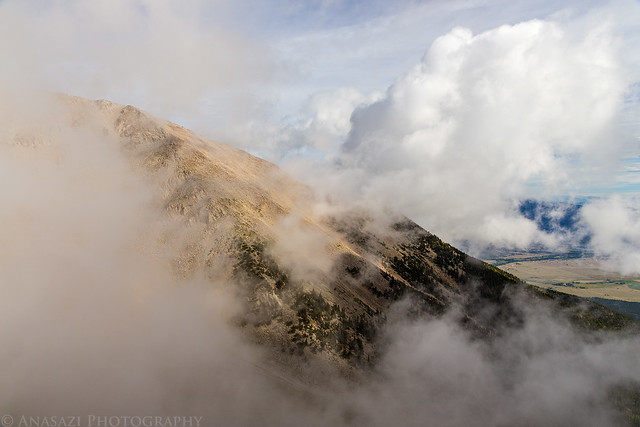
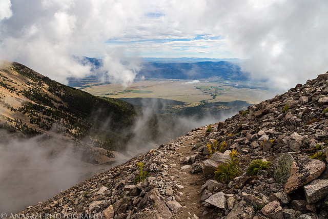
I started hiking just as dawn broke and I got to enjoy a colorful sky as I followed the ridge towards Mount Antero.
After descending back to Chalk Creek, I thought it would be a good idea to take Tincup Pass over to Taylor Park and then return to Buena Vista over Cottonwood Pass for a late lunch. It has been a few years since I have driven over Tincup Pass, but I certainly don't remember it being so bumpy! By the time I reached the smooth gravel road near Tincup I was happy to be off that rough trail.
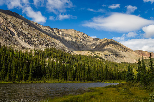
When I finally reached Buena Vista, I had a late lunch and then took the road up Mount Princeton so I could find a campsite for the night. I ended up finding a nice site a little ways past the radio towers and setup camp. Even though I was tired from a lack of sleep the previous night, I was unable to get any rest. I didn't sleep well this night and probably didn't get any more sleep than I did the previous night.
I was tired, but that wasn't going to stop me from reaching the summit of Mount Princeton. My alarm went off on Sunday morning at 4:30am and I was up at the trailhead and starting my hike shortly after 5:00am. I started the hike in the dark, but there was plenty of moonlight to light the way so I didn't need to use my headlamp at all. It was a very peaceful start to the day.
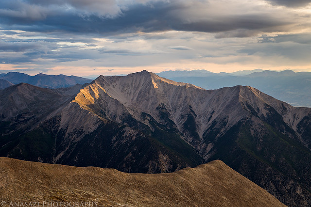
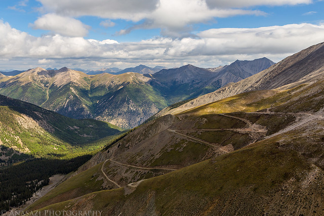
I must say, out of the ten 14ers that I have hiked so far, Mount Princeton is probably my least favorite. Even though the trail was only two miles to the top from the upper trailhead and the views were nice, the trail mostly crossed large boulder fields which really started to annoyed me after a while, especially on the way back down.
When I reached my Jeep, I drove back down to load up my camp and then started the drive back home. I took I-70 back home so I could grab a burger from GRIND in Glenwood Springs and see the aftermath of the flooding near Parachute. When I made it back home, I went right to bed and took a nap so I could try to catch up on some much needed sleep. It was a tiring but fun weekend.
I can't decide which I like better- alpenglow, sunrises or sunsets! And your beautiful photos aren't helping in my dilemma. But it's hard to take a bad pic of the Collegiates. Having done Princeton, I do plan on completing Antero soon. Loved reading this
rudelson, thanks...I currently shoot mostly with a Canon 6D.
You can find a list of my current photo gear on this page if you would like more info: http://adventr.co/about/
Caution: The information contained in this report may not be accurate and should not be the only resource used in preparation for your climb. Failure to have the necessary experience, physical conditioning, supplies or equipment can result in injury or death. 14ers.com and the author(s) of this report provide no warranties, either express or implied, that the information provided is accurate or reliable. By using the information provided, you agree to indemnify and hold harmless 14ers.com and the report author(s) with respect to any claims and demands against them, including any attorney fees and expenses. Please read the 14ers.com Safety and Disclaimer pages for more information.
Please respect private property: 14ers.com supports the rights of private landowners to determine how and by whom their land will be used. In Colorado, it is your responsibility to determine if land is private and to obtain the appropriate permission before entering the property.