Download Agreement, Release, and Acknowledgement of Risk:
You (the person requesting this file download) fully understand mountain climbing ("Activity") involves risks and dangers of serious bodily injury, including permanent disability, paralysis, and death ("Risks") and you fully accept and assume all such risks and all responsibility for losses, costs, and damages you incur as a result of your participation in this Activity.
You acknowledge that information in the file you have chosen to download may not be accurate and may contain errors. You agree to assume all risks when using this information and agree to release and discharge 14ers.com, 14ers Inc. and the author(s) of such information (collectively, the "Released Parties").
You hereby discharge the Released Parties from all damages, actions, claims and liabilities of any nature, specifically including, but not limited to, damages, actions, claims and liabilities arising from or related to the negligence of the Released Parties. You further agree to indemnify, hold harmless and defend 14ers.com, 14ers Inc. and each of the other Released Parties from and against any loss, damage, liability and expense, including costs and attorney fees, incurred by 14ers.com, 14ers Inc. or any of the other Released Parties as a result of you using information provided on the 14ers.com or 14ers Inc. websites.
You have read this agreement, fully understand its terms and intend it to be a complete and unconditional release of all liability to the greatest extent allowed by law and agree that if any portion of this agreement is held to be invalid the balance, notwithstanding, shall continue in full force and effect.
By clicking "OK" you agree to these terms. If you DO NOT agree, click "Cancel"...
After injuring my right knee in mid-August at an obstacle course, I wasn't sure this trip was going to happen. First thought after tearing up my knee: Ski season! Second thought: Labor Day weekend plans! In the following couple of weeks, the knee - partially torn meniscus and some IT band damage - was healing slowly, and I wasn't able to do any training/conditioning hikes or to rock climb. Still, sensing a strong team, I was reluctant to pass up this opportunity. I reasoned that if I am considerably slowing down the group or in too much pain, I'd turn around. With that, I arrived at Mill Creek TH on Thursday night. The rest of the crew arrived 2-3 hours later and we briefly discussed the game plan for the next day. Despite 60% chance of rain in late afternoon, the start time was set at 5am - and I was liking the group already. Confidence!
Day 1 - Dallas
August 30, 2013
Distance: 11.5 miles (according to GPS)
Elevation: ~5,700 ft (according to GPS)
Time: 10.5 hrs (4.50 am to 3.20 pm)
Team: Rick M, Ben, Matt Payne and Natalie (nkan02)
A lot of ground is already covered in other TRs, so I am going to add a few words on route finding. The Roach guidebook correctly describes taking the left turn at 0.4 mile and 3 switchbacks leading to a meadow near 10k, but his map lacks this detail, so I am including a .gpx track which may be useful for groups trying to find the route in the dark.
Turn left at the signed junction after about 0.4 miles from the TH. if you pass it and find yourself crossing the bridge, you've gone too far.
We didn't take the Stan's shortcut either up or down. The turn off to Sneffels Highline Trail is easy to spot and the trail takes you to the bottom of the Dallas south face near 11'400 ft. Leave the trail and ascend the grassy slopes aiming for the center of the cliff bands.
We used the grassy ramps to get higher on the south face
Fairly soon we were able to locate a climbers trail which even was marked with cairns. The sky, which was very cloudy earlier in the morning, was starting to look better.
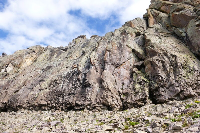
Approaching the cliff bands
The crew ascending the slopes
We hit a short section of Class 3 territory, but even this cripple was able to navigate the terrain without too much trouble
Eventually we found ourselves underneath an imposing cliff band near 13,000 ft. We turned right and followed the cairned trail leading to the ridge.
Rick traverses under the cliffs and leads the way to the rib crossover.
After crossing the rib we found ourselves on the East face. Most of the trail is Class 2+ with a short section of Class 4 Traversing the East face on climbers' trail
Looking down at our route
The summit pyramid comes into view for the first time
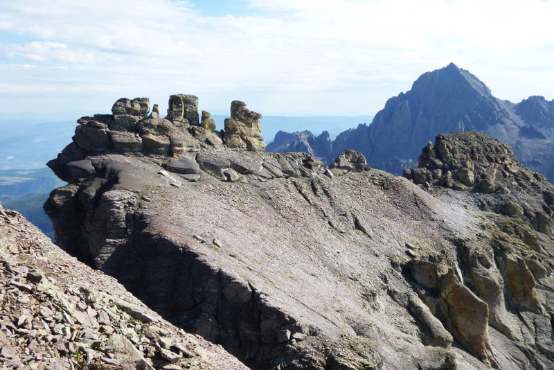
Some "hoodoos" on the ridge - and Sneffels
Matt is cruising through the Class 4 section
There is webbing if needed
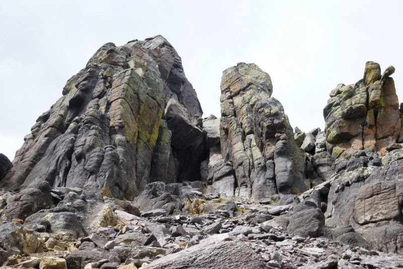
Approaching the summit tower.
This section was confusing. Ignore the "left" and "right" towers and concentrate on the "middle" tower. Its left side, marked with the "car sized chockstone" is the one you'll rapel to from the summit. Keep moving to the right and find the Class 4 chimney.
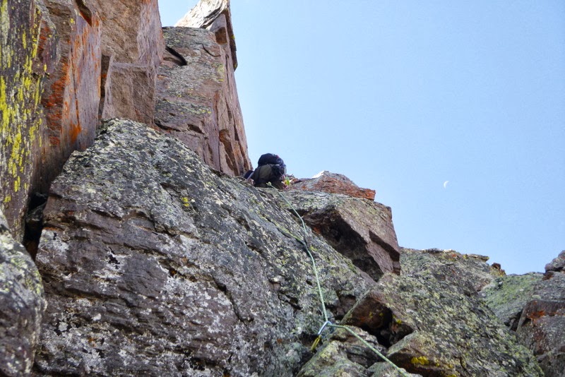
Matt climbing up the chimney
Webbing at the top of the chimney
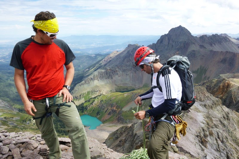
The crew studying the route and deciding on the next moves
As stated in other TRs and contrary to what Roach says, it is not necessary to do an airy traverse on the ledges. Rick scouted the higher line and we were able to traverse the rib into the North face.
The route description again gets confusing. The key words to look for are the downward "sloping ramp". Descend half-way down the ramp, then look to your left and up. You should be at the bottom of the summit pitch, with the pointy chockstone at the top.
Summit chimney and crack system
Rick did a beautiful job leading the pitch placing just one BD cam #0.75 in the first 15 feet. He declared the rest of the pitch to be Class 4. Maybe, but with daily rains in the San Juans and the pitch being on the North face, the rock wasn't completely dry. Add muddy wet boots and a bum knee which doesn't bend all the way and you can't trust the feet. Long story short, I was glad to have a rope on this one.
Matt is getting ready to climb the summit pitch
Rick is belaying from above while Matt is trying to find some firm ground on slippery slope (the crux)
Close-up of the crux
The summit view
Ben climbing final steps to the summit as Rick looks on.
In his San Juans intro, Roach writes about "diseased, knife-edge ridges with no logical means of support". Looking in the direction of "West Dallas" and "T 0" I saw some ridges that would fit that description.
The crew on the summit. Photo credit: Matt's camera
With time being around noon, the clouds started to move in.
Rick is setting up the rappel under Ben's watchful eye
Matt starting on the rappel
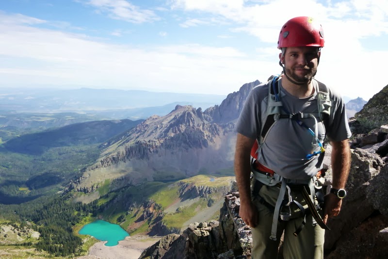
All smiles at the end of rappel
Descending from the "left" gully. "Car-sized" chockstone is seen in the background.
Another look at the summit tower. Right gully - route up; left gully - route (rappel) down.
Ben descending the East face
The descent was fairly uneventful, except for Matt slipping and sliding on one of the ledges and getting a few cuts and bruises. Nothing like a memento from the San Juans!
By the time we got down to the treeline, it started raining. We decided not to look for the Stan's shortcut, but to cruise down a familiar trail. And so we did, arriving back at the cars shortly after 3pm.
Day 2 - Teakettle
August 31, 2013
Distance: 3.6 miles (according to GPS)
Elevation: ~2,900 ft (according to GPS)
Time: just over 6 hours (6.00 am to 12.00 pm)
Team: Rick M, Brad, Matt Payne and Natalie (nkan02)
The knee was still holding up, so I was in for the second day of climbing. We car camped at the campground low on Yankee Boy basin road and piled up in Rick's truck around 5.30am. The road got pretty bad after the Camp Bird mine, so we glad we had a 4WD. According to Rick, the road got significantly worse even compared to a month ago. Subarus could probably make it within a mile or two from the 4WD TH. We set off from the truck shortly after 6am and hiked up the road for about 0.3 miles. We then started the direct ascent up the grassy slopes.
We reached the upper basin near 12,000ft and surveyed the route ahead Brad, Rick Matt
I have a nagging feeling that we didn't ascend the route Roach describes. Instead, we climbed the hellish scree aiming for the saddle between Teakettle and "Coffeepot". About 1,000 ft of pure San Juans scree
As we were ascending, I kept thinking that it was a melted out snow slope, if I ever saw one. I recalled CarpeDM (Dave M) telling me something about this nasty scree - I should listen more to you, Dave, you seem to be spot-on on many things. I was also marveling that my knee was holding up so far on this unpleasant slope. Of course, I jinxed it. Suddenly I heard "rock", looked up and saw a boulder rolling towards me at a good speed. I knew I had to jump out of the way, but my knee just froze. Eventually, I yanked it out of the scree and moved right. Ouch. The boulder narrowly missed me, but it took a heavy doze of ibuprofens and about 2 minutes of rest before I could start moving again. Nothing like a reminder that you are a gimp on a steep loose slope. Eventually, the guys in front found the entry to the Black gully - we never had to downclimb to it, our route was straight up.
Rick and Brad at the entrance of the Black gully. Coffepot is in the upper right corner.
Black Gully looked like a river of mud... Wet loose dirt with loose rocks. I kept thinking it would be much better with snow.
I couldn't be happier topping out on the ridge around 8.30am - about half an hour behind schedule, according to Rick, but the weather still looked spectacular. One of those rare blue bird San Juans mornings! After gaining the ridge, the route gets fairly straightforward - just follow the cairns
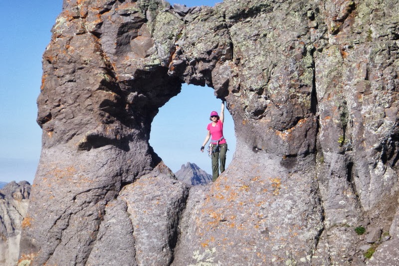
While Matt, Brad and I played with the Teakettle handle posing for pictures, the ever-efficient Rick was already setting up the belay station.
Photo by Matt Payne
With Brad belaying him, Rick led the pitch and made it look easy.
Three pieces of protection was used - a nut/stopper, a sling around a horn and a medium sized hex in the middle of the upper crack. We also used a 30m 8mm rope.
Rick is putting a sling on a rock
Rick on the upper section
In no time, our fearless leader was on top. Next, it was my turn to follow. The rock looked dry and the boots were muddy, so I switched into my rock shoes. I was so glad I did! The pitch, albeit short, was a blast. Since I couldn't do high stepping, I had a lot of fun stemming. Rick said I had good footwork for a gimp. I do what I can.
Photo credit: Rick
Sneffels and Cirque mountain
The Wilsons
Dallas, climbed the day before
We waited for Matt to climb up with Brad belaying him from the ground, and then I volunteered to switch places with Brad - it would be tough to fit all of us on the tiny summit.
Brad climbing up - his 2nd or 3rd 13er. Photo by Rick
By the time the last person rappelled down around 10am, the clouds were already building. I was really hoping for at least Coffeepot and maybe even Potosi, but already felt my energy level plummeting - the Teakettle scree definitely took its toll on me.
Descending the Black gully
For now, we decided to descend the Black gully and then re-evaluate. The ski technique was employed - descending one-by-one and then hiding in a "safe zone". Yep, this terrain would make much more sense with snow. I was driving Matt mad by uttering a word "ski" way too many times...
Coffeepot - so close, yet so far away.
Somewhere in the Black gully Brad announced that he was suffering from AMS. While we could have split the group with Brad descending with Matt, and me and Rick going for Coffeepot, I was struggling to find enough motivation to ascend (and then descend) additional 400 ft of hellish scree. Coffeepot and Potosi will have to wait for another time.
Short Class 3/4 section in the Black gully
Carefully picking your own line down the slope
Scree surfing is about to commence
Once Black gully ended and the slope widened, we were able to fan around the slope and pick our own line. After slipping and falling a few times on my butt, I made it down to the bottom mostly intact.
Coming down
By the time he got down to more agreeable terrain, Brad was really hurting and was losing remnants of his breakfast at an alarming rate. Again, I was glad we didn't split up, although we couldn't do much except offer the moral support and carry his pack and harness (Rick). Trying to get Brad down as quickly as possible, we took the beeline to the truck. Although there seemed to be a faint trail with sporadic cairns, I thought that our ascent route was more straightforward. We got to the truck soon after 12pm.
Day 3 - Points 13,832 and 13,811
September 2, 2013
Distance: ~13 miles
Elevation: ~5,600 ft (according to GPS)
Time: 7.0 hrs with 30 min on the summit (6.30 am to 1.30 pm)
Party: solo
With the knee holding up so well for the first 2 days of hiking, I decided to give it a day of rest (which included Ouray Hot Springs) and hit a few more peaks before heading back to Denver. I arrived at the Grizzly Gulch TH, ate dinner and was chased into the car by rain around 7pm. Little did I know that the rain (with thunder and lightning) would continue through the night! When my alarm went off at 4am, it was still raining, so I went back to sleep. When I woke up next time a quarter to 6, it finally stopped raining but the cloud cover was still thick. I found motivation in seeing other people getting ready and heading up the trail for Redcloud and Sunshine. Well, I am here, so I may as well hike... Besides, I was putting some faith in weather forecasters - they said "rain after 2pm", so be it. I set out at 6.30am.
Cruiser trail up the saddle with Redcloud
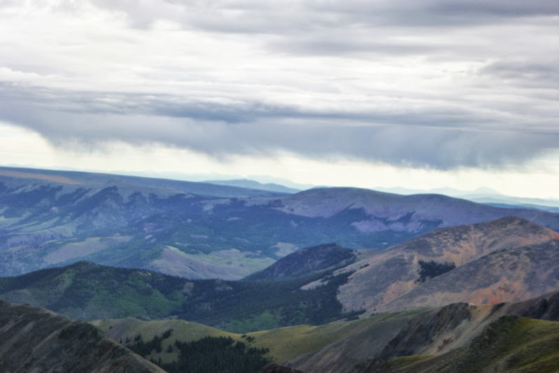
Gloomy skies ahead
From the ridge, I could see it was raining just to the east of me, but there was no lightning and the cloud wasn't big, so I kept moving.
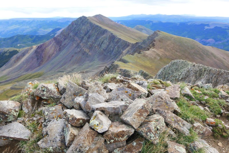
Summit of Pt 13,832
Reached the 1st summit around 9am and noticed that the weather is not deteriorating any further, but in fact is improving. Onward to Pt 13,811.
Trail is easy Class 1 all the way, so no technical difficulties or partners to distract me from my thoughts. Maybe because of it I wanted the hike to be over soon. I got to Pt 13,811 just after 10am and took a half an hour break. Then the sun came out.
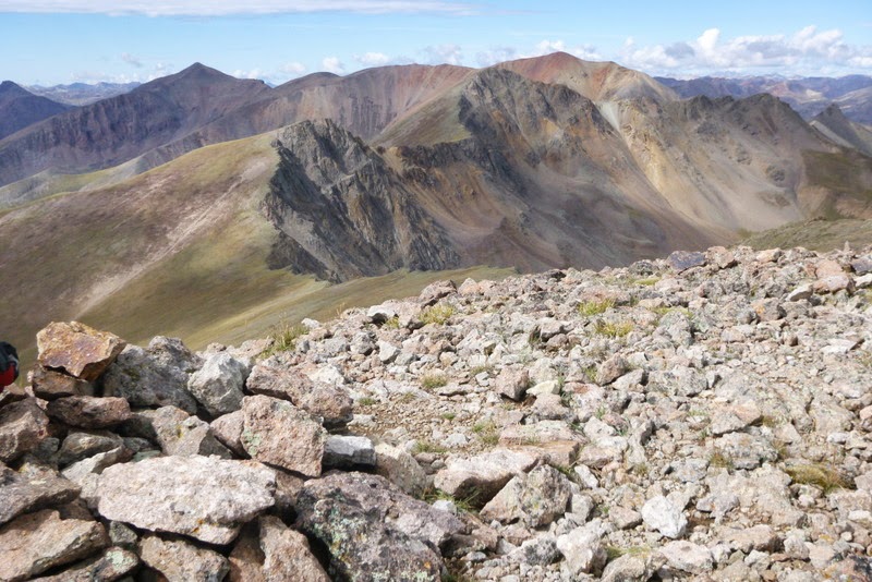
Looking back at the ridge run from Pt 13,811
Uncompahgre and Wetterhorn steal the show
Clouds
Redcloud and Sunshine on the way back
Uncompahgre
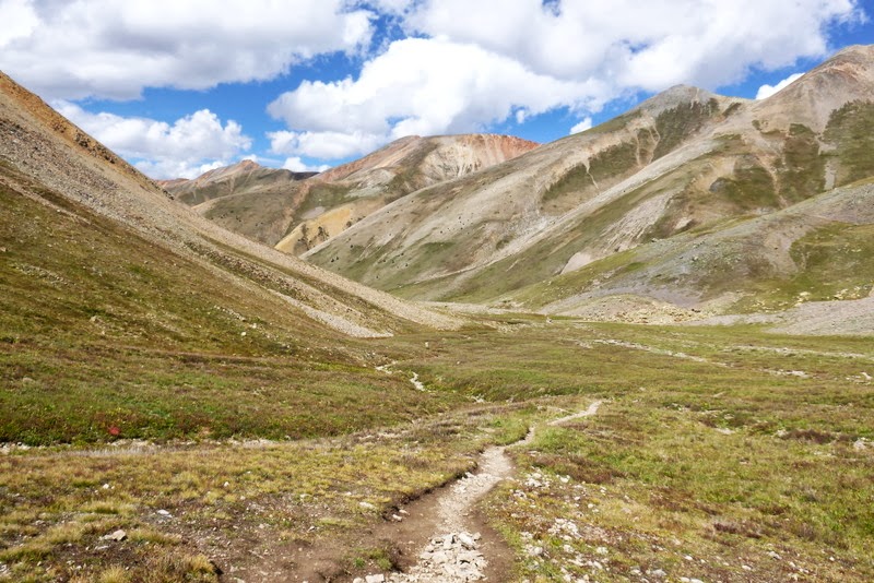
Silver Creek basin
Cliffy side of Redcloud
Handies from Grizzly Gulch with obvious avalanche paths in the valley
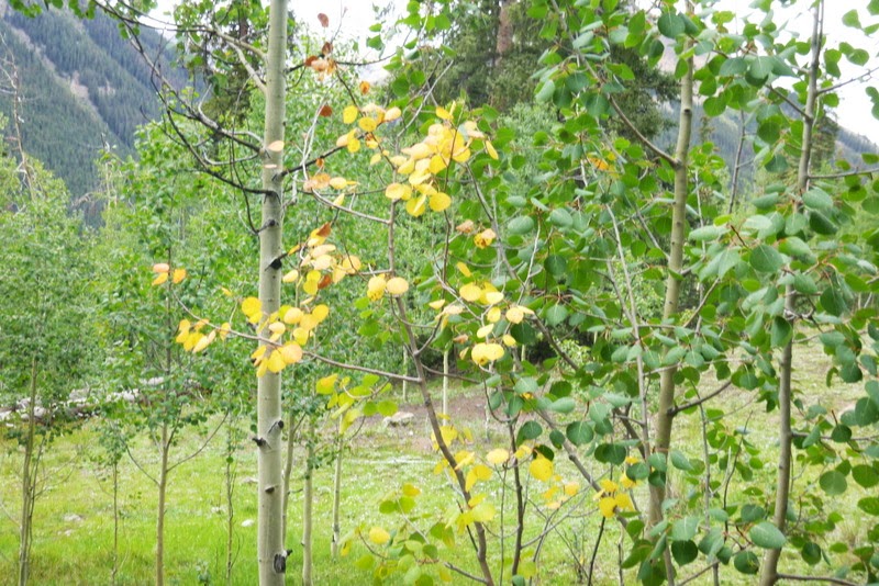
Fall is in the air
Sometimes one just has to believe the forecasters. Back at the car at 1.30pm and it is not raining just yet! The knee wasn't happy in the last few miles and it would be swollen by the end of the day. Oh well, it will have a few more days to recover...
My GPS Tracks on Google Maps (made from a .GPX file upload):
Thanks for the amazing memories Natalie! Great climbs! Grats on those other 2 centennials too. I guess I'll have to be the one to make a reference to Kilpacker in my trip report 8)
That's an amazing area with some stunning scenery! You got some fabulous shots of the route, Natalie! Hope your knee didn't suffer too much, but it sure looked like it was worth the abuse! Great job!
Natalie was an awesome climber. She MUST have been fakin that knee! I mean who climbs like that all banged up? Loved havin this team! Perfect climbing weekend!
And Natalie racked up 28.1 miles and 14,200 vf over the span of 4 days. All on that bum knee. Throw in some 5.3 and 5.4 alpine climbing, and ya gotta say that is pretty darned amazing.
Brian - thanks for counting for me, because I wasn't. I know I still have a long way to go with Centennials. Some of them are really fun mountains indeed.
inthemtns - thanks. I wish there would be more mountains like that. Do you know of any other C5 13ers? I am all ears
Matt - it was great climbing with you. And GREAT photos. I was really impressed by your cruising through all the tricky sections with such a heavy camera. That really shows dedication to your craft!
Dave - how's the married life? Let's climb together something soon. Preferably C5
emohr - thanks. Handle is a unique perch indeed. Before you know it you'll find your way up there.
MtnHub - thank you. My PT was definitely not happy with the weekend shenanigans, but as you said, it was tough to pass up this opportunity!
Rick - not faking. We should climb again sometime when I am back to normal, maybe then you won't need a 60m 10lb rope as a handicap to slow you down! AND you won't get away so easily from climbing additional peaks. lol
Please don't mention any numbers, this likely wasn't too smart on my part. Here is another number for you - I sat longer in traffic on Monday that it took me to climb 2 centennials. Not a great galons per peak ratio. Oh, and you totally rocked this weekend, making everything look so easy. Thanks again for putting together an amazing group. I hope we can climb again soon.
Caution: The information contained in this report may not be accurate and should not be the only resource used in preparation for your climb. Failure to have the necessary experience, physical conditioning, supplies or equipment can result in injury or death. 14ers.com and the author(s) of this report provide no warranties, either express or implied, that the information provided is accurate or reliable. By using the information provided, you agree to indemnify and hold harmless 14ers.com and the report author(s) with respect to any claims and demands against them, including any attorney fees and expenses. Please read the 14ers.com Safety and Disclaimer pages for more information.
Please respect private property: 14ers.com supports the rights of private landowners to determine how and by whom their land will be used. In Colorado, it is your responsibility to determine if land is private and to obtain the appropriate permission before entering the property.