Download Agreement, Release, and Acknowledgement of Risk:
You (the person requesting this file download) fully understand mountain climbing ("Activity") involves risks and dangers of serious bodily injury, including permanent disability, paralysis, and death ("Risks") and you fully accept and assume all such risks and all responsibility for losses, costs, and damages you incur as a result of your participation in this Activity.
You acknowledge that information in the file you have chosen to download may not be accurate and may contain errors. You agree to assume all risks when using this information and agree to release and discharge 14ers.com, 14ers Inc. and the author(s) of such information (collectively, the "Released Parties").
You hereby discharge the Released Parties from all damages, actions, claims and liabilities of any nature, specifically including, but not limited to, damages, actions, claims and liabilities arising from or related to the negligence of the Released Parties. You further agree to indemnify, hold harmless and defend 14ers.com, 14ers Inc. and each of the other Released Parties from and against any loss, damage, liability and expense, including costs and attorney fees, incurred by 14ers.com, 14ers Inc. or any of the other Released Parties as a result of you using information provided on the 14ers.com or 14ers Inc. websites.
You have read this agreement, fully understand its terms and intend it to be a complete and unconditional release of all liability to the greatest extent allowed by law and agree that if any portion of this agreement is held to be invalid the balance, notwithstanding, shall continue in full force and effect.
By clicking "OK" you agree to these terms. If you DO NOT agree, click "Cancel"...
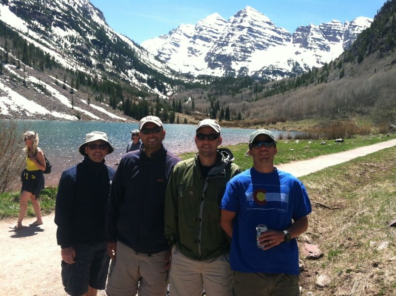
I first saw the north face of north maroon 13 years ago, and after looking at it for the first time in person, I finally got a chance to climb and ski it this past weekend. On Saturday, the bro and I with some friends did a recon hike up to Maroon Lake to scout the line and met a couple of dudes that had climbed and skied the route that day. The word was that the bootpack was in to the summit and that the route was mainly skiable save for a couple of short downclimbs. All this information was rather agreeable to me.
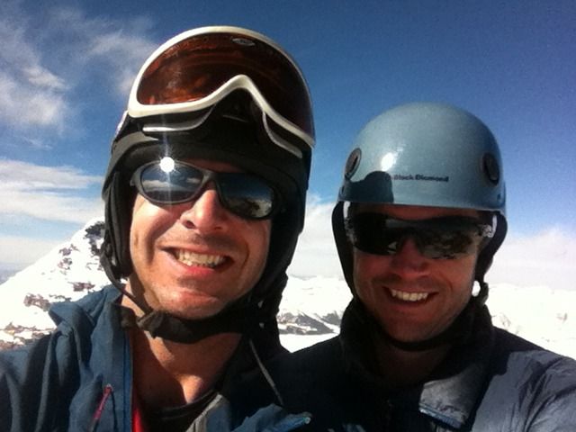
Recon trips are easy, drinking beers at Maroon Lake.
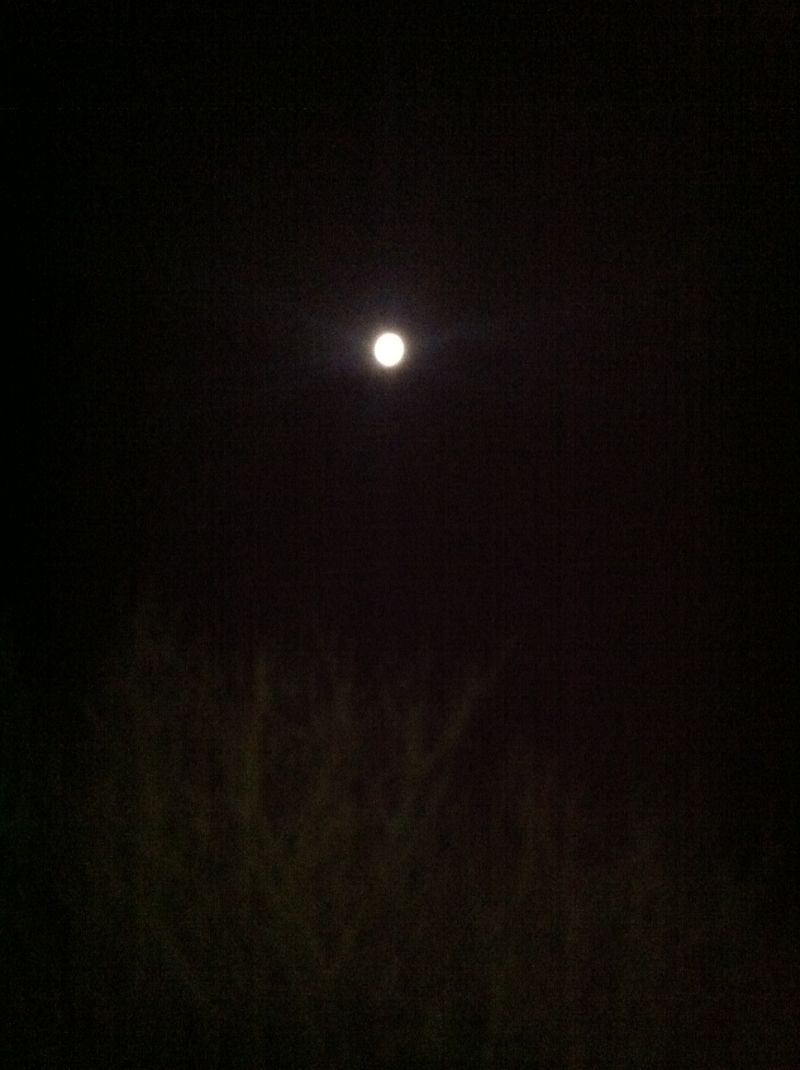
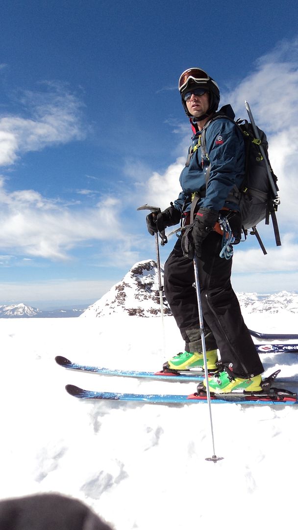
Most of the ski reports I read of north maroon said "we started around 3am, summited around 10am and should have started earlier". Since we are slow gapers I figured we'd better start around 1am, that would put us on the summit around 9am. We were camped at the difficult campground up towards independence pass, so we set the alarm for 12am, got dressed and did the 30 minute drive up to Maroon Lake. Dancing the sorting gear dance in the parking lot, packs thus assembled we began the languid march up to the crater lake trail at 1am under the light of a full moon.
Do you see that? That's the moon.
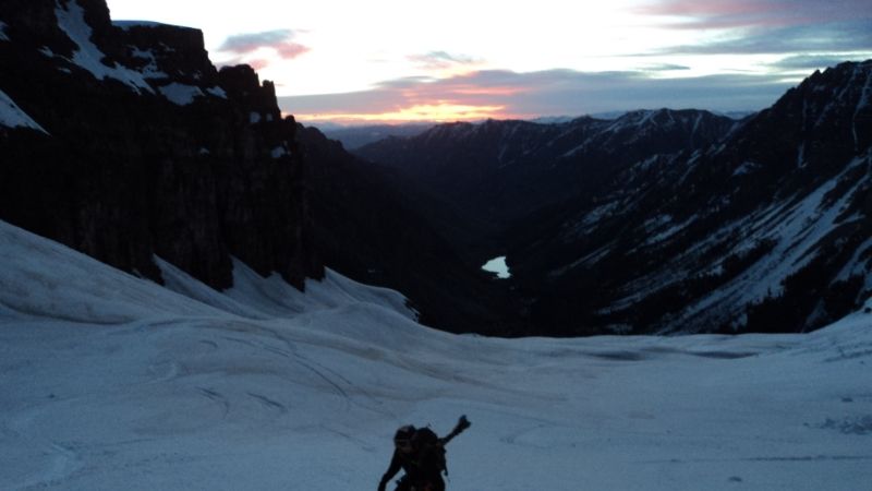
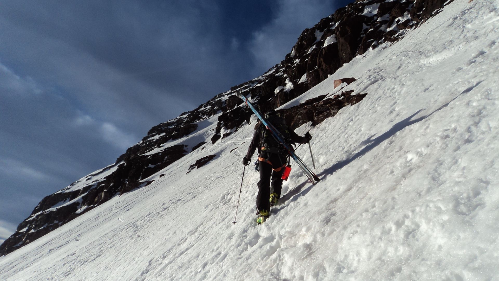
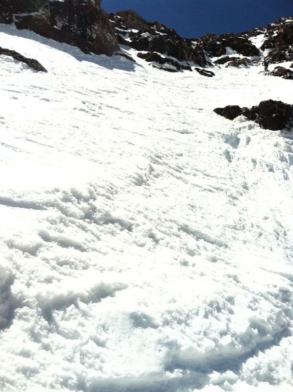
The trail up to the junction went smoothly and before you know it we were heading up minnehaha gulch, from the junction you want to climb up about 600 vertical feet and a little over half a mile. We dropped in too soon and lost some elevation, but were quickly back on route, and didn't lose too much time. In snow season, it's difficult to say if there really is a good route up to the upper basin. Just cross the river, then try to find an open looking snow gully and climb it. The snow was awesome up to this point, solid, the black diamond whippets and sabertooth crampons enjoying the task at hand. We crested the gully into the upper basin as the eastern glow awakened a new day.
First light of the day is always a special time.
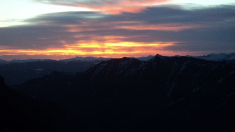
A beautiful sunrise is sure to cure whatever ails you.
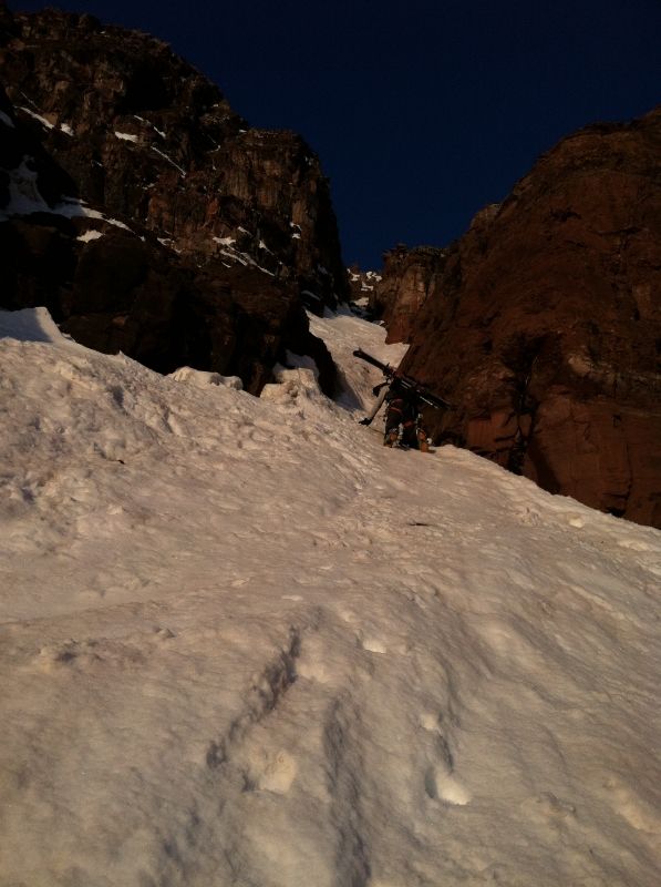
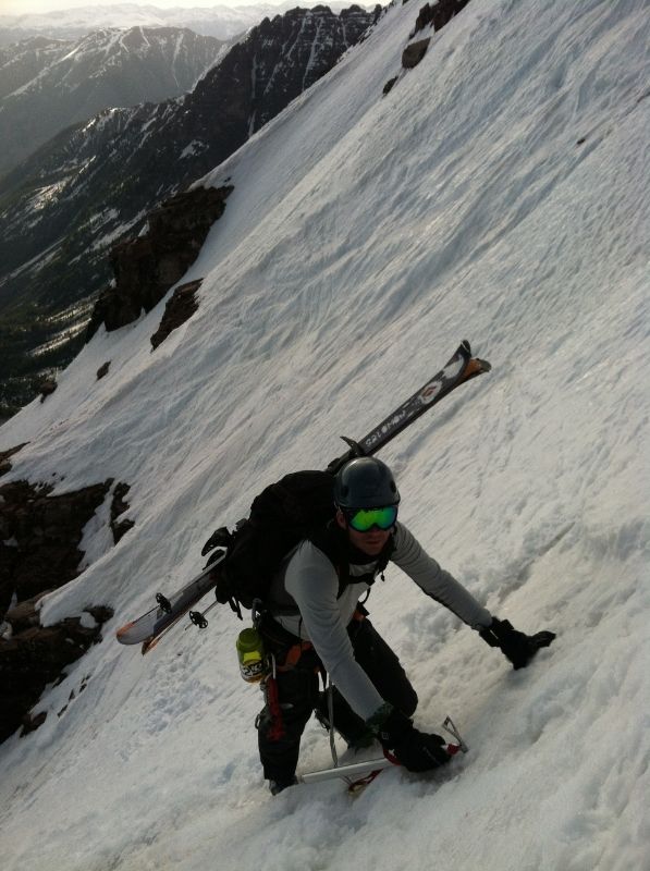
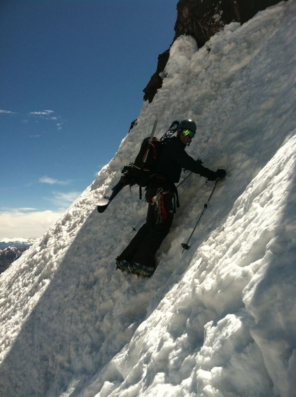
We switched over to crampons and ice axe around 5:30 am and began the climb up the face. I'd read enough trip reports and guidebooks to know the general way, but it's a maze up there for sure so we were happy to have some tracks to follow. The lower gully that lead to the first snow field was firm and narrowed to about 4 feet at one point. The initial gully is about 40-45 degrees and Mike took the lead.
Above the first cliff band you do the traverse up and left, just heading towards the less obvious center gully. We went a little too high initially but easily navigated around the rock bands. Walking on snow like this is fun.
Keep climbing and don't look down.
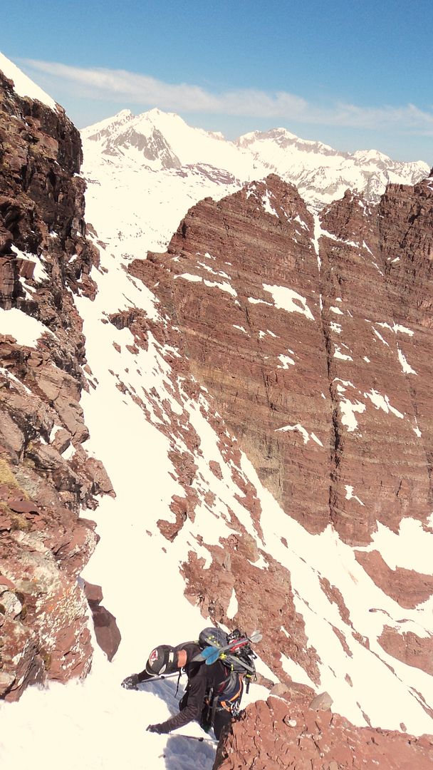
There was a section towards the top of the middle section where there were no more ski tracks and you could see where the previous days group had downclimbed and traversed over and around an exposed cliff band. I'm not sure if there is usually a ski route through there or we just missed something, but we planned on doing the same as that looked like our best option.
Mike about to get serious.
Taking a break before it gets too serious.
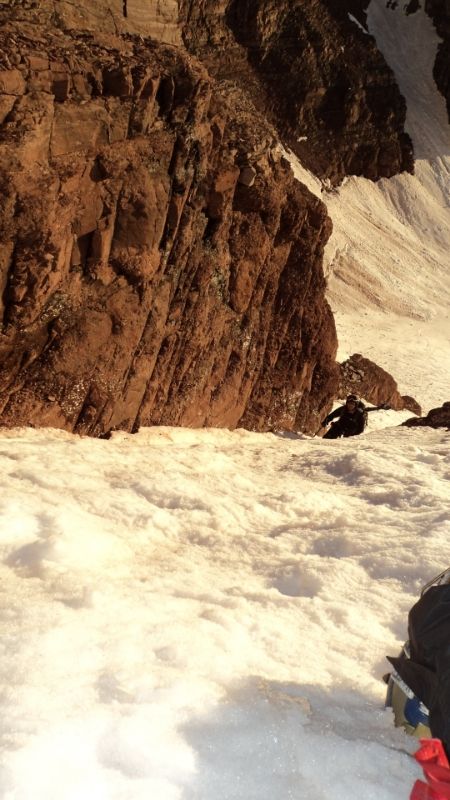
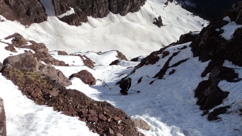
Once through the gnarly middle section you want to do another traverse up and to the left aiming for the left edge of the punk rock band.
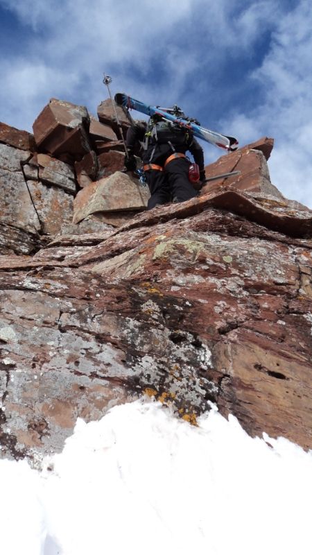
Once at the punk rock band, we decided to climb the rock to the upper snowfields, we didn't really see a snow route, so a little 4th class move got us up and over and we planned to downclimb this as well on the descent.
Finally, at 8:30 am, we arrived on the summit. The climb up had gone just about as well as one could hope. The descent seemed like it was going to be a little involved but doable. Due to some early morning clouds,we waited on the summit for an hour for the snow to soften and started the descent at 9:30am.
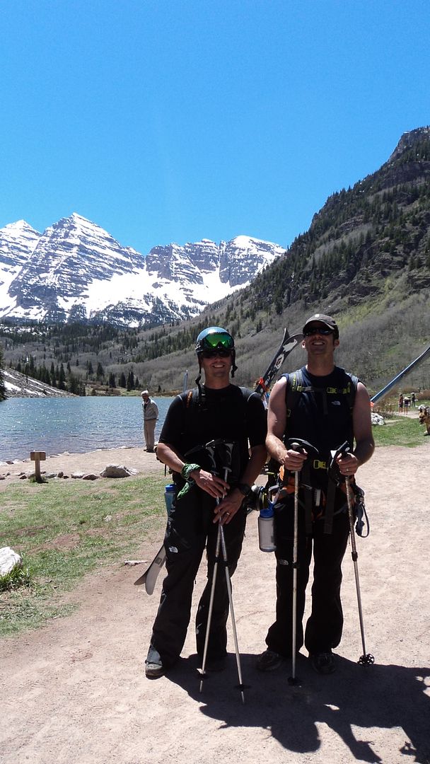
Happy climbers with S.Maroon peaking off of the shoulder.
I'm anxious, nervous, and excited all at the same time, let's get this thing going.
The upper snowfield is nice and mellow until it gets to the punk rock band, we didn't see a snow route down this so we took the skis off, downclimbed 10 feet, and reattached the skis at the base of the cliff. Lots of exposure up in this spot, which is why there are no pictures, I was too gripped to take the camera out. After the rock band it's a traverse down and right to connect back up with the upper middle section.
Negotiating the upper middle section.
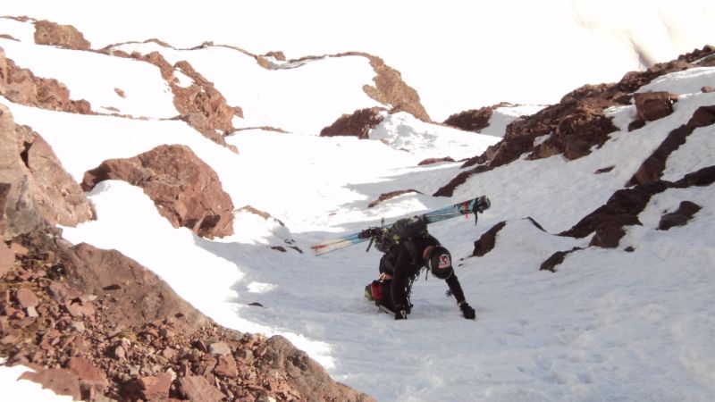
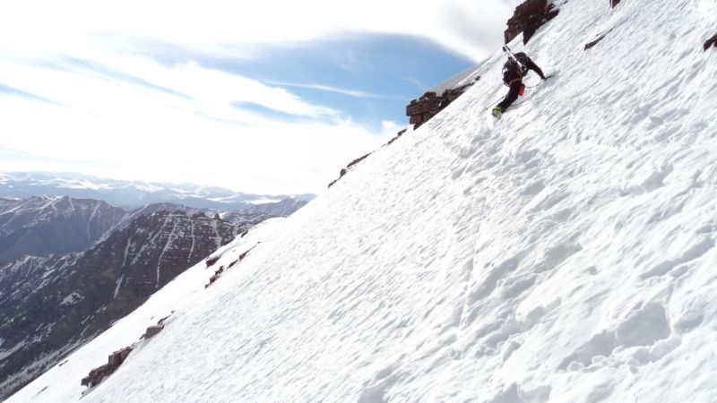
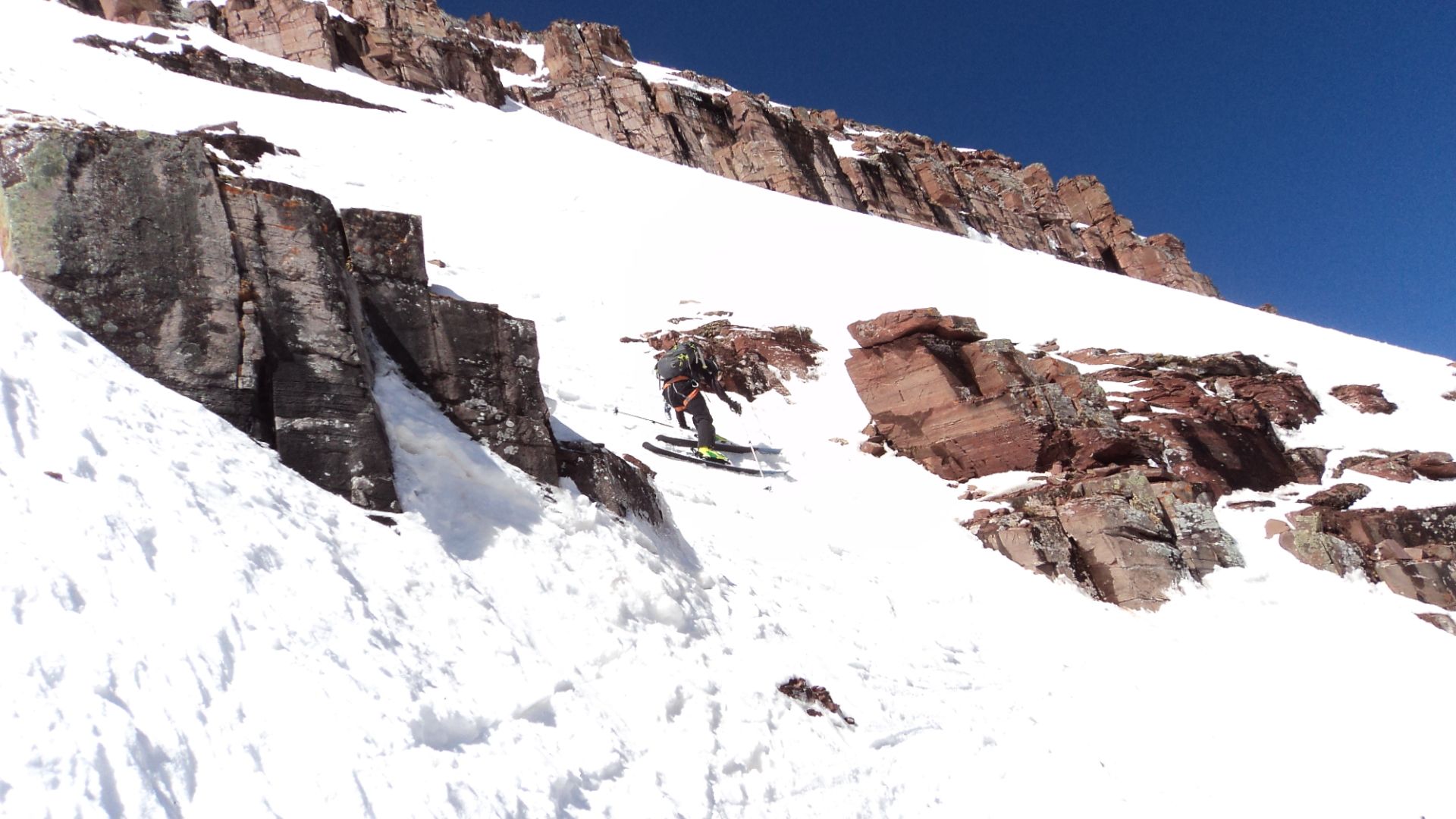
Starting the downclimb, steep snow to a rock band and then the skis went back on, maybe descended 50 feet but it was slow going.
Mike taking his time across the steep snow from the above rock band, we had spotted a small platform that the previous crew had flattened out and set our sights on it.
Skis on with the cliffs above that were negotiated earlier, you can see Mike just below the cliff band getting ready to make some turns.
Once below the lower middle section it was back to the lower snowfield above miners ski jump, that smile says it all "only one certain death cliff from this point on"
Once across the lower snowfield and back to the entrance gully we negotiated the narrow section by side slipping down some rocks, then dropping down about 3 feet to the snow below. The lower apron, oh dream of joy, it felt good to be here.
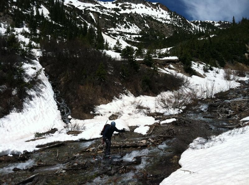
River crossing steeze.
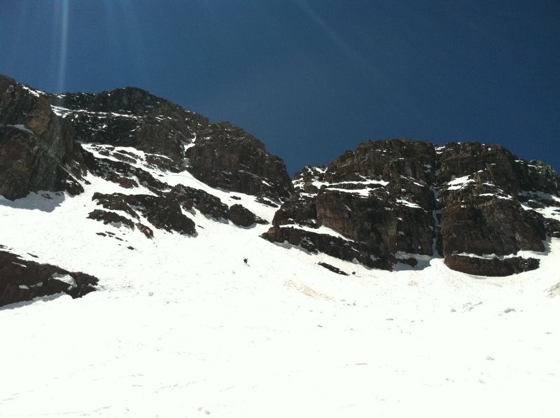
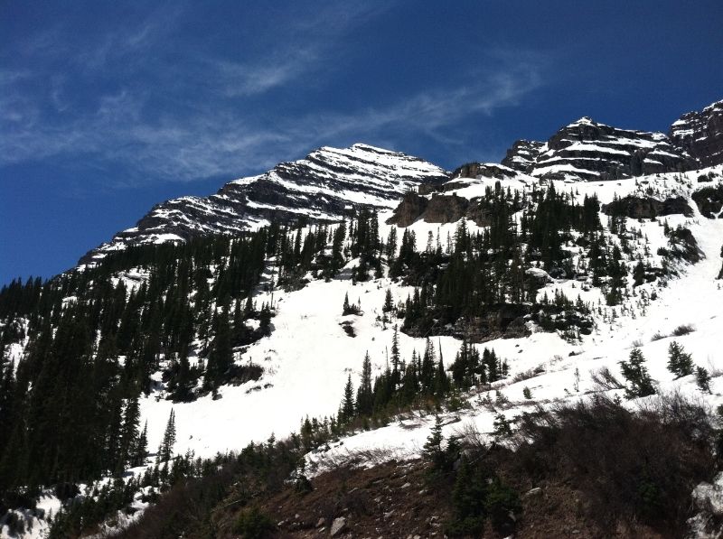
Looking back from near the creek crossing at the lower headwall and the upper slopes of the north face.
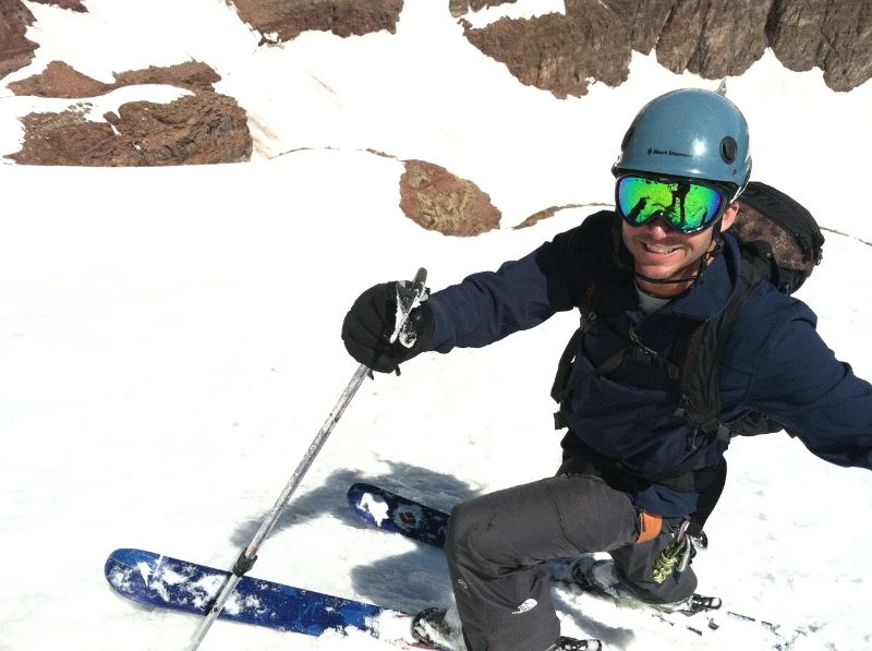
Back on dry ground, we trudged our way down the trail. After 13 hours total we were back to the car with cold beers waiting for us. That was a good one, incredible climb, good ski, would have been a better ski with more snow, but I would fathom we had average conditions. These are genuine smiles of two joyful and relieved skiers to have been so fortunate on North Maroon.
Glad to see that went well for you guys. BTW, no one who skis the north face of North Maroon is a gaper. You are automatically disqualified from gaperdom if you ski that line. Congrats!
On a fun and challenging classic. Glad to see someone post a TR on this one this year. I'd have expected the cruxes to be a tad more filled in last weekend, guess it just goes to show how fast everything's melting out. Good work pushing through it nonetheless.
that was an awesome day, definitely one of the top 14er climbs I've done. As far as the coverage goes, it was amazing seeing the difference from the the front range/ten mile/mosquitos to the elks. Way more snow further east, if this coolish weather keeps up we'll be skiing in the indian peaks till july.
I try to keep the number of pics in a TR, limited to just what I think are the best but still tell the story. I wish we had more ski pics, but was so focused on the descent that thinking to take pictures didn't come too mind too often.
the full album of all the pics from the weekend is here, you're welcome to look through to see if you see anything useful in there. more pics
Great work accomplishing such a challenging route and being able to safely ski it!
Caution: The information contained in this report may not be accurate and should not be the only resource used in preparation for your climb. Failure to have the necessary experience, physical conditioning, supplies or equipment can result in injury or death. 14ers.com and the author(s) of this report provide no warranties, either express or implied, that the information provided is accurate or reliable. By using the information provided, you agree to indemnify and hold harmless 14ers.com and the report author(s) with respect to any claims and demands against them, including any attorney fees and expenses. Please read the 14ers.com Safety and Disclaimer pages for more information.
Please respect private property: 14ers.com supports the rights of private landowners to determine how and by whom their land will be used. In Colorado, it is your responsibility to determine if land is private and to obtain the appropriate permission before entering the property.