Download Agreement, Release, and Acknowledgement of Risk:
You (the person requesting this file download) fully understand mountain climbing ("Activity") involves risks and dangers of serious bodily injury, including permanent disability, paralysis, and death ("Risks") and you fully accept and assume all such risks and all responsibility for losses, costs, and damages you incur as a result of your participation in this Activity.
You acknowledge that information in the file you have chosen to download may not be accurate and may contain errors. You agree to assume all risks when using this information and agree to release and discharge 14ers.com, 14ers Inc. and the author(s) of such information (collectively, the "Released Parties").
You hereby discharge the Released Parties from all damages, actions, claims and liabilities of any nature, specifically including, but not limited to, damages, actions, claims and liabilities arising from or related to the negligence of the Released Parties. You further agree to indemnify, hold harmless and defend 14ers.com, 14ers Inc. and each of the other Released Parties from and against any loss, damage, liability and expense, including costs and attorney fees, incurred by 14ers.com, 14ers Inc. or any of the other Released Parties as a result of you using information provided on the 14ers.com or 14ers Inc. websites.
You have read this agreement, fully understand its terms and intend it to be a complete and unconditional release of all liability to the greatest extent allowed by law and agree that if any portion of this agreement is held to be invalid the balance, notwithstanding, shall continue in full force and effect.
By clicking "OK" you agree to these terms. If you DO NOT agree, click "Cancel"...
Secrets of Gray Needle and Other Stories:
Five Days in the Weminuche Wilderness
Peaks: Sunlight Spire, Noname Needle, Grey Needle
Dates: August 18 through 22, 2012
Climbers: Sgladbach, Dancesatmoonrise
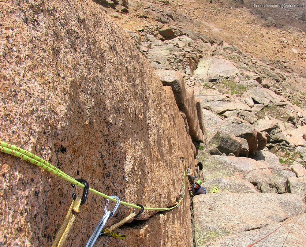
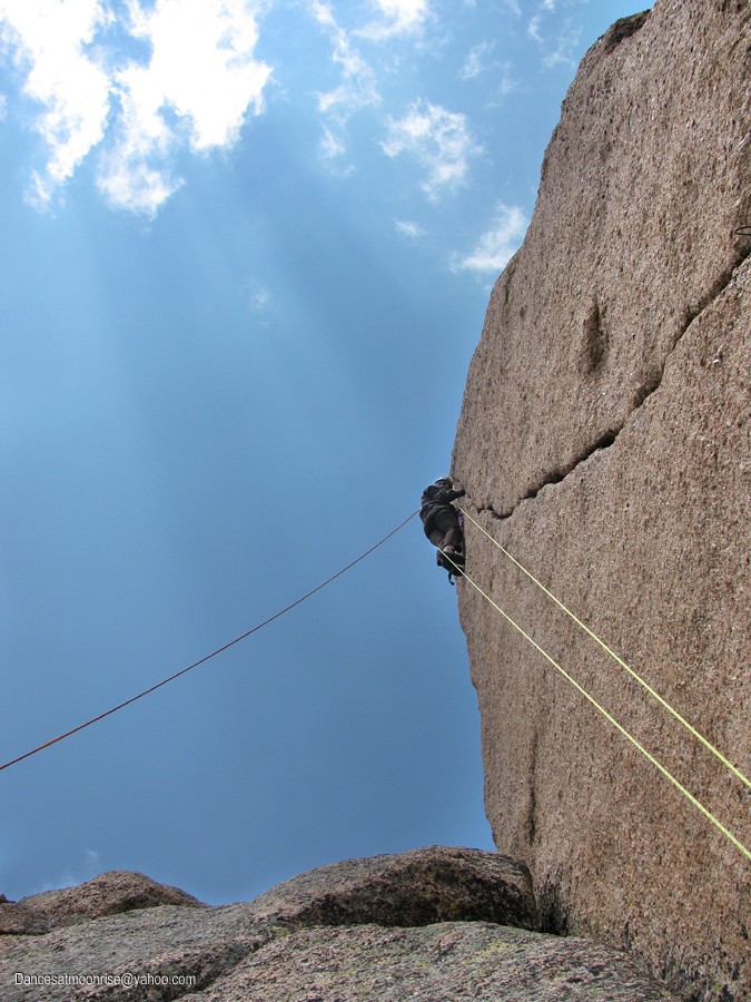
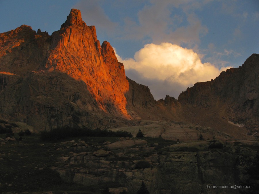
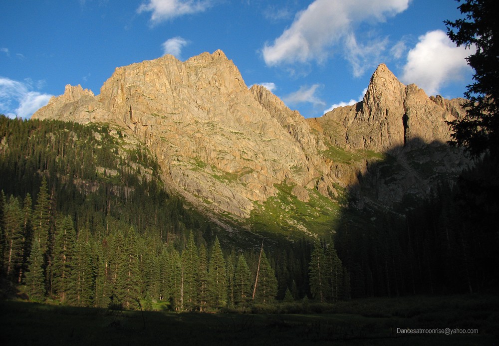
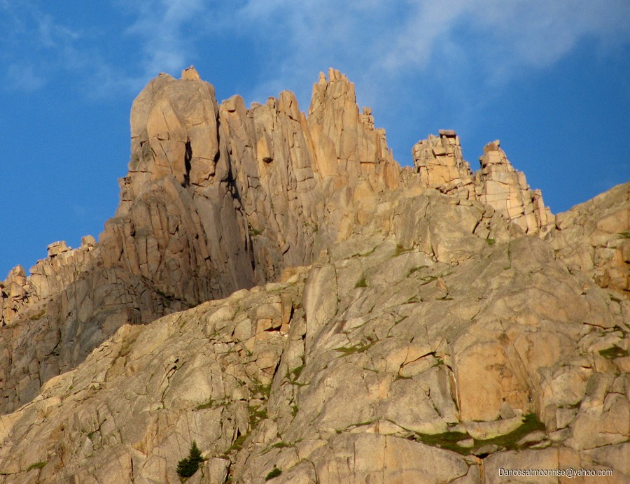
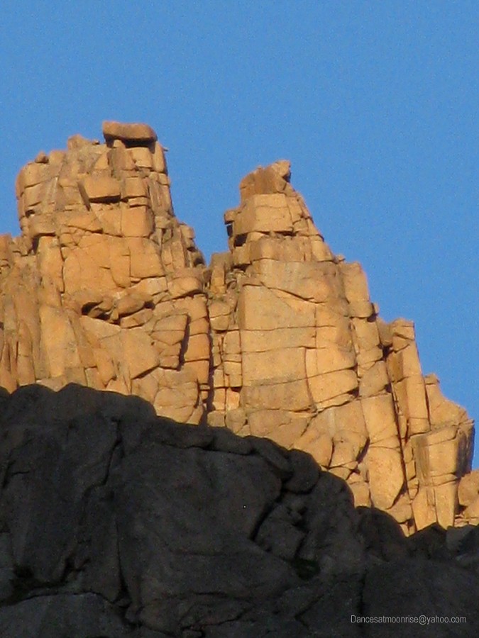
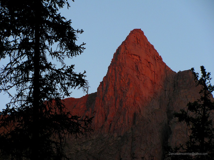
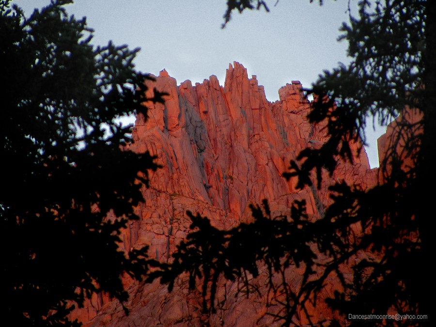
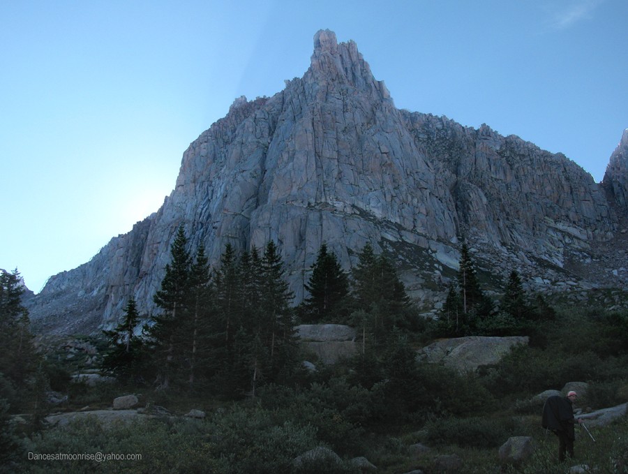
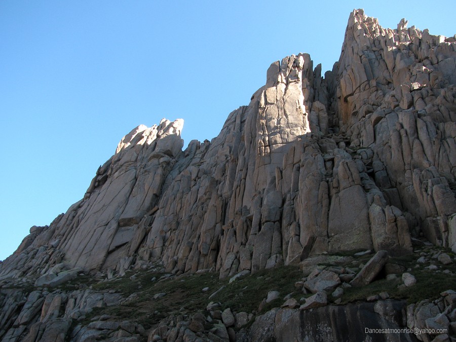
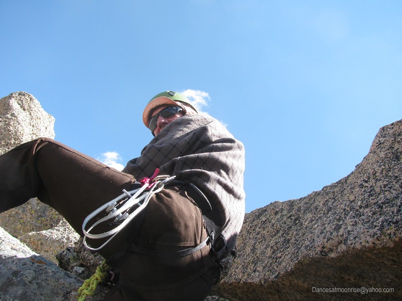
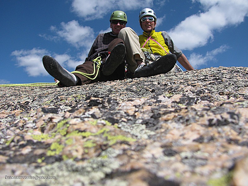
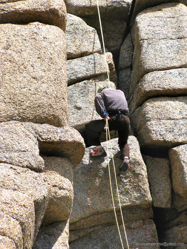
View from the sharp end: Sunlight Spire.
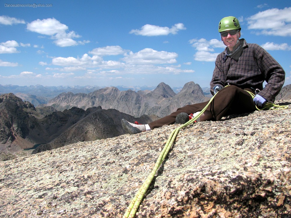
A few words about Sunlight Spire
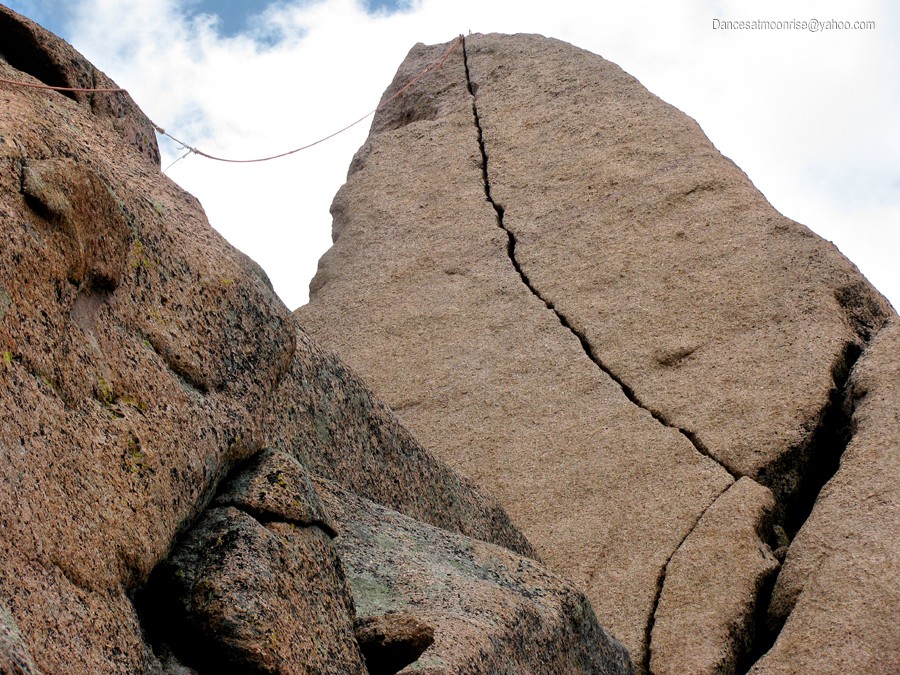
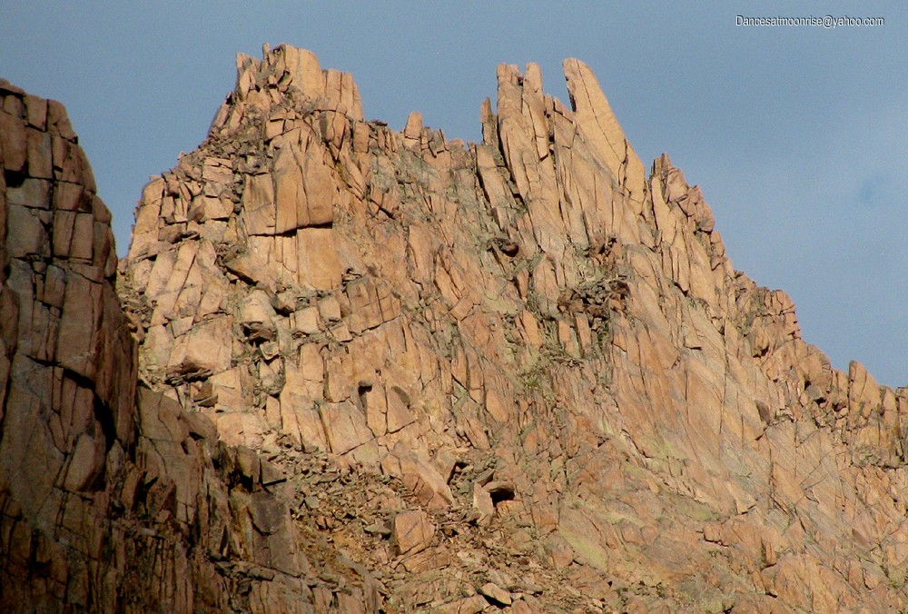
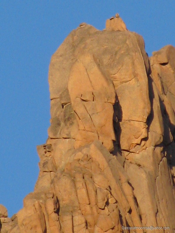
Sunlight Spire is the name given to this beautiful, steep crack line culminating on a compact summit near 14,000 feet. The origin of the name likely represents its use by alpine climbers through the years. The Spire is not officially named by the USGS.
About five or six years ago, the USGS resurveyed a number of peaks. On average, the majority of peaks gained about seven feet of elevation, including peaks in the San Juan range. Some alpinists have therefore conjectured that Sunlight Spire, with a surveyed elevation of 13995 prior to the resurvey, may in fact now be a 14er. If so, it is both officially un-named, and unranked. Sunlight Spire has about 200 feet of prominence. In other words, the vertical drop between the Spire and nearby 14er Sunlight Peak, is about 200 feet. By convention, a minimum of 300 feet of prominence is required to consider a peak as ranked. Still, there are those that feel Sunlight Spire is, or should be, the "60th fourteener." Or the 59th, if one does not count North Massive. Mostly, though, the appeal of the Spire to alpine climbers is its gorgeous hand/finger crack splitting a clean, overhanging face, culminating in a compact summit near 14,000 feet.
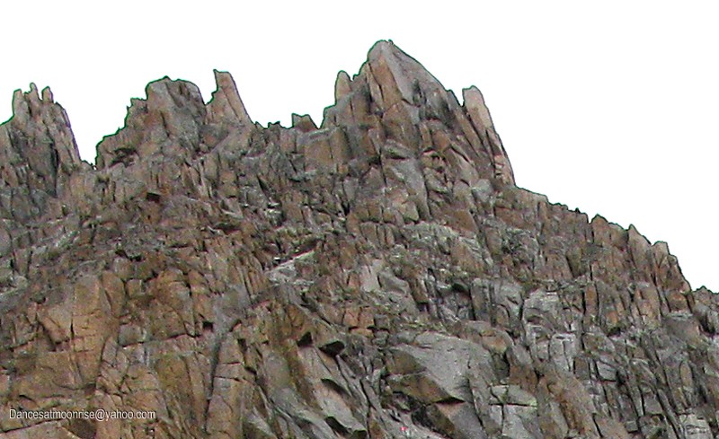
A few words about Gray Needle
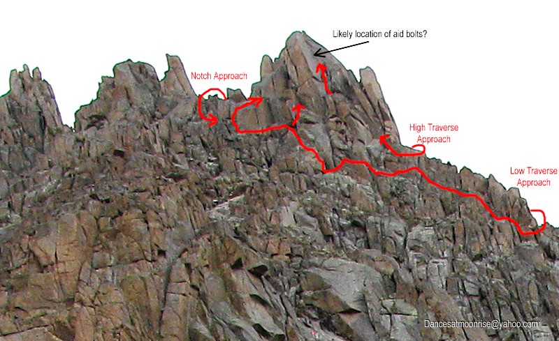
Not much is known about Gray Needle. It's a ranked 13er along the Jagged Mountain ridgeline, at 13,430, along with Noname Needle, 13,620. Many long-time Colorado mountaineers know of no one who has definitively climbed this peak. There reportedly exists a 1954 American Alpine Club journal entry documenting a 1953 ascent during which the ascent party utilized expansion bolts for a 30-foot section on the summit block, presumably a bolt ladder for direct aid. It is uncertain that Gray Needle was actually the peak which was climbed. If the 1953 ascent party actually climbed the peak, it still remains uncertain whether Gray Needle has yet to see a first free ascent.
Steve Gladbach is among the few that have climbed all the ranked, named 13ers. He was also the fourth, and last (as of this writing,) to climb all of Colorado's 14ers in calendar winter. A current goal for Steve is to continue with the ranked, un-named (by USGS) peaks above 13,000 feet. Gray Needle thus represents a sizeable challenge within this category.
And a little Personal History
I first saw Sunlight Spire in 2010, on a trip to the Chicago Basin, to climb the four 14ers there. (TR here.) As soon as we saw it, my partner and I knew we wanted it. However, we did not have technical gear with us, and due to his work schedule, only had two days to hike the 42 mile round-trip from Purgatory TH and make the 12 hour round-trip drive. I knew I'd be back.
Last month Roger, John, Britt, and Steve had planned to go in for Jagged Mountain. We were hoping to add Sunlight Spire. Schedules, logistics, and, ultimately, weather, precluded any reasonable consideration for the Spire on that trip. Steve offered a block of time during the last half of August.
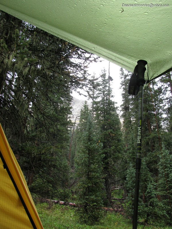
GFS models were less than perfect, suggesting rain on our first day into the Chicago Basin (Saturday the 18th,) a possibly good day for the Spire on Sunday, a completely socked in day on Monday, a completely clear day on Tuesday, with rain returning before Noon on Wednesday. I really wanted to see high pressure parked over the Great Basin for this trip. Two days before leaving, Steve offered the option that we go as planned, or go in October, or give it a shot next year. Turns out the models were remarkably accurate, even if they spared us from storm on our first day in.
CLIP TO LIKE: SUNLIGHT SPIRE
Getting There
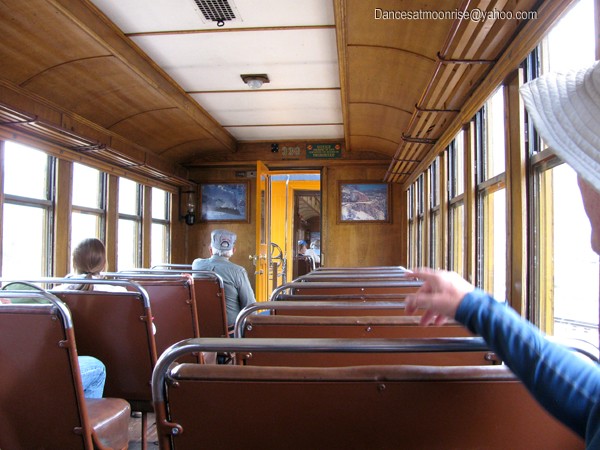
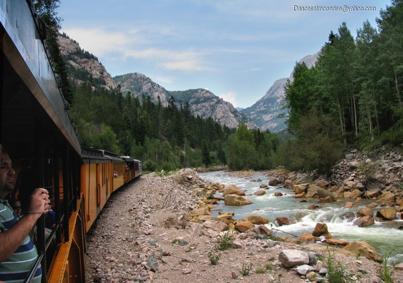
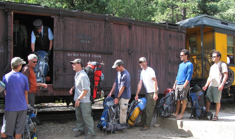
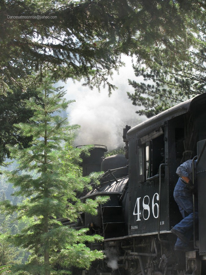
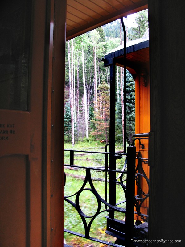
We met in Silverton at 2:00 pm, and took the 2:45 train to the Needleton drop-off, with the idea that we'd make a Chicago Basin camp before dark. The train was running 30 minutes behind schedule. We hoofed it and still made the Basin in plenty of time to set up camp before last light.
This is the first time I'd been on the train. Definitely fun!
The train from Silverton is not very crowded.
The late train should still get you into Chicago Basin before sundown.
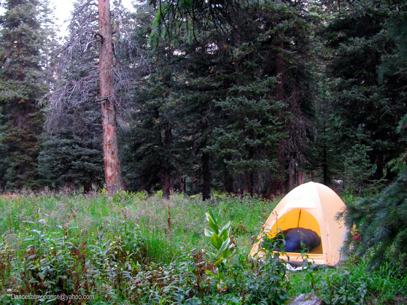
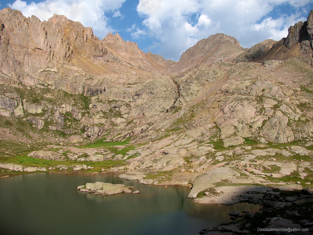
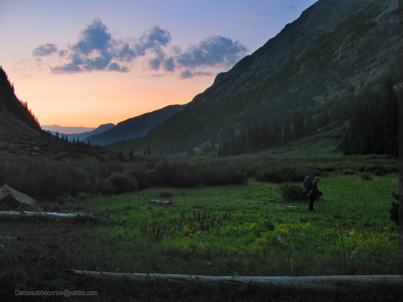
Many idyllic camp sites are easily found in the still-pristine Chicago Basin.
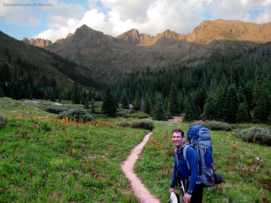
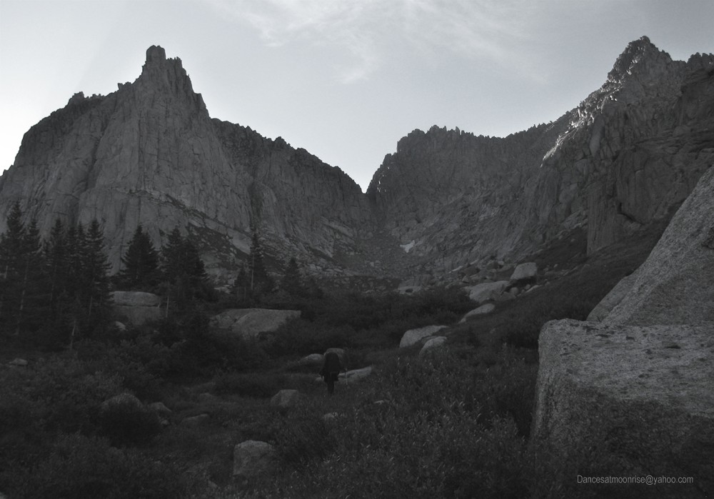
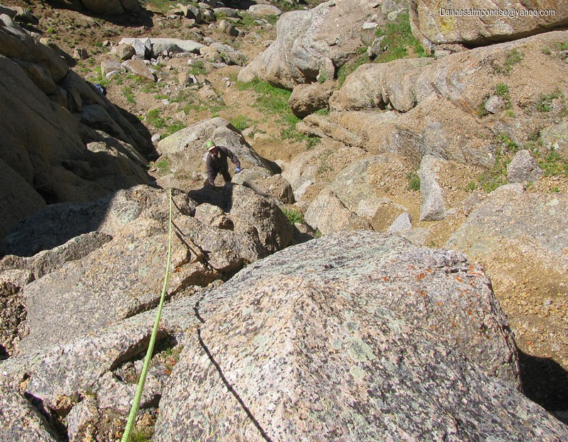
Approach
We broke camp Sunday morning and moved packs up to Twin Lakes. We decided to suspend the packs from overhanging rock. Steve found a sizeable rock to tie a line to, which worked well. The goats, marmots, and other critters either couldn't get the packs, or didn't care to. Up to the Spire we headed, with "a rope, a rack, and the shirt on my back" as the old saying goes. Well, we had a few emergency supplies, too.
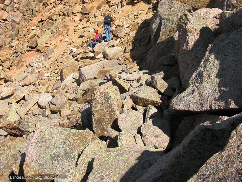
To gain the base of the Spire, take the standard trail to Sunlight Peak. It was upgraded about two years ago by the CFI, and is in much better shape now, though the last couple hundred verts before the saddle can still be loose and a little sketch. Just before reaching the saddle, where one would ordinarily go left for the Peak, look for a sizeable cairn to the right, in the talus.
Looking back at the cairn, center, which marks the start of the traverse to the Spire. The climbers in the photo are just below the saddle, where one turns
left for the Peak, and right for the Spire.
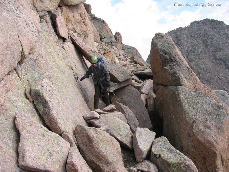
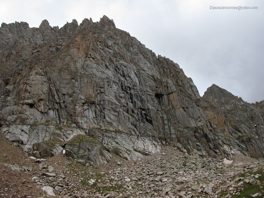
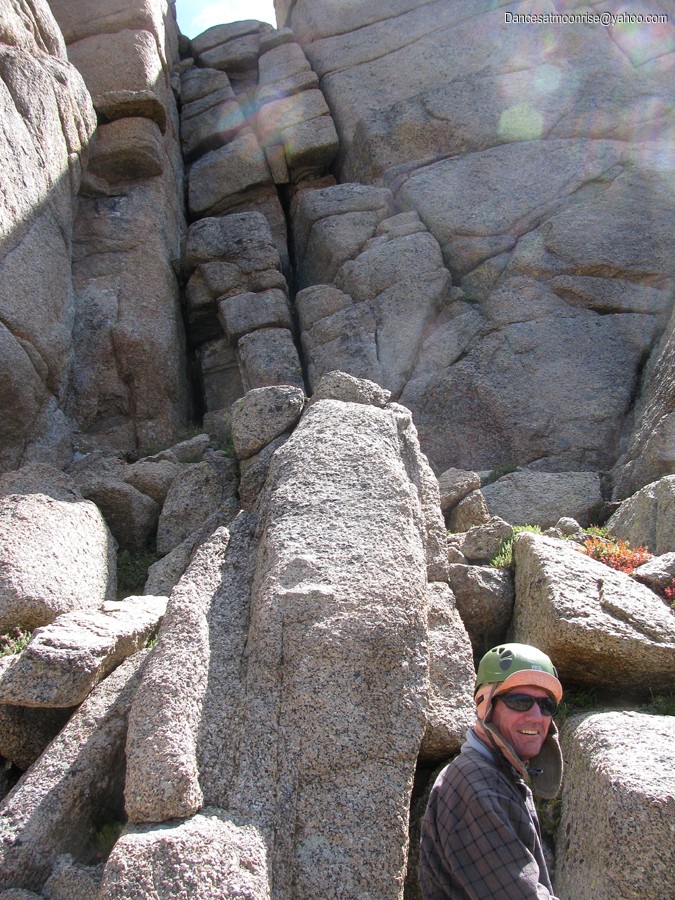
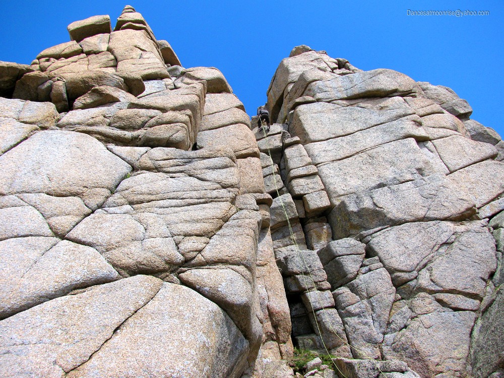
The cairn above marks a third class route to the base of the Spire. The route is sparsely cairned. Keep aiming up and right for the Spire; route-finding should not be too difficult. The third-class upward traverse puts one about 70 feet below the base of the spire, at the start of what is called the first pitch, rated 5.7.
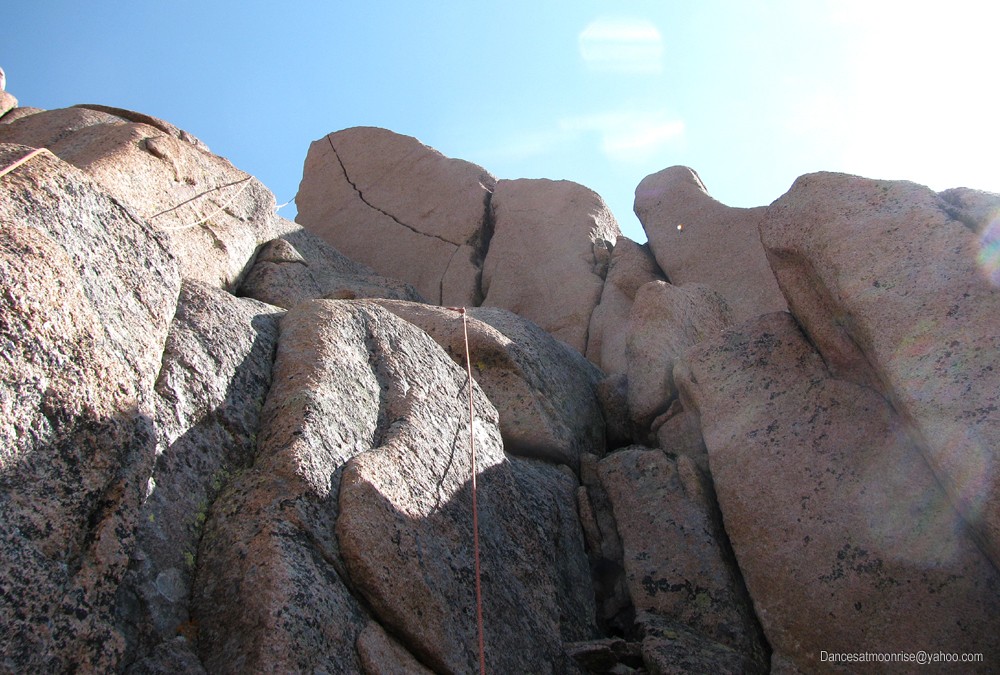
The base of the so-called "first pitch." Though referred to as 5.7, it's really a fairly easy scramble. The ropes are hanging from the top, and the belay at the crux pitch. They are in poor condition.
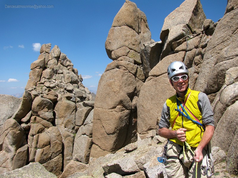
The day's quarry.
Difficulty
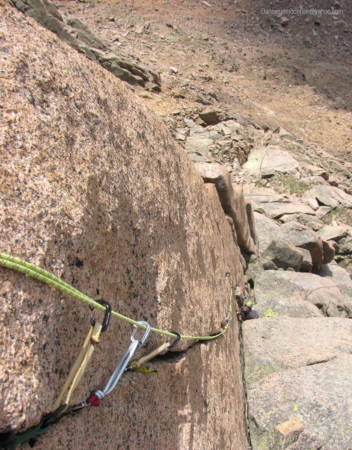
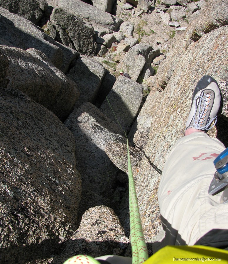
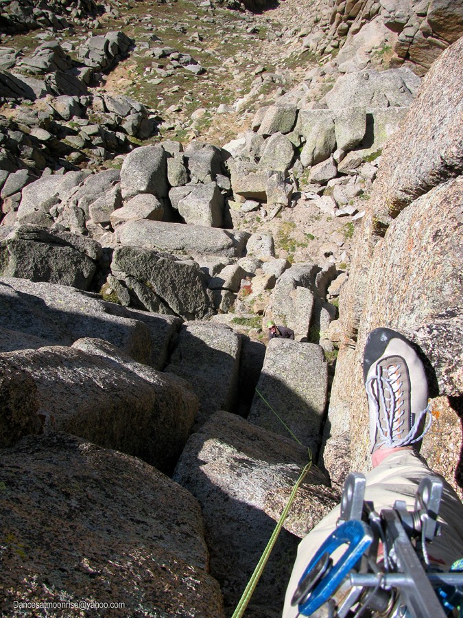
The Spire is astounding. I was dubious, but be assured, it really is overhanging. With no warm-up, this one is tough to hit directly. The so-called "first pitch" is rated 5.7, but we found it mostly a third-class scramble. Steve wanted a rope because he hurt his shoulder the day before leaving. I chose to forego an anchor for this first pitch, instead placing two pieces about 10 feet above Steve to secure us both to the rock, and brought him up to the anchor at the base of the Spire, which consists of two 1" tubular webbing slings secured around a large block.
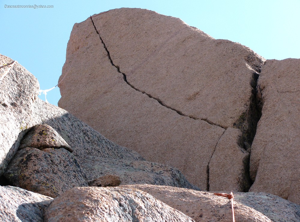
First pitch.
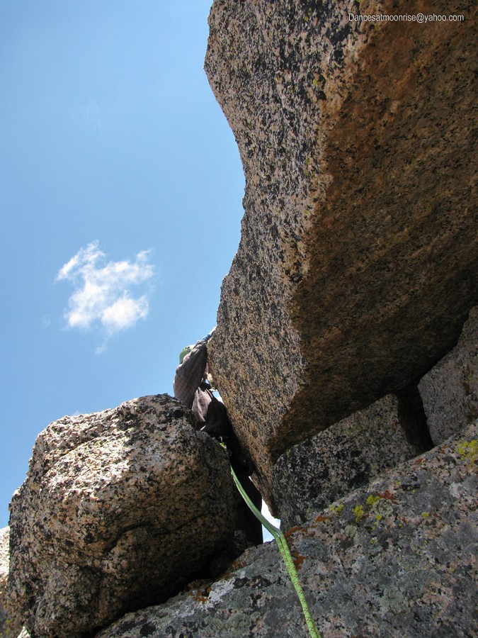
If the first pitch is not 5.7, neither is the summit pitch 5.10. I found the 5.7 section much easier; the 5.10 section, harder. Of course, crack climb ratings are hand-size dependent. My size 8� hands did not fit a lot of the hand jams, thus requiring finger stacks and locks and rendering much of the route thin-hands. As to pro, the crack takes wired stoppers very well, and surprisingly takes more of the smaller pieces than hand-sized pieces. Besides, you need any hand-sized holes for your hands.
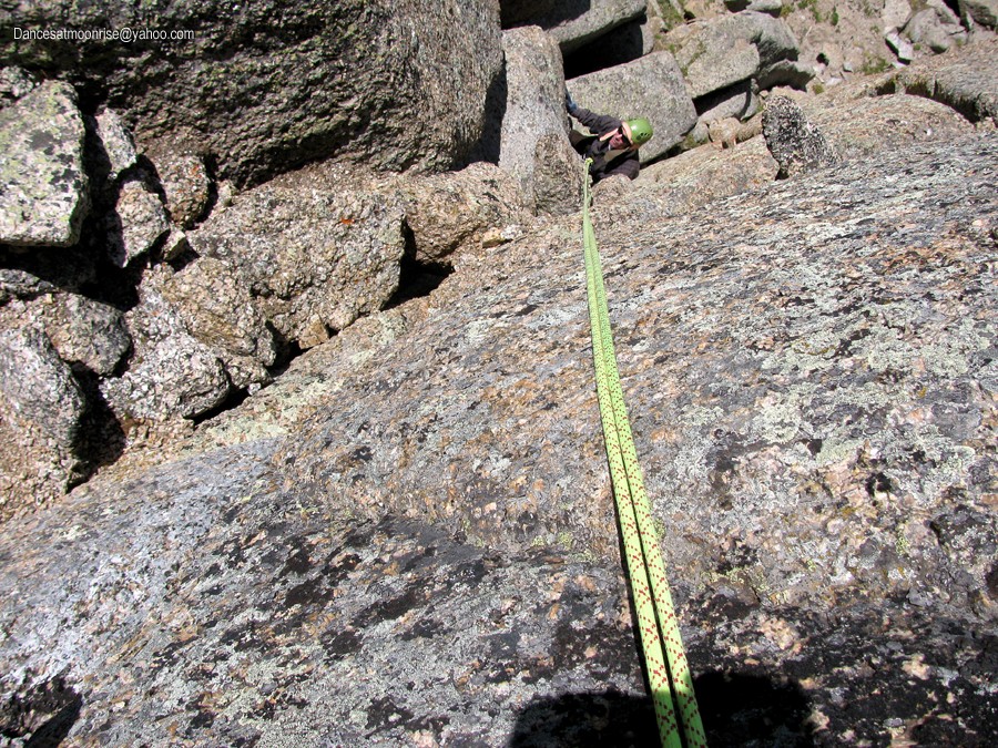
Steve provided a solid, accurate belay for this exciting route.
That buttress on the left is a bit of a problem. It wasn't obvious till we were there, that the buttress actually follows you just to the left and below for the first half of the climb. Doing the math, you can't get 2 feet from your last piece without the risk of wrecking a left ankle in the event of a fall. Three feet? A tibia. Five feet above your last piece? You may as well free-solo. This feature makes strength and confidence a necessary requisite for the route, until the obstacle is cleared through the last half of the climb, where one can relax and run it out a little.
Getting out of the way of that pesky butress below.
Pro
As of the last TR I'd read, there were two fixed pieces. This number has now grown to four, the additional pieces being wired stoppers, further testament to the fact that the crack really eats stoppers nicely. They don't weigh much, so bring a few in the 3/4" (narrow dimension) down to maybe the 3/8" range. The fixed pieces make leading easier, but it's still one tough route. Don't forget that buttress right below you for the first half of the route.
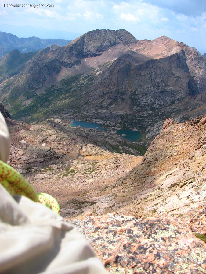
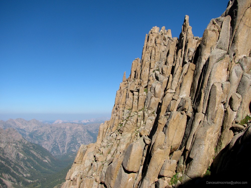
The views from the summit are outstanding.
A minimalist rack for this route might be the above assortment of stoppers, a #2 Camelot, maybe a #3 Camelot, two #1's, two 0.75's, two 0.50's, and two cams a little smaller than a 0.50 Camelot. If you wanted the full tilt, double up on the #2 Camelot, maybe also the #3, triple up on the #1 and 0.75, and maybe the 0.50. Stoppers should be in the range of a quarter to three eighths width, up to five-eighths to three-fourths inch on the larger sizes. Camp Nano 23 biners will reduce weight, as will dyneema slings. A twin rope, 60 meters, tied in at the middle and used in standard twin style, will get you up and down the roughly 50 foot crux pitch. A single rope may certainly be used, but will be heavier to carry.
The less exciting Sunlight is over there.
Anchor
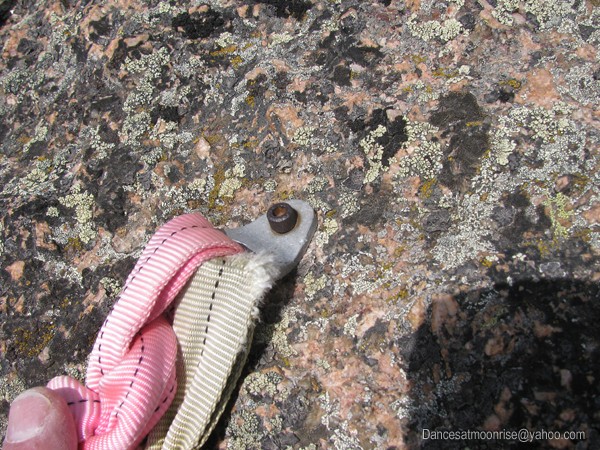
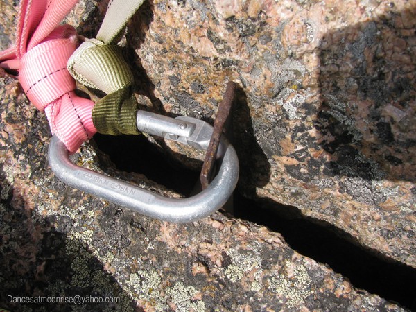
Folks have commented that the anchor leaves a little to be desired, and I wouldn't disagree. We donated a #9 hex to the project. Unfortunately, the cord (spectra) had to go around the large pin, rendering it a less-than-ideal placement. In any case, there are now four placements, none of which are ideal, but all of which are more or less equalized.
This rusty bolt is not 3/8". Probably 5/16", maybe 1/4". Perhaps the weakest link.
The crack bisects the summit. This pin is near the edge, and appears solid. We added a #9 hex a few inches in back of the pin,
and equalized it on a new sling directly into the anchor.
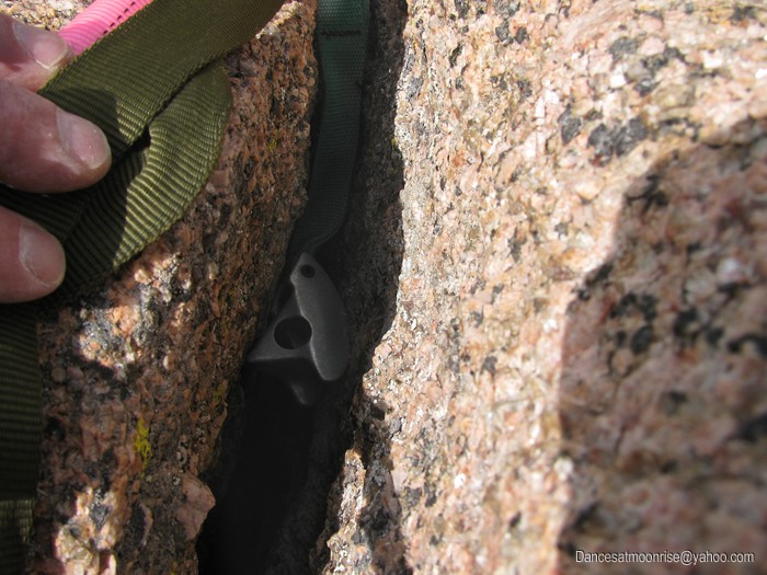
Hidden beneath the slings is a tri-cam. It may not be placed correctly. Some of you guys that use them might comment. It still seems solidly wedged.
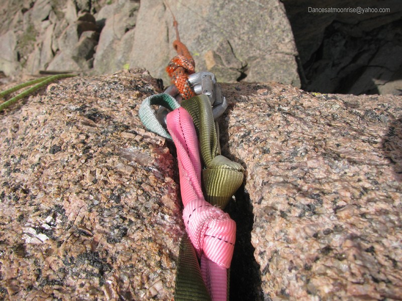
The whole thing is more or less equalized onto two biners, over the edge.
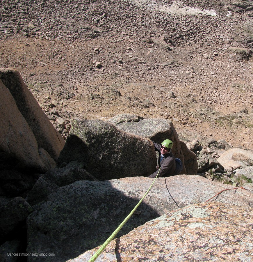
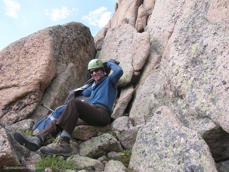
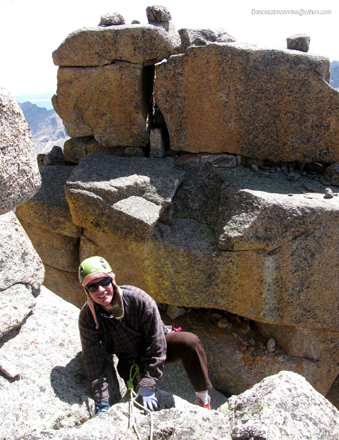
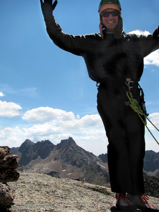
Steve planned to jug the route, so we set taut lines at the belay, using a prussic after he got started. This way, if we needed to exit in a hurry, we could just pull the rope and go. Steve got the summit in classic mountaineering style.
Go, Steve!
In the bag.
Extra Credit
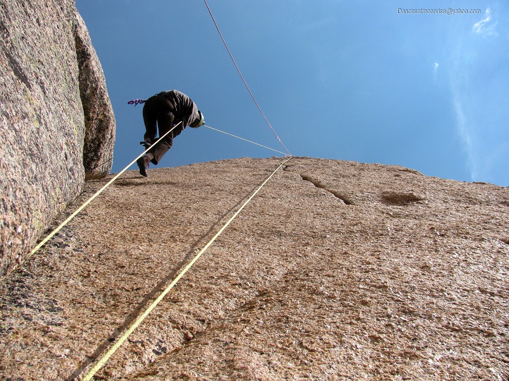
Both of us now back at the belay, it was becoming evident the weather was with us, so we decided to go for some extra credit. Steve provided an excellent belay as I took off, unencumbered with prior worries of cratering onto the buttress. I have to say, that was the most exhilarating three minutes of the day, or maybe the whole trip. Steve lowered one ecstatic, blown and breathless climber to the deck, where we prepared to rap. I strongly recommend top-roping the route if you have time. It's so much fun just to run the route without stopping to pro.
Happy team mate.
One 70m will get you from the summit to within a few feet of the base of the first pitch. If you have a single 60, no worries. Pull the rope and thread the rap ring at the base of the crux pitch and make it two raps. We opted to use a 70m x 8mm twin for the whole trip. We used it as a single rope on 4th and low 5th class sections, and the leader tied into the middle to use standard twin technique for the more serious 5th class pitches. This allowed 117 feet for a pitch, as a twin, and of course, allowed 117 feet of rappel length. All this for about six pounds of rope that stuffs down to about the size of a down jacket. A nice way to go.
Sorry, we should have cut those manky ropes down. Would someone mind getting it, please? Thanks!
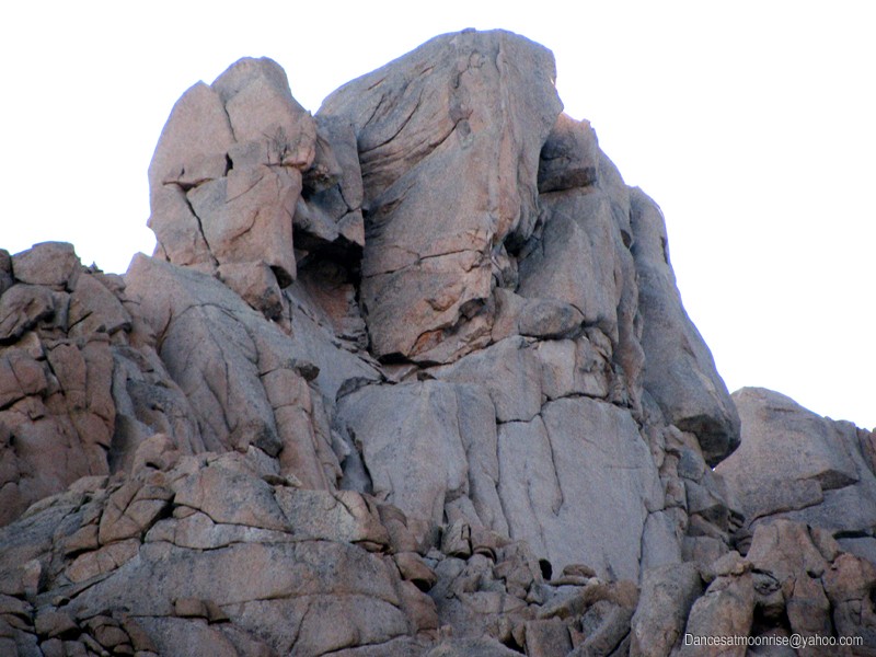
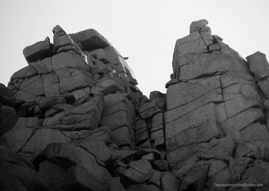
This notch is part of the third-class traverse between the saddle and the Spire, nearer to the saddle.
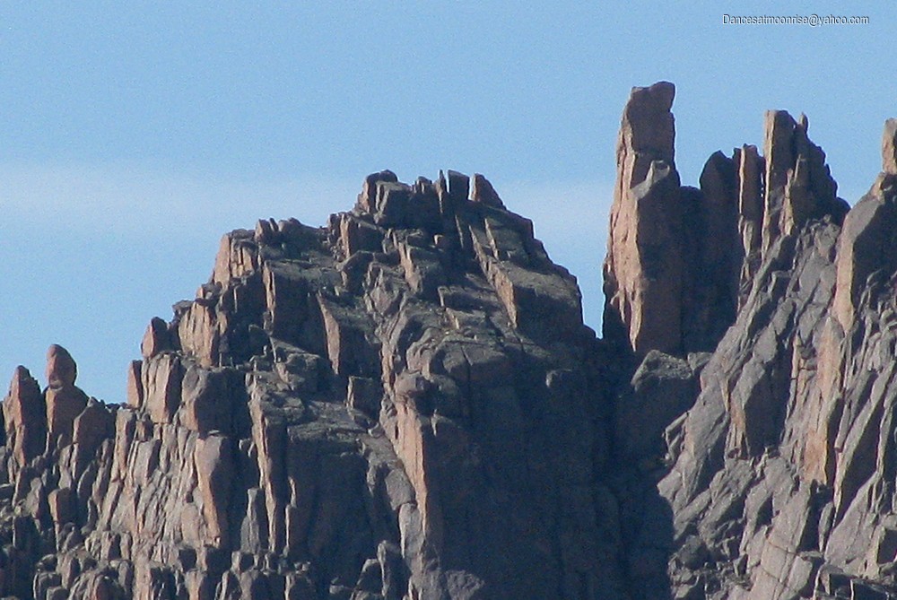
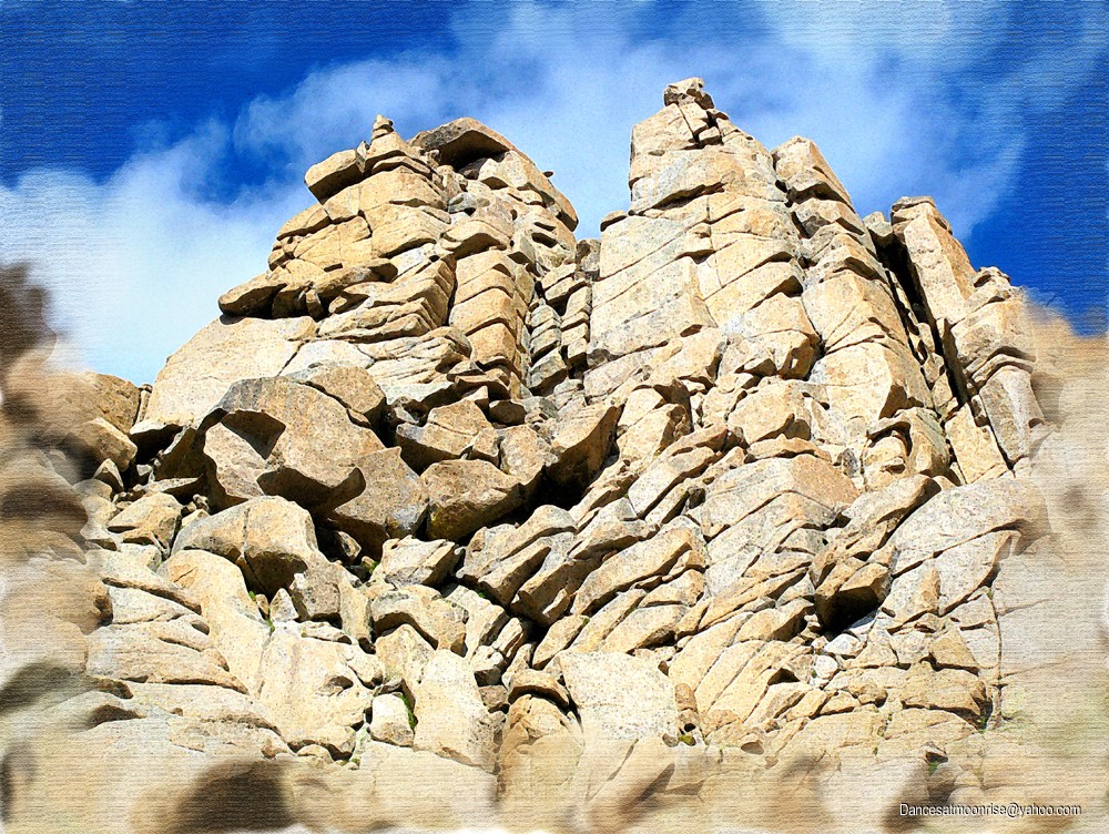
WILL THE REAL GRAY NEEDLE PLEASE STAND UP?
Humping the Pass
Back at twin lakes, we pulled the packs and shouldered up to head over Twin Thumbs Pass. The climb was not unpleasant; the scenery astounding.
A look back at this beautiful place, and a beautiful route.
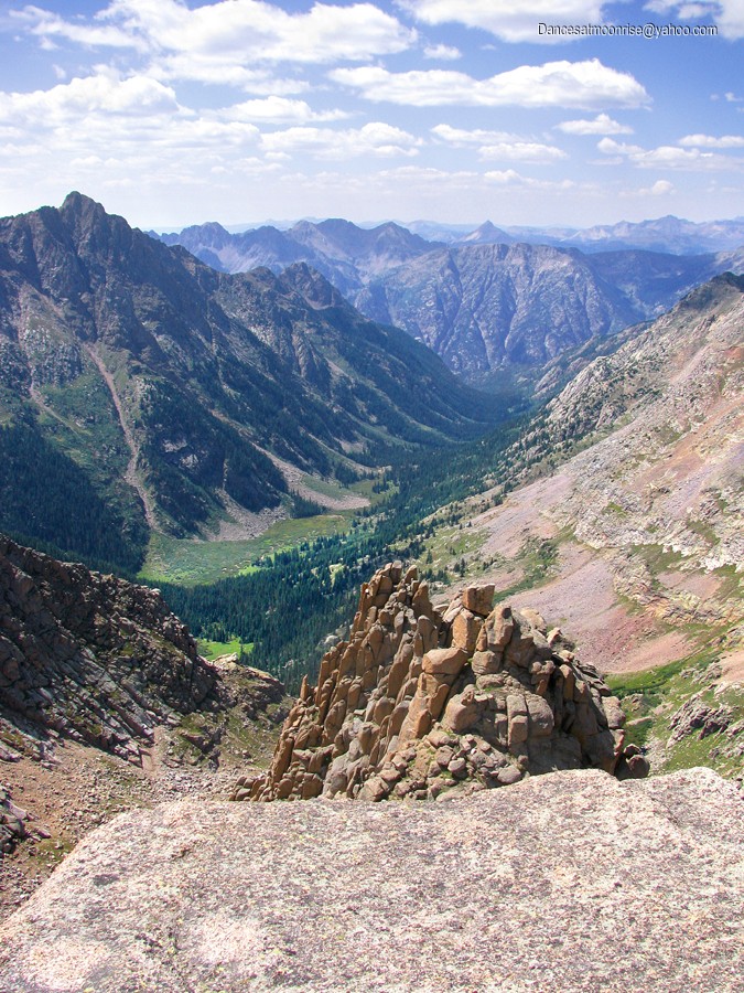
At the Pass, there are two routes down. Steve likes the east side of the pass. They each have their difficulties. The north side of Twin Thumbs Pass descends steep, loose dirt. In fact, much of the descent into Noname Basin is rough. In defense of the drainage, however, we were treated to unparalleled views, beauty, and solitude. There's a lake about halfway down. Very peaceful.
High above Noname Basin.
Looking back to Twin Thumbs Pass.
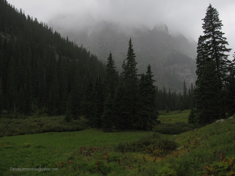
The section above the lake is mostly straightforward, with a hard bend right to get around a headwall, then back left on a sub-drainage down to the lake. The first third from the lake to the bottom of the Noname drainage was not bad. The middle third gets nebulous. You have to cross to the left side due to steep walls. Cross back to the right as soon as you can, or you end up fighting some mighty large, thick willows. The bottom third is not too bad. We got to the bottom of Noname Basin at last light, joyful to once again have a trail.
Finally in Noname Basin.
Home Sweet Home
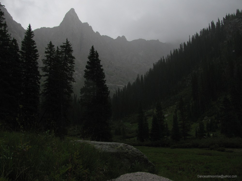
I'd previously scouted a high camp on what, according to the map, should be relatively flat, treed terrain, near timberline. It required us to hike another 200 verts up, in the dark. Steve found a cairned trail which we believe is used to access Jagged Mountain, via the pass to the north of Gray Needle. With a little faith and a couple headlamps, we soon found a nice meadow by the creek and called it home for a few days.
The next morning proved GFS models remarkably accurate. It was raining before we even made it out of the tents. Steve allowed as how he would go out of his gourd to sit in the tent all day, so we made a plan to explore as high as we could for the next day's effort. He took the drainage to the south of Gray Needle (leading up to Noname Needle and the saddle with Peak Ten) and I took the route to a small alpine tarn on the north side of Gray Needle.
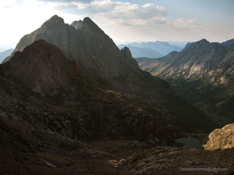
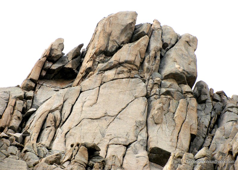
The north side. Gray Needle is the furthest high point to right, or west, with the huge walls below it.
Down day: GFS models are right on the money.
Steve's line was basically what Rosebrough describes as the route to Noname. Rather than taking the Peak Ten saddle and up the south ridge, the line ascends a shallow southwest alpine subgully to the base of Noname Needle. From this vantage point, he was able to get within a few hundred feet of the Grey Needle summit, with views of the south and west aspects of the summit block. My line took me to views of the north aspect. The north and east sides appear to offer easier weaknesses through the summit block section. However, the approach from this side is guarded by impressive walls and scree.
Nearly back to camp from scouting duties. The strikingly beautiful peak is Knife Point (13,265.)
Home Sweet Home.
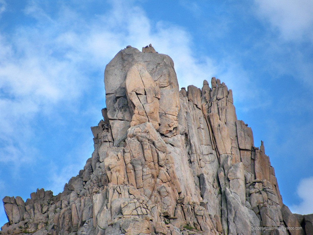
The sun came out for a bit in the late afternoon. Steve hit the sack and I did some recon photos from the expansive meadow just beyond camp. The late day sun was shining nicely on the peaks. For the first time, I saw clearly a magnified view of the west aspect of the Gray Needle summit block.
The Gray Needle and Noname Needle massif is to the far left. Middle is the Peak 10 massif. At far right is Knife Point.
Gray Needle at left, Noname Needle's twin summits are at right.
Gray Needle's impressive summit block. We got to calling the rock in front the "chess piece" because it looks like
the bishop on a chess board.
Noname Needle will prove to be fairly user-friendly.
The north side photo taken during Monday's recon. The "chess piece is seen in profile, at far right of the summit block.
These notations were made after the trip, on our best knowledge to date.
Summit Day
We got a good start on the day, knowing the trail well from the day before. GFS models also held nicely. We had the whole day, without really any threat of storm. Steve's feeling was that we could get closer from the south approach, so we took the line up toward Noname Needle. This line looks impressively steep from camp, but goes at third class without too much sketch.
Steve's feeling was that Gray Needle, above, named by early miners, had to be what what was seen most prominently from the basin below.
Starting up the drainage to the south of Gray Needle.
Southwest aspect of Gray Needle's summit block. The main block in the middle is probably about 30-50 feet high. The "chess piece" is out front,
to the left of the main summit block.
The ridgeline from Noname to Gray Needle has four rock piles. Gray Needle at the extreme west end, two sub-piles, and then Noname Needle, which itself is composed of two rock piles. The summit is the left, or north one, which is identified by a living-room sized block of rock which caps the whole thing. I wanted to go up into one of the notches between needles to see what the other side looks like. The map depicted what appeared to be a flatter area connecting all four needles, which if true, would have allowed easier study for summit block weaknesses. However, even getting up to these notches was not easy hiking.
More rock piles on the south side. Gray Needle is at far left.
The twin summits of Noname Needle. The true summit is the one on the left.
The "Coke Bottle Needle." Note the bottle-shaped rock perched on the ledge at center. It's probably 20 feet tall.
At one point, Steve decided to forego further exploration in favor of summitting Noname Needle. I was ok with that as long as he realized this meant that we'd burn the time needed to get the primary objective. I think his idea was to come back with a summit in the bag, and hoped to have a lot of terrain questions answered from the summit of Noname, as it is about 200 feet higher than Gray Needle.
I couldn't help gazing back toward Sunlight Spire.
By golly, there's probably a line on the Spire's east face as well. Hmm...
I got my chance at a notch anyway. The notch between Noname and the needle just to its west, happened to be along a nice route to the base of Noname. It was comfortable scrambling, and Steve would have been OK with it, had it not been for the shoulder. I took the rope up and set a belay. The other side of the notch looked nothing like what the map appeared to depict. It was more of the same; rock and steepness. But from here it was an easy walk to the base of Noname's central weakness, so we headed over and geared up to climb.
Steve joins me to look through the window notch between Noname and the needle just west.
Noanchor Needle?
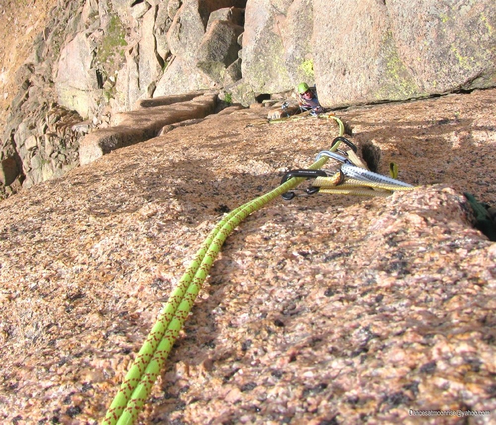
Steve thought the route was rated 5.8, which seemed about right. We used twin technique; I tied into the middle. This got us up the central weakness, where we would have had to break up the pitch anyway, due to rope resistance. This was about a 100' pitch. I used three pieces for the lead. A #10 hex, maybe a #2 Camalot, and maybe a #1 Camalot. A #3 worked well, along with some smaller cams, for an anchor.
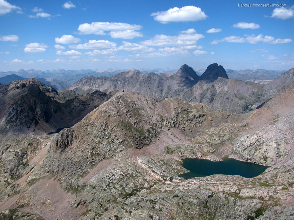
We took a fourth class second pitch up and around to the base of the summit block, where we swung leads, putting Steve on the summit. The views were amazing. One interesting finding is that these needles nearly align perfectly from the perspective of the location of our camp. From camp, we could only see three needles. Unfortunately, from the summit, for the same reason, we saw nothing of Gray Needle or its elusive north and east sides.
Arrow and Vestal seen from the summit of Noname Needle.
We lucked out with a perfect weather day.
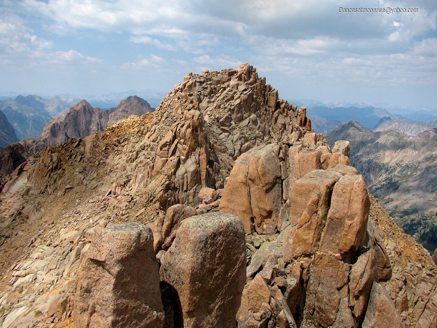
Jagged Mountain.
Our camp is in the small green meadow at lower left center. The needle at center is a sub-peak which obscures Gray Needle and veils approach terrain.
Yet another mystery that really puzzled me, was zero evidence of any rap anchor. I looked everywhere but the south summit, which we didn't ascend. I would have thought the top of a 100 foot first pitch would be the most logical place for a rap anchor. Nothing. There were rocks piled up on the summit, so people get up here, but how do they get down? That 5.8 section is too stiff for most people to comfortably downclimb, unprotected. The mystery will have to remain unless someone who has been up this peak will please tell us how they got down without leaving a rap anchor! : )
A single 60m rope will get you down off the west side of Noname Spire.
Steve.
After getting off, the flat-tops above us were still flat, barely grey, and it was apparent we had some time for extra credit. Tomorrow was pack-out day, so we wanted to take this few hours to scout.
Thank you for a wonderful day, stately Noname Needle!
Gray Needle: Up-Close Recon
We were able to scramble up onto the southwest aspect of Gray Needle, within about a full rope-length of the summit block (though roped climbing would likely involve more than one pitch.) What lies above is deceptive, because it appears different from different aspects and elevations.
Below Gray Needle's south side. A nice line can be seen just left of the two shallow roofs, though it would likely go in the 5.11 range.
"Steve's Ramp," top center, below the summit block, south side.
Steve thought he saw what looked like a fourth-class ramp to the summit. A short scramble up and left revealed his ramp to be a pretty serious fifth class weakness. We found several possibilities, but nothing that looked like typical easy mountaineering fifth class stuff. I really wanted to see the north and east sides, but at this point, we didn't have much time, and even less energy. To get to the north side, we'd either have to descend and re-ascend in the drainage to the north, or rope up and try to traverse up and over. This late in the day, those were not good options. It was a good recon, and we saw a lot. The south or west side might go. The north or east side might be easier. To be continued....
Goodbye for now, beautiful, mysterious Gray Needle...
Last Train Home
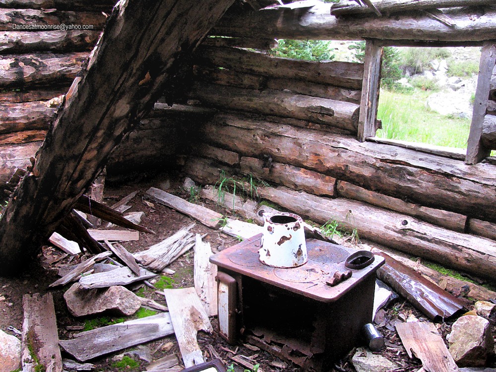
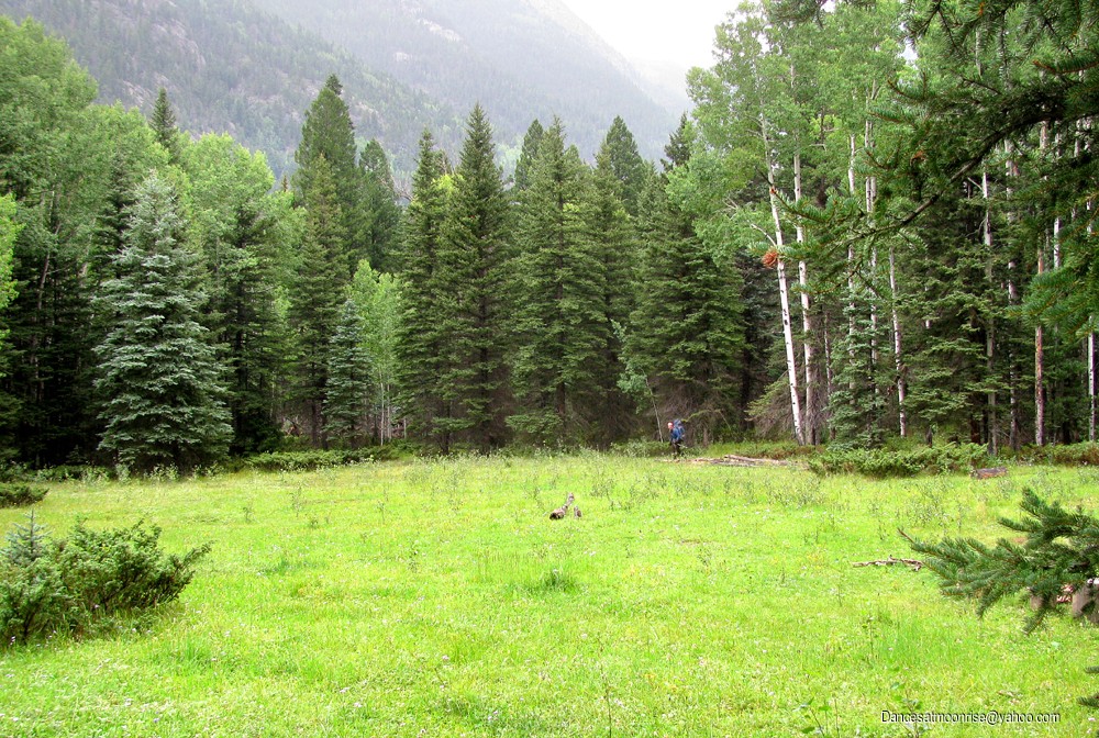
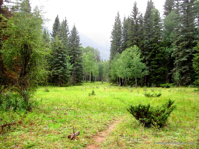
Back in camp, Steve was quite animated. We didn't get to bed till late, and I was slow getting out of camp Wednesday morning. We made good time down Noname canyon, both seeing it for the first time. The trail was mostly good, with occasional areas where it became harder to follow, especially around an old cabin. How good was our time? Steve called it "ankle breaking speed."
Honey, I think I left the stove on.
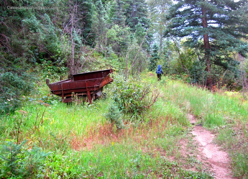
This all changed when we got to the Animas. The trail from Noname and Animas over to Needleton is tricky. It ascends about 150 verts (but feels twice that) to get above the steep walls of Ruby canyon at the Animas.
If you come in from Needleton to ascend Noname canyon, be sure not to miss the cairn marking the trail up Noname Canyon. It is probably five minutes or maybe ten minutes north of a huge ceramic insulator thing laying on the ground like a cairn; one of those high-tension line insulator things.
There are a couple of creek crossings. Watch for the cairns, they usually tell you the best place to cross.
The meadow about five minutes north of the Needleton dropoff. Confusing trails here. See text.
The smaller meadow just south of the big one, above.
There is one confusing area about five or ten minutes north of the Needleton drop-off, in a large meadow. There are some stumps set up around a fire. The north end of the meadow has the trail that goes over to Noname. As we came back, I walked a straight line through the meadow, as there were no cairns, and found a cairn on a stump, and more on the ground, as one enters the trees, marking a good trail, at the south end of this meadow. However, Steve said this is wrong. He had just entered the meadow from the north end, and took a right turn. I headed toward the river and found the trail down below a headwall. He thought maybe the other one (at the south end of the meadow) went to Ruby. If you come up from Needleton, you want the trail going out the north end of the meadow, which takes you to Noname. If coming back from Noname, you want the trail going out the west side of the meadow (downhill toward the river.) The train drop-off is only maybe 5 minutes from here. We made great time till we hit this whole Animas section. It's probably less than two miles but took us 85 minutes. Total time from our high camp was about 3:15, moving faster than we'd have liked.
Looks like we may be going back in next month for more. It will be interesting to see if we can find the weakest line to the summit. It will be especially exciting if we find that reputed old bolt ladder on the summit block; not that 60 year old rusty quarter-inch buttonheads with beer-tab hangers will even hold body weight at this point.
Excellent trip gentlemen. Well documented as always Jim. Those meadows on the hike out look so beautiful I think I could take a book and camp an extra day. What an immense amount of mountaineering experience together at one time. Congratulations!!
Great pix, great TR, great adventure 8/27/2012 5:00am
One question, though: Isn't it a no-no to leave behind bolts, slings, etc. in a federally protected wilderness area (”where man himself is a visitor who does not remain.”)
One of the finest TRs I've ever read--beautifully written with spectacular photos! Thanks for sharing this creative masterpiece, and congratulations on some marvelous climbing.
Pat, as intimated in the text, I thought it was hard. Definitely on par with the overhanging/roof handcrack on Whimsical Dreams (11b, Turkey Rocks, South Platt.) Harder than Drumstick Direct (10d, wide hands, same area.) Easier than Piece of Cake (11c, thin hands, Turkey Tail.) That would put it in the 11- range, just as you were thinking. The good news, it pro's well; the bad news, that butress on the left is 2-3' below your left ankle for the entire first 1/2 of the way, owing to the left-leaning nature of both the crack and the butress below.
Yes, your beta was excellent. Thanks, man!
Hey, take a look at the MP post and see if I forgot anything. Didn't mention anything about rack, which we thought should actually be heavier on the smaller pieces and wired stoppers.
Thanks for the report. Mark L. and I were camped just above you guys in Noname and talked with Steve a couple of times before and after your climbs. We climbed Knife Point the day you got those great sunny day shots on Gray Needle. I hope Steve shared those scrambled eggs with you!
Kent
I really enjoyed this trip report - well done! Though I never knew Steve, this community loved him so -- it was nice to read about him again and imagine what he might be climbing this summer.
Caution: The information contained in this report may not be accurate and should not be the only resource used in preparation for your climb. Failure to have the necessary experience, physical conditioning, supplies or equipment can result in injury or death. 14ers.com and the author(s) of this report provide no warranties, either express or implied, that the information provided is accurate or reliable. By using the information provided, you agree to indemnify and hold harmless 14ers.com and the report author(s) with respect to any claims and demands against them, including any attorney fees and expenses. Please read the 14ers.com Safety and Disclaimer pages for more information.
Please respect private property: 14ers.com supports the rights of private landowners to determine how and by whom their land will be used. In Colorado, it is your responsibility to determine if land is private and to obtain the appropriate permission before entering the property.