Download Agreement, Release, and Acknowledgement of Risk:
You (the person requesting this file download) fully understand mountain climbing ("Activity") involves risks and dangers of serious bodily injury, including permanent disability, paralysis, and death ("Risks") and you fully accept and assume all such risks and all responsibility for losses, costs, and damages you incur as a result of your participation in this Activity.
You acknowledge that information in the file you have chosen to download may not be accurate and may contain errors. You agree to assume all risks when using this information and agree to release and discharge 14ers.com, 14ers Inc. and the author(s) of such information (collectively, the "Released Parties").
You hereby discharge the Released Parties from all damages, actions, claims and liabilities of any nature, specifically including, but not limited to, damages, actions, claims and liabilities arising from or related to the negligence of the Released Parties. You further agree to indemnify, hold harmless and defend 14ers.com, 14ers Inc. and each of the other Released Parties from and against any loss, damage, liability and expense, including costs and attorney fees, incurred by 14ers.com, 14ers Inc. or any of the other Released Parties as a result of you using information provided on the 14ers.com or 14ers Inc. websites.
You have read this agreement, fully understand its terms and intend it to be a complete and unconditional release of all liability to the greatest extent allowed by law and agree that if any portion of this agreement is held to be invalid the balance, notwithstanding, shall continue in full force and effect.
By clicking "OK" you agree to these terms. If you DO NOT agree, click "Cancel"...
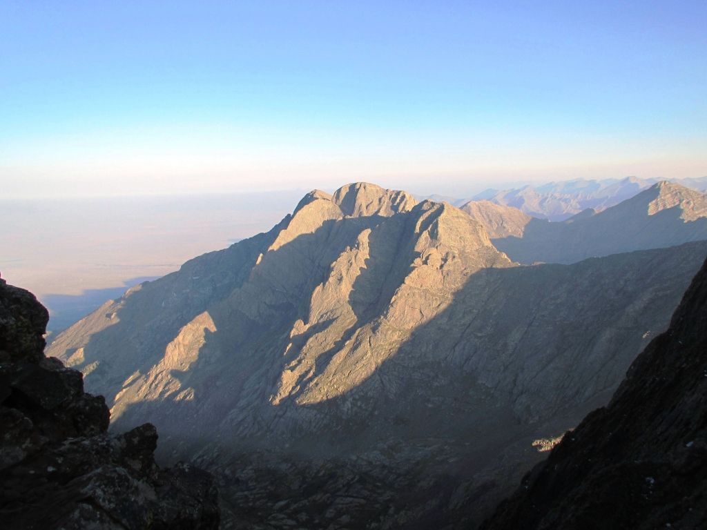
I will never forget the first time I saw Crestone Peak. It was on an early summer day from the top of Kit Carson. It was during the week, with no other parties on the mountain. My partner had turned back many miles before, exhausted from the effort of the unrelenting elevation. On that day, I had Kit Carson's summit and its views all to myself.
There, across the great divide, sat the North Face of Crestone Peak, just, staring at me. Sitting there in the quiet, utterly alone, I remember being frozen in awe. From that lofty perch, I felt the full weight and presence of the Crestones. With the great cliffs, high spires, frightening NW coulior and towering dual summits stretched out before me, I thought to myself, "That is less of a mountain, and more of a fortress." I will never forget the feeling of utter magnificence, power, and presence of the mountain know simply as "The Peak."
Fast forward more than two full years and my pursuit of 'the list' has taken me all over our wonderful state. From Sawatch slogs to thrilling scrambles to winter routes to some 13ers along the way , I have progressed, learned, and enjoyed all kinds of things about the high places of Colorado. With only four peaks left to my goal, the Crestones were the final 'real' challenge and what I hoped would be a fitting exclamation point to my journey.
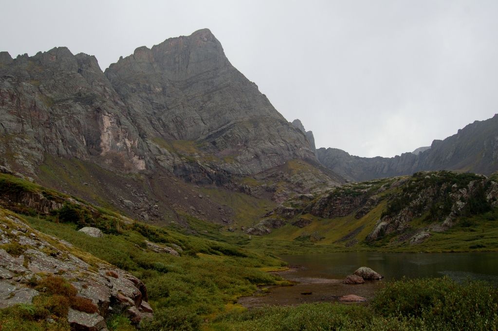
And of course, as with any climb like this, good partners are the 11th essential. Andrew and Dillon were just as excited as I was for the climb as we packed up and drove to South Colony. The road to the TH is in about as fine of condition as it ever could be, with only one, maybe two, questionable spots. A quick pack of the gear later, and we were on our way to South Colony, with a few darker clouds looming up the valley. Our plan was to arrive at the lake to set up camp, followed by an evening ascent of Humbolt. However, just before we reached the camp sites, a pretty good summer squall rolled in. Thick rain was was soon replaced with dime sized hail and rolling thunder from the heights above. Sulking under the cover of thick trees waiting for the storm to move on, we seriously hoped we would not have to attempt all three peaks the next day.
Sensing a break in the storm, we hiked in the final 10 minutes to camp and a welcome greeting from the Needle. The view from there will move all but the most "dispassionate souls."
A quick assembly of the tent only partially saved the gear from the wet. As Andrew passed out, Dillon and I wandered over to the lake, muttering about the weather which had been carrying on for some time by now. But, I suppose if there was ever a good place to sit and take in a mountain storm, the base of the Needle is it. Crawling back to the tent a while later, we rolled into our sleeping bags feeling defeated, wishing it would just...stop.
And sure enough, waking some scant 30 minutes later, the sun was out and it was a glorious evening. We knew this was the window, and we hastily geared up for the slog to the top of Humboldt.
Along Humboldt's ridge, lustily eying the Ellingwood Arete. Bucket list. (Dillon)
After the leisurely hike up the road earlier in the day, followed by a nice rest, we were feeling very strong rolling up to the saddle. Carrying two packs between three guys, I was leading at what I thought was a very respectable pace. Then, Andrew said something stupid. I believe the dialogue went something like this:
Andrew (looking at the lakes below): "Wow, look at all the fish leaping!"
Me: "Are you going to go fishing later when we get back?"
Andrew: "Maybe. It depends on how soon you get us up this damn mountain."
At that point, my mind said, "Oh no...", but my pride said, "Oh hell naw!" No other words were spoken, but the race was on.
Poor Dillon. Being a few steps behind, he had heard none of it. All he knew is that his two climbing partners, (for some seemingly inexplicable reason) had decided to sprint the final 1,500 feet up Humboldt. It was never really acknowledged until later, but I think Andrew and I both knew we were in for some pain once the gauntlet had been laid. All told, camp to summit in 1:15ish. Haha, men really are complete idiots sometimes....
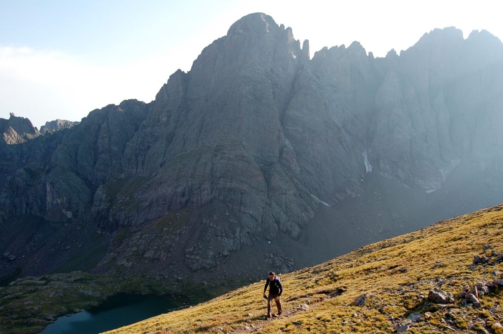
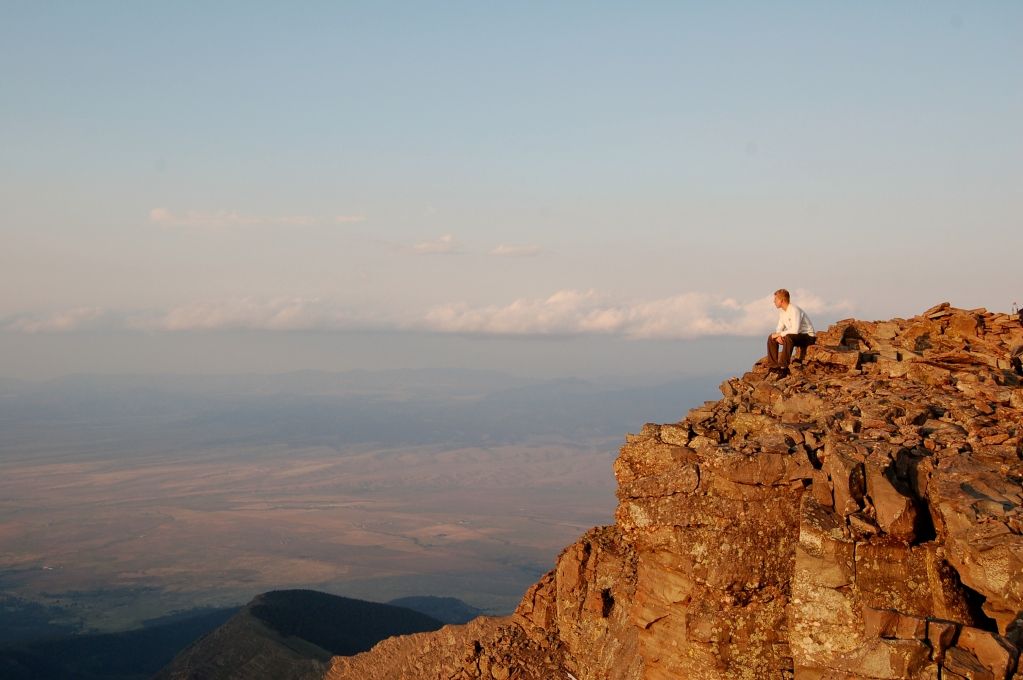
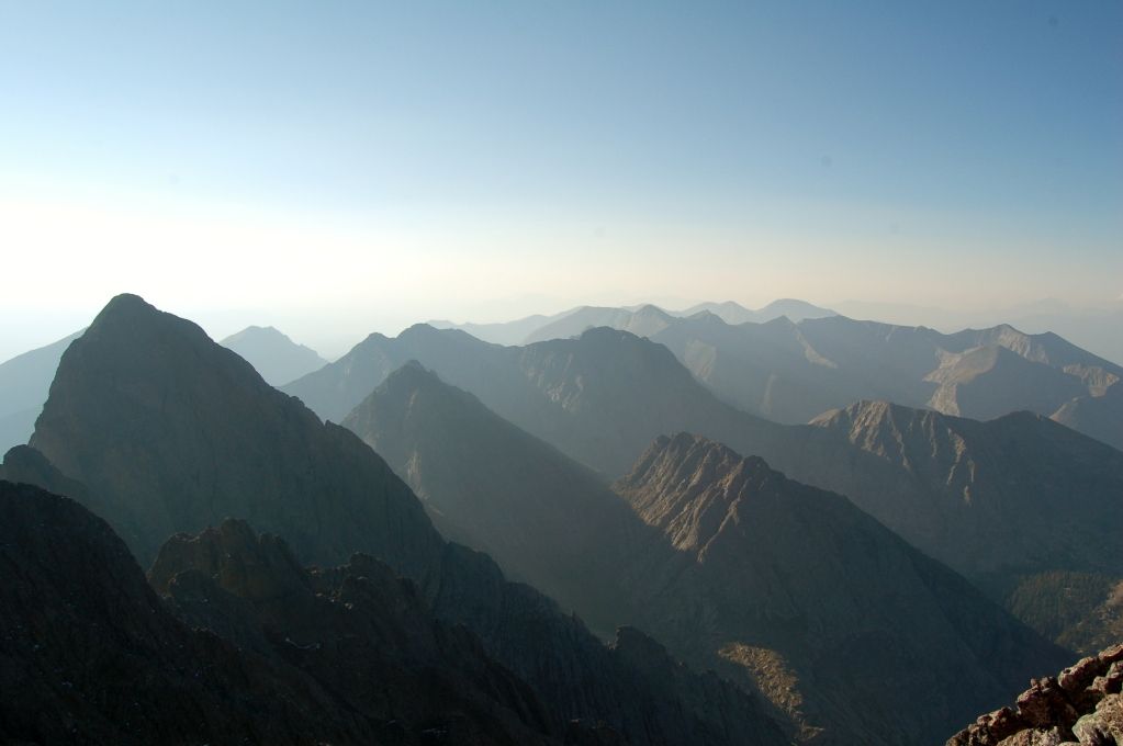
Oh well. The views from the top are worth it. I am fully convinced that God created Humboldt just for the viewing pleasure of being able to look at the Crestones. Then he made it 14,000ft so people would some day climb it and marvel at his creation. And yes indeed, it is good.
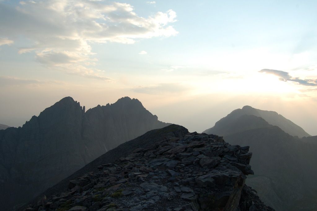
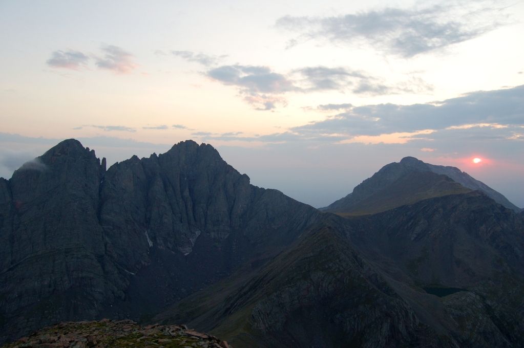
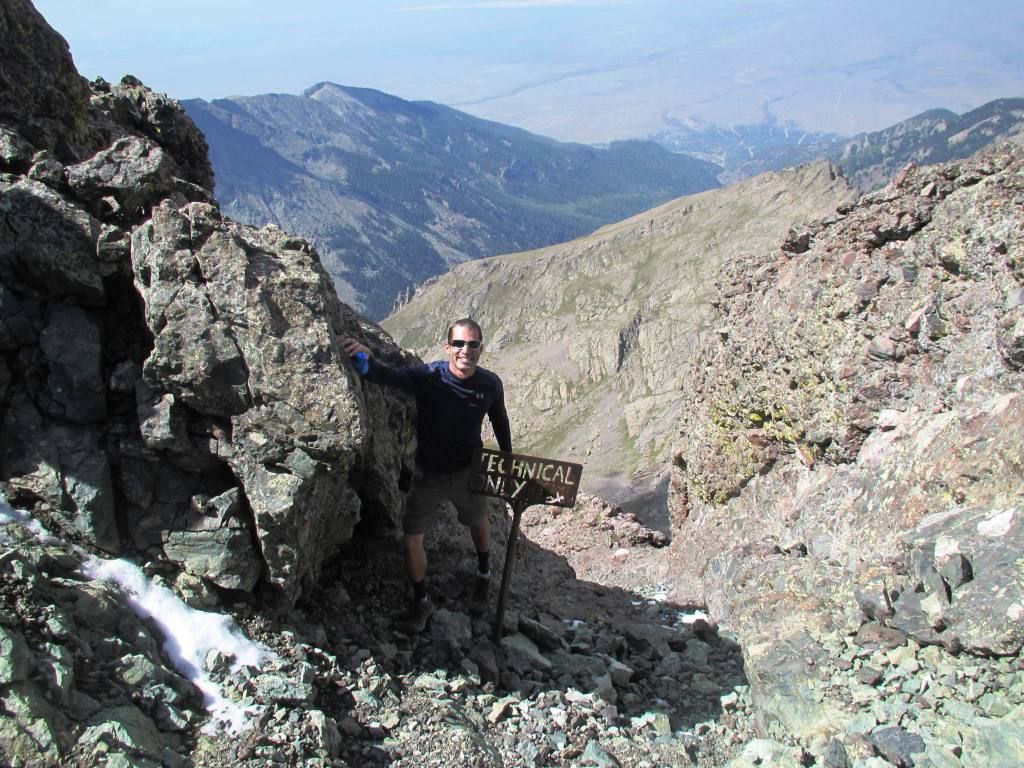
End of the world, or just the Crestones?
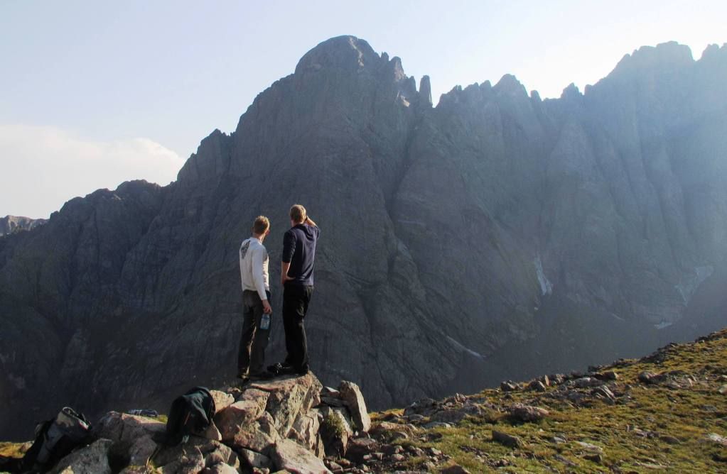
Summit views to the East. (Dillon)
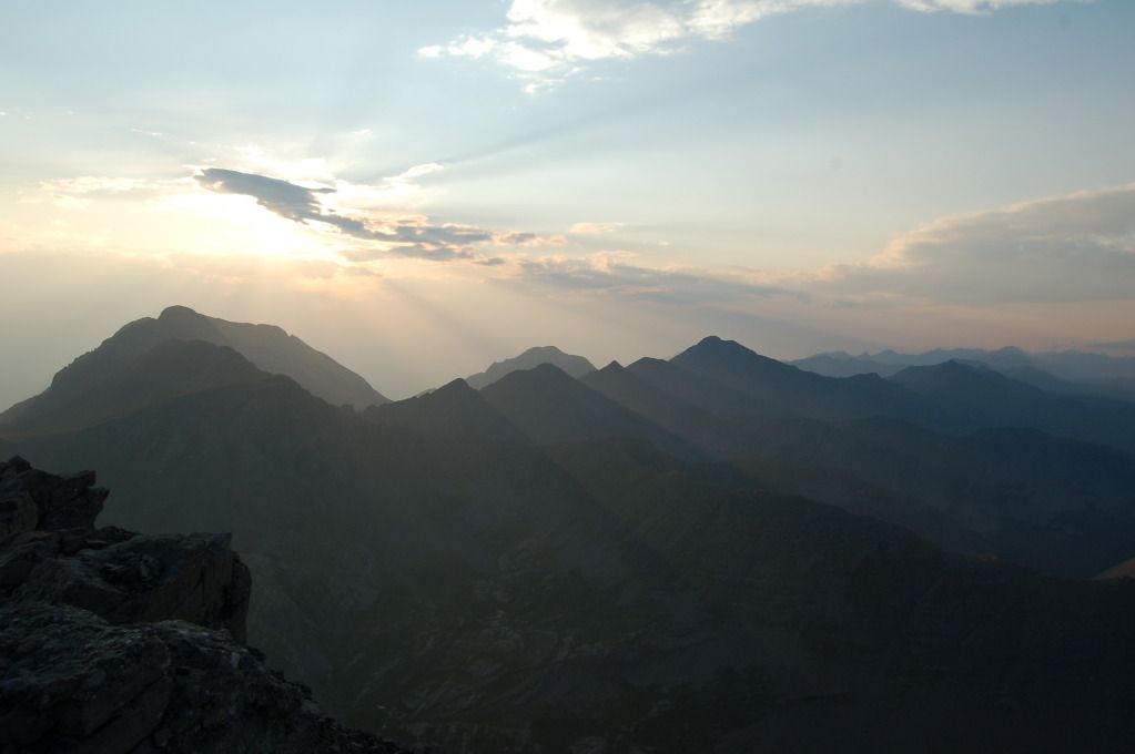
Kit Carson with the Sangres beyond.
Andrew taking it all in.
One final summit shot with the sun sinking fast. Humboldt is a unique vantage point to enjoy such a special place.
Headlamps led us back to the tent and the warmth of our bags. Alarms were set for 4:00 the next morning, and I glanced at all of the beta I had collected on the traverse one last time.
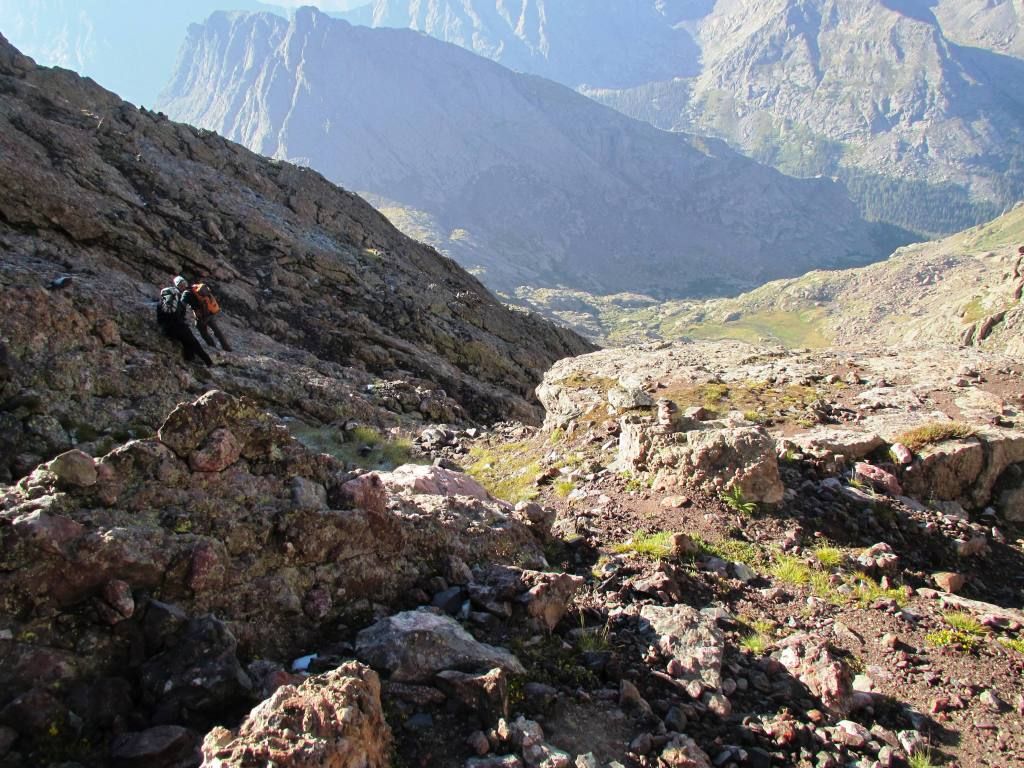
The next morning was an easy wake up call. We knew an early start was essential for the traverse, and the excitement was high knowing there was so much fun coming in the day. We rolled over Broken Hand pass without any issues, rested at the North side of Cottonwood Lake, and then continued on into Bear's Playground.
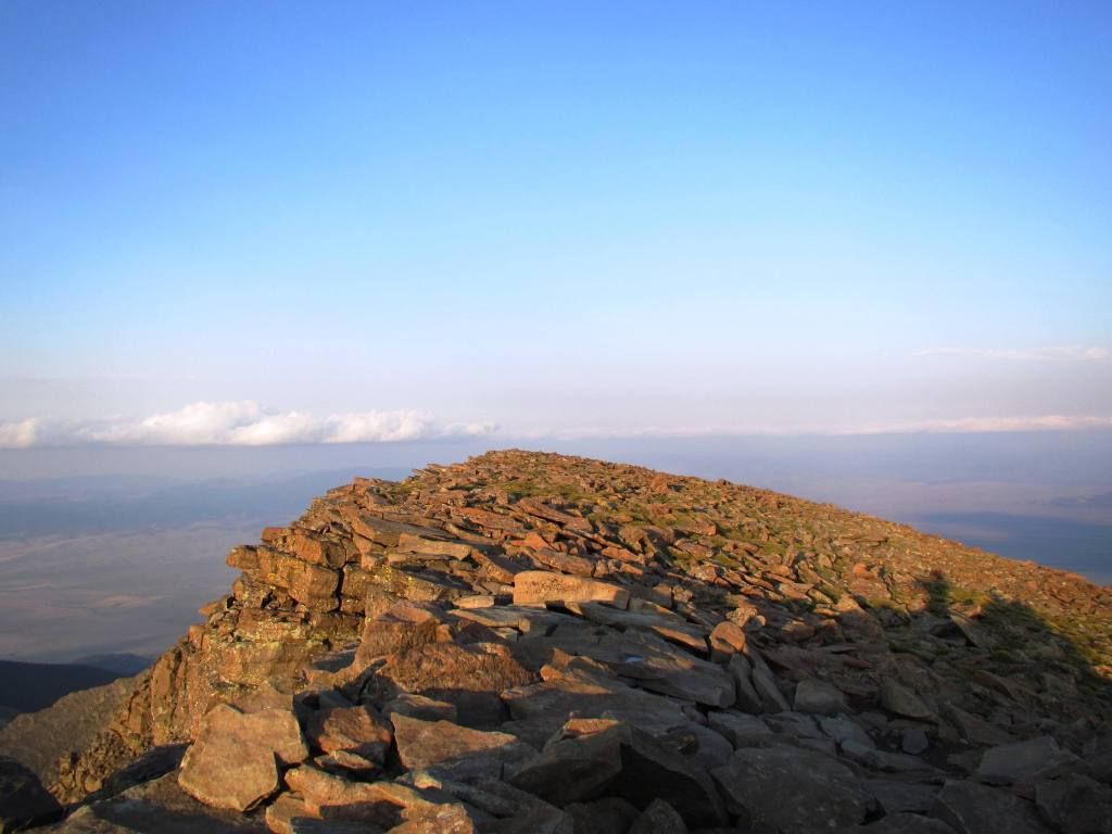
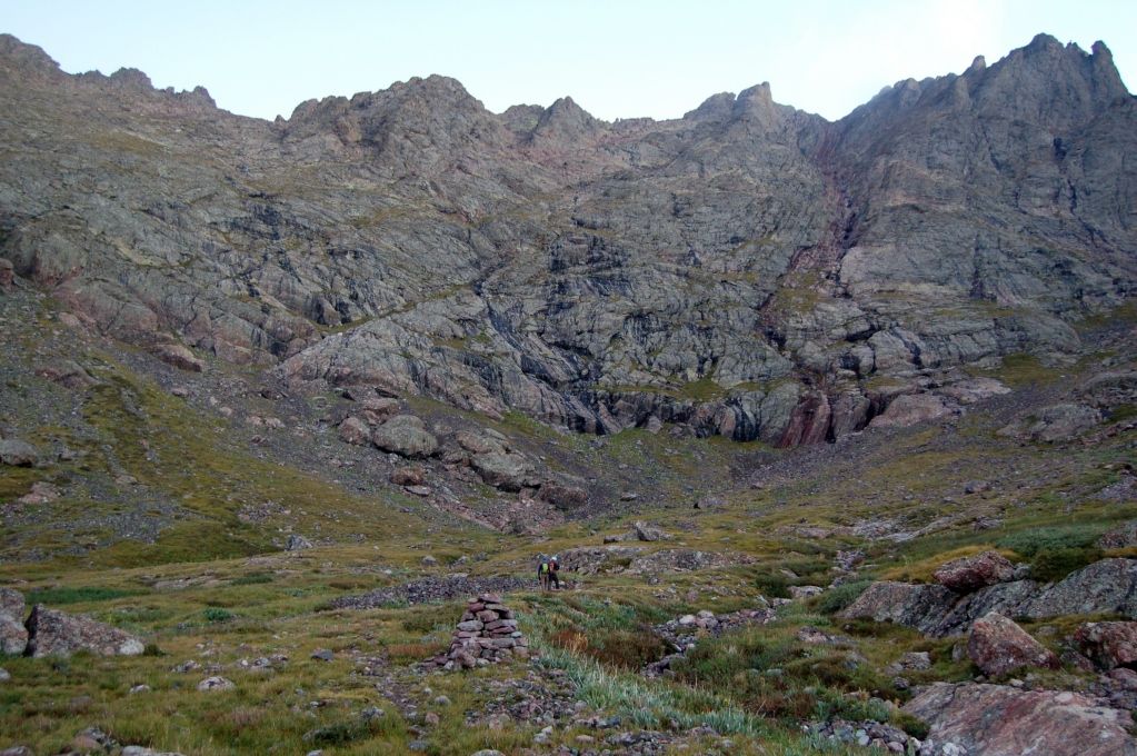
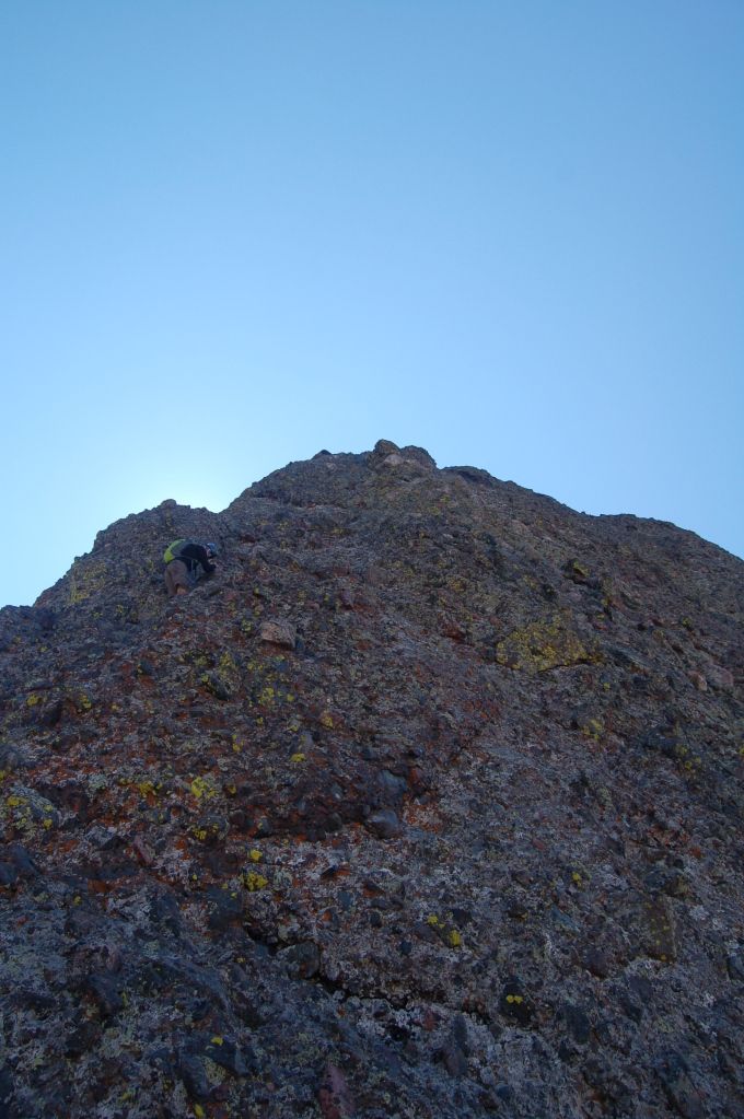
The first real light of the day highlights the prominent Red Gulley up the peak, the first "piece of the puzzle" for the day.
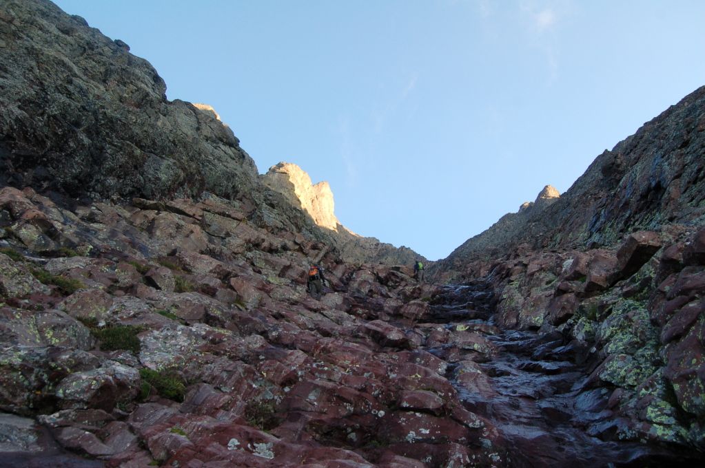
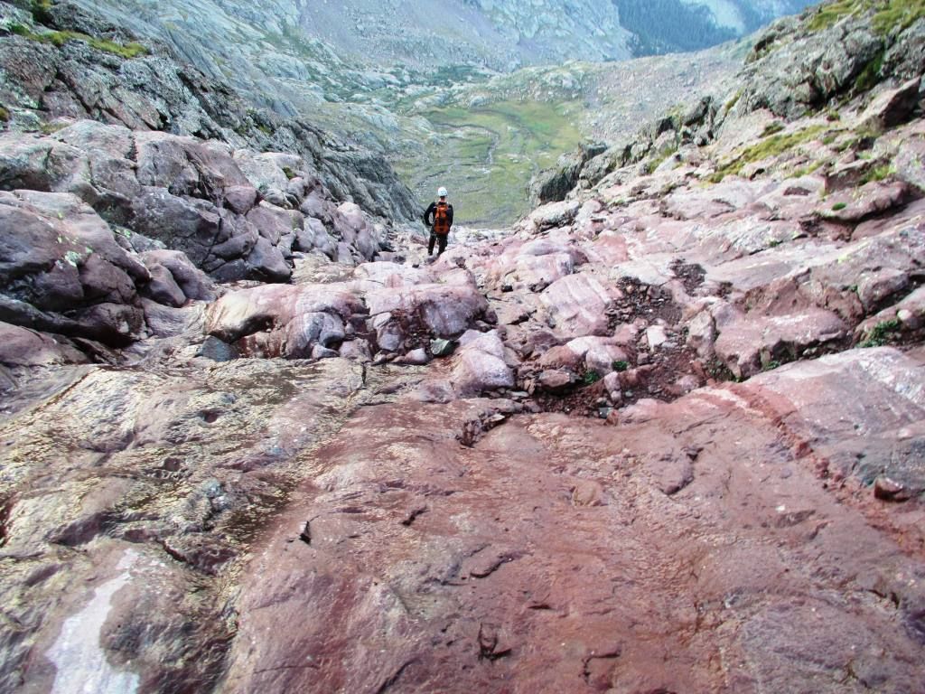
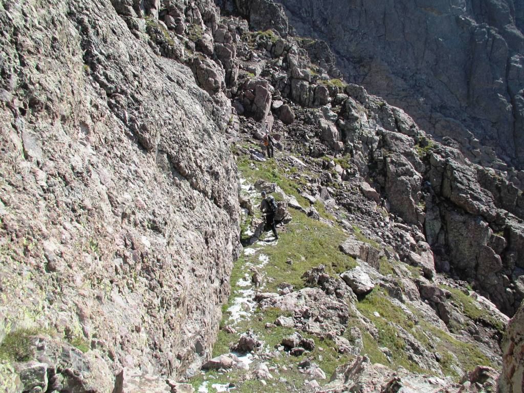
The Red gulley is very straightforward. Cairns easily mark the entry point, and from there it is a simple, albeit taxing, straight shot up to the saddle. The gulley was in about as good of conditions as you could ever ask for, and we found the scrambling enjoyable, if not a bit underwhelming. As has been reported many times, the moves were simple class 3, the rock relatively stable, and exposure limited. The one thing we did diligently look for was the exit point of the traverse. All of the information out there speaks to how low it is in the gulley, so we tried to mark our exit point for later as we climbed.
Scrambly!
Up up it goes. (Dillon)
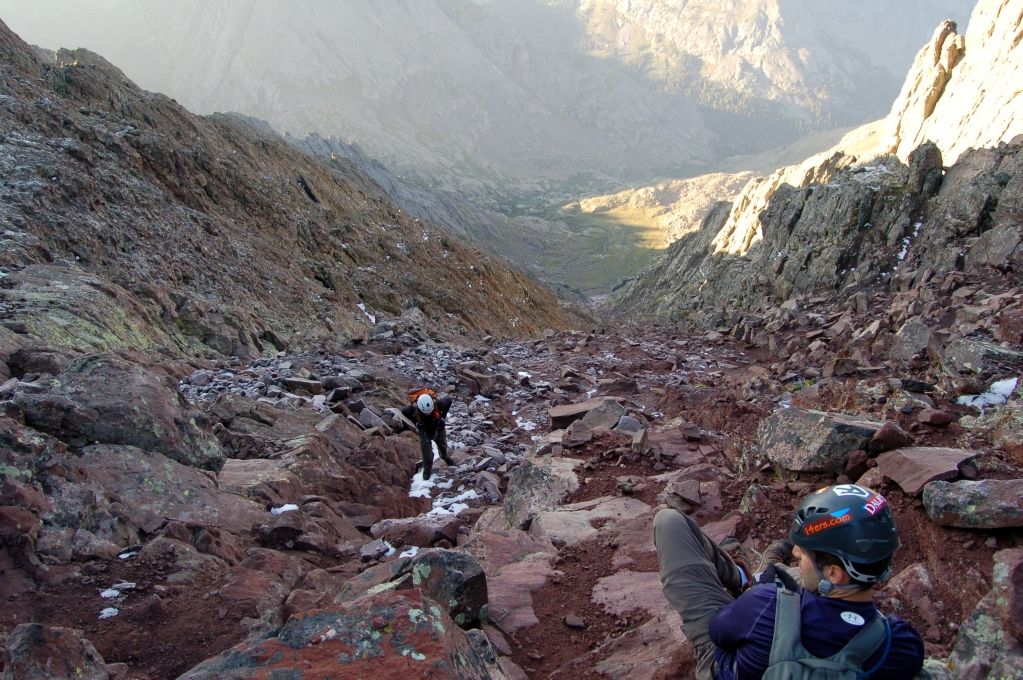
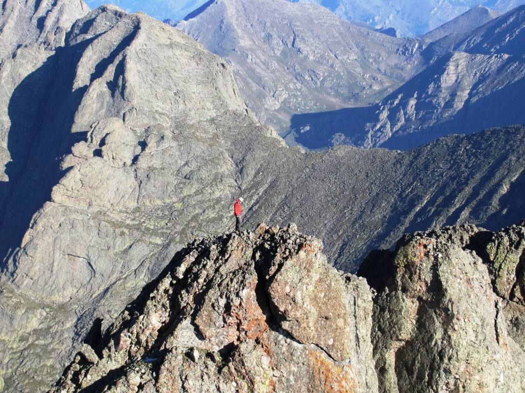
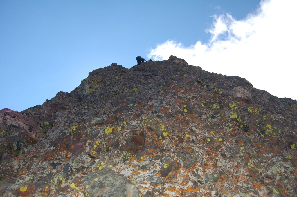
Topping out after a solid, but exhausting effort to the top.
From the saddle, only a few (very) short moves remained to the true summit. Again, all easy class 3 from here:
Kit Carson Massif (Dillon)
The Needle and beyond.
Descending back to the saddle, Dillon and I went for East Crestone while Andrew felt the Siren's Call of Northeast Crestone. A quick side trip had him there in no time; certainly looks like the North Buttress route is worth the return trip. (Dillon)
The Traverse
Already thrilled with the fun climb to The Peak and the excellent weather, now the 'real' fun started. I had read as many TRs as possible is preparation for this climb. The beta they provided was invaluable. However, I still felt that I did not really find a succinct set of how to do this. There are plenty of VERY useful tips and thoughts on the traverse online, but I still wanted more. So, I included some shots and notes at the end of this report for anyone looking to do this. Hopefully some of my notes are helpful to someone else eying this route.
As for us, we did not find it to be overly difficult from a route finding perspective, but it could very easily have become much more challenging if getting off route or not taking your time to pick the correct option. Suffice it to say, we had an amazing time on the traverse. The position was truly spectacular, the weather was gorgeous, the rock solid, and the climbing was a ton of fun.
Exit point from the Red gulley. (Dillon)
The ledge systems are a fun and remarkable place to be. (Dillon)
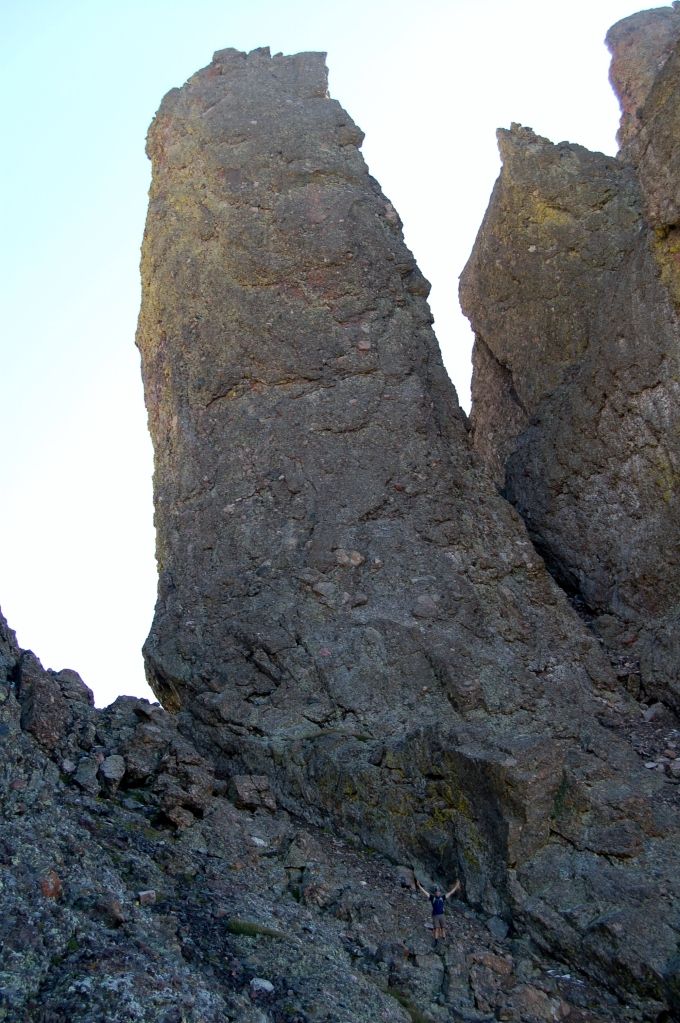
Dillon reaching the Black gendarme. Truly, one of the more incredible features out there...
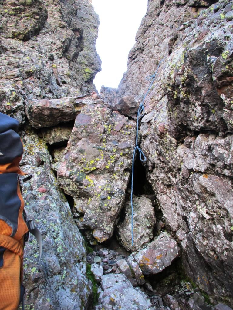
We opted to go straight up the gulley to the knife edge past this point. There was a strand of 8 mil cord hanging for the short class 5 moves, which we chose not to use. While not exposed, there was no question in mind this series of moves was the trickiest of the whole traverse. (Dillon)
Moving past the knife edge into the final gulleys.
(Dillon)
(Dillon)
(Dillon)
One way trip!
As I said, we more or less made it to the final pitch of the Needle without any route finding issues, which was a blessing. All that was left was to climb this last infamous wall. I know everyone has an opinion on this, so I'll give mine. Frankly, two things stuck out to me while climbing this:
#1. The exposure was not as bad as I was expecting. True, it is an airy spot and a fall would be a big no-no, but it just wasn't the thousands of feet of air I was expecting. More like, dozens...
#2. The climbing was definitely trickier than I was anticipating, and this made it a challenge. We went up climbers left, but not so far left as to be out on the sheer Northeast face. There were definitely some tricky moves in there which had me on my toes. Of all of the 14ering I have done, I can confidently say this is the most dangerous and challenging single pitch I have climbed un-roped.
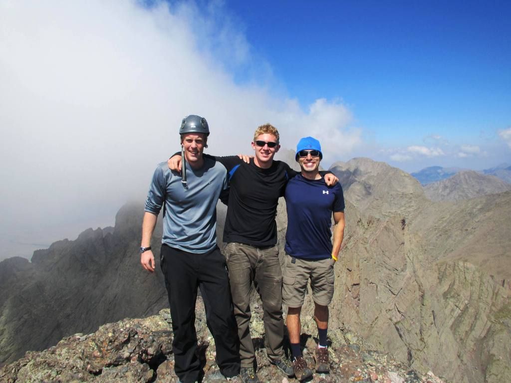
But also, this is just an incredibly thrilling spot to be in. The adrenaline was pumping moving up the face, and I felt a palpable surge of relief upon reaching the shelf on the top. With only one peak left to go (and that being a party climb) this was a pretty awesome 'symbolic' finish to the 14ers. Andrew and Dillon also climbed it like champs, and we soon found ourselves letting out sighs of exhilaration on the top!
Dillon leading the charge. We felt climber's left offered the easiest rock.
My turn - fun.
Andrew has never been scared on a mountain, and he wasn't about to start now.
Relief! After all the scrambling and the thrilling finish, the striking summit of the Needle was an awesome way to end the day. A few other parties welcomed us to the top, including a girl who had just climbed the Needle as her finisher. Nice!
Earned it! (Dillon)
Ego shot!
The trip back down the Needle was uneventful. We were, however, very glad to follow another party on the descent who graciously pointed us into the proper West gulley. Although, upon crossing over, the East gulley looked like a lot of fun all the way to the top as well. Perhaps something to think on for next time...
Coming back to the pass and then out again, as usual, I was very grateful and overjoyed at the day. Our climb had been spectacular in just about every sense of the word. I was overly thankful for my excellent partners as well. These guys are both beasts, and the friendship and teamwork on the traverse made it all the better. I've probably said it a million times (and on every TR), but there really is no substitute for good partners. My only fear on the hike out was actually thinking about this TR. Given that I had just climbed with Dillon, I could only hope that it is not down-voted into oblivion by his crew upon the posting. I small price to pay I suppose, for such a great day out there.
Thank for sticking with it if you did. Happy climbing!
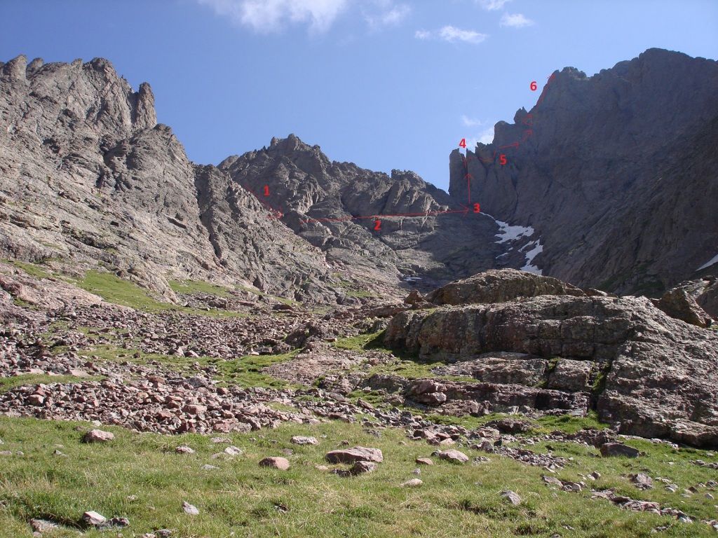
Traverse Beta*
Overview: I am not the expert on this route, and there are plenty of great resources online to help understand where you need to be. I read probably a dozen TRs before I really got the 'sense' of how to put this together. With that in mind, I tried to outline the main points below in my mind, along with some helpful pics. Here is a good reference shot for all of the points I have marked below.
1. Look for the low exit point out of the red gulley while descending the Peak. This should be marked with cairns and some 300-400 feet below the summit. Finding the correct roll over spot is key to the whole traverse. It is much lower than you might think, and you will know pretty soon if you found the right spot because of the cairns.
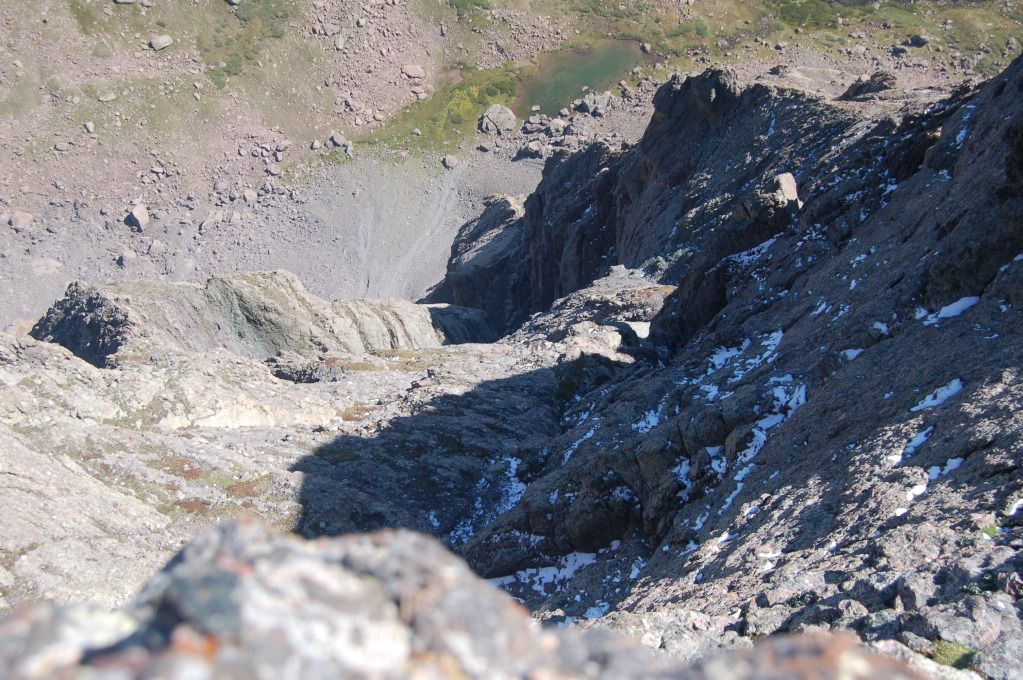
Here is a shot I took of the exit from the Red Gully. This is directly opposite of where you want to go (the route is 180 degrees behind this), but it is a good marker to look for on the opposing wall. Here is a look at right where we rolled out of the Red Gulley, with a cairn visible.
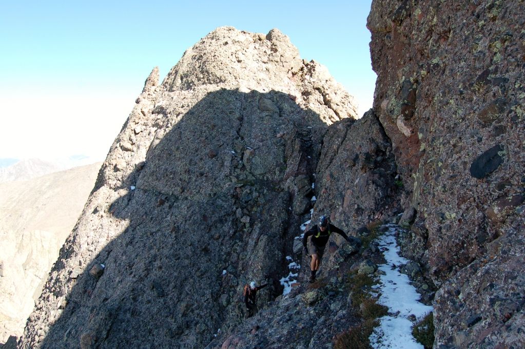
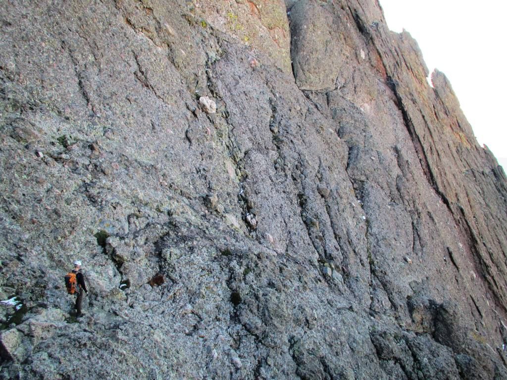
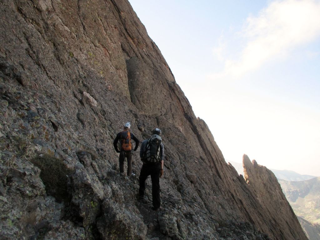
2. The first 2/3 of the traverse crosses a series of grassy ledges well below the actual ridge crest. In this area, the cairns are plentiful and the route finding is easy, provided you take your time and never move along without seeing the next cairn. When in doubt, we looked down and right for direction. For the next 30-60 minutes, the route rolls over shoulders and various gulleys along the grassy ridges. If you ever find a move which is above a soft class 4, you are probably off route. Look around and try again. There is a surprising amount of elevation loss in this section. We got a few shots of these ledges here, here, and here. Note the visible cairns in some of these shots.
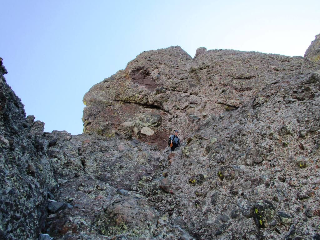
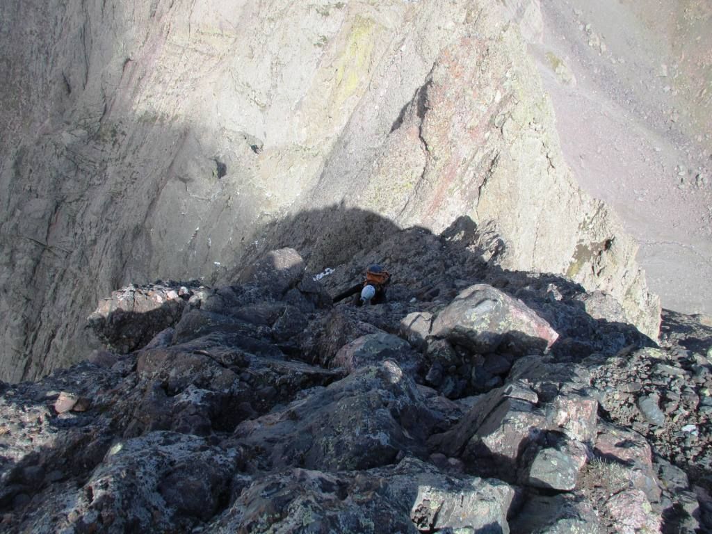
3. While climbing along the ledges, three prominent gendarmes loom coming just off of the Needle's summit. The objective is to reach the gulley beneath the unmistakable first 'black gendarme'. If following cairns and on route, the base of the gulley should be reached some 100ish feet below the gendarme itself - the route takes you right to this base. This spot marks the end of the down, as it is all up from here. It also represents the last feasible bail-off point should weather or other issues occur. Here is a climber beneath the black gendarme. The route goes up the gulley to the right.
4. From the gully below the black gendarme, there are options. This was one section which mightily confused me in looking at TRs, so hopefully this beta is useful. From here, it seems the choices are:
A. Follow the gulley straight up next to the black gendarme to the top. This option involves a short (10-12ft) single section of class 5 moves before reaching the saddle between the gendarmes. While the moves are not terribly difficult, they absolutely were class 5.0-5.2 (IMHO) and the hardest single moves of the traverse. There was a short 8mil cord hanging as well, which we opted not to trust at all. Past this at the the top of the gulley, a short (15-20ft) thrilling knife edge leads to a shoulder which leads to the second gulley.
B. Do not climb the gulley beneath the black gendarme. Roll over the shoulder much lower and follow the next gulley up to reach the points where the routes meet past the knife edge. As we took option A., I can't really say much more about this option, but I believe others have done it successfully.
I outlined the two choices as I understand them, with option A in RED and option B in GREEN.
5. Cross another gulley and shoulder until reaching the last gulley below the final pitch. This spot is hard to describe, but essentially you should see the next two gendarmes. The goal is to follow a series of shoulders and gulleys to the notch between the final pitch off the Needles' summit and the third gendarme. Keep watching out for small cairns in this section as well to confirm being on route.
6. Climb the final pitch to the summit. This face is no joke. The exposure here is the most severe of anywhere along the route, and the climbing is a stiff class 4. We ascended climber's left, but not so far left as to be out on the extremely exposed Northeast face. The right option seemed to present more difficult climbing. The holds are bomber and the line is pretty obvious, but this is absolutely a no fall zone. Photos of us on the last pitch can be found here, here, and here.
NOTES: There is probably much more to it to that, and I would in no way want to cast myself as the expert on this route. However, I hope that is some useful beta. I think the main points to remember are to stay low and follow cairns on the first 2/3 of the traverse. Then move cautiously and carefully on the last 1/3 and climbing sections. Aside from the one short section of class 5 below the black gendarme, we never exceeded 4th class up to the last pitch. While many of the positions were very thrilling, if on route, the exposure should never be extreme for very long.
*Photo credit goes to Dillon for most of these, as he had the camera out and was workin it. Thanks for getting so many great shots of the ridge!
Awesome write-up, informative description, and great pics. For the Peak side, there is a higher traverse that cuts through a slot before dropping down a gully to meet up with the ledge. It is faster to just do the ledge the entire way as you've marked. Also, I've taken your Option B around the gendarme - it is an airy low 5th and probably not as aesthetic as cutting through the gendarme. That fixed cord is interesting - perhaps some guide placement?
Zambo - you've outdone yourself with this one man! You hit home on it all. Awesome job. Andrew - you are a wildman! Have a I mentioned that before? Thanks to both of you for keeping me in check on that final pitch. My grandmother thanks you as well. I think there is a typo in there though: Your RT Humboldt time was 15 minutes, not 1:15. Beastly effort boys... What a freaking spot that is down there! Had a GRAND ole time. Thanks!
As someone planning to do this very trip in a few days, your report has immediately vaulted onto my short list of reference TRs, and may well be the most useful one! Congrats on a great day of climbing...you have me stoked for the traverse! Nice work
Glad everything went well for what looks to be a great trip. That area is definitely worth another visit, or several! One left Zambo...
Caution: The information contained in this report may not be accurate and should not be the only resource used in preparation for your climb. Failure to have the necessary experience, physical conditioning, supplies or equipment can result in injury or death. 14ers.com and the author(s) of this report provide no warranties, either express or implied, that the information provided is accurate or reliable. By using the information provided, you agree to indemnify and hold harmless 14ers.com and the report author(s) with respect to any claims and demands against them, including any attorney fees and expenses. Please read the 14ers.com Safety and Disclaimer pages for more information.
Please respect private property: 14ers.com supports the rights of private landowners to determine how and by whom their land will be used. In Colorado, it is your responsibility to determine if land is private and to obtain the appropriate permission before entering the property.