Download Agreement, Release, and Acknowledgement of Risk:
You (the person requesting this file download) fully understand mountain climbing ("Activity") involves risks and dangers of serious bodily injury, including permanent disability, paralysis, and death ("Risks") and you fully accept and assume all such risks and all responsibility for losses, costs, and damages you incur as a result of your participation in this Activity.
You acknowledge that information in the file you have chosen to download may not be accurate and may contain errors. You agree to assume all risks when using this information and agree to release and discharge 14ers.com, 14ers Inc. and the author(s) of such information (collectively, the "Released Parties").
You hereby discharge the Released Parties from all damages, actions, claims and liabilities of any nature, specifically including, but not limited to, damages, actions, claims and liabilities arising from or related to the negligence of the Released Parties. You further agree to indemnify, hold harmless and defend 14ers.com, 14ers Inc. and each of the other Released Parties from and against any loss, damage, liability and expense, including costs and attorney fees, incurred by 14ers.com, 14ers Inc. or any of the other Released Parties as a result of you using information provided on the 14ers.com or 14ers Inc. websites.
You have read this agreement, fully understand its terms and intend it to be a complete and unconditional release of all liability to the greatest extent allowed by law and agree that if any portion of this agreement is held to be invalid the balance, notwithstanding, shall continue in full force and effect.
By clicking "OK" you agree to these terms. If you DO NOT agree, click "Cancel"...
The weekend forecast did not look favorable. People were already posting about what to do this weekend during the monsoonal apocalypse. We decided to have a go at KC and Challenger Point anyway, and see if we could get it done.
At 4PM, as we were driving S from Poncha Springs, we drove through torrential rains. The windshield wipers could not keep up with the downpour, and we were forced to slow down to 30 MPH. At this point, we started to wonder if we had embarked on an ill-fated endeavor.
I wanted to provide some route beta on Kit Carson's class 3 alternate approach to the summit. We first heard about this possibility from Bergsteigen and HarknessHouligans.
It's really easy to find the entrance. It's on Kit Carson Avenue just before the normal ascent gully (which is before the rock rib and before the true saddle with Columbia Point) The entrance is easily seen because there is a bunch of small rockfall at the base, and when you turn climbers left into the mountain, it's obviously class 3.
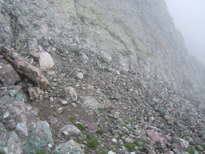
Obvious Rockfall:
Start of class 3 from KC avenue, looking up:
Another look at the entrance area:
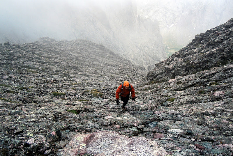
Almost immediately, you see a small prow ahead. We chose to go to the right, because left looked a little steeper and I am not sure where it ends up. It looks like it "goes" but it may be more class 4.
After the prow, there was a small "nipple", which we weaved to the left of.
It fluctuated between class 2 and class 3 climbing. Here's a look back.
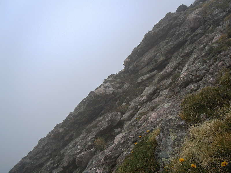
This gives you an idea of the slope angle, at the steepest point. I don't think this is exaggerated.
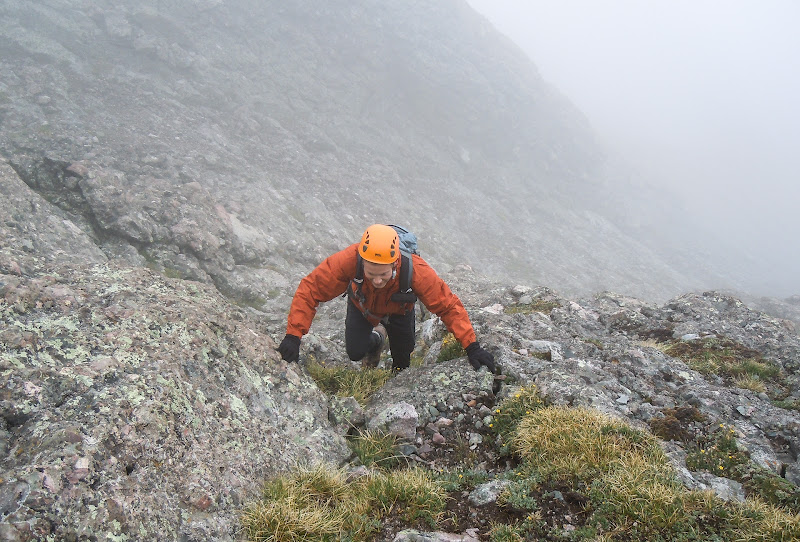
A "crux move" of moderate 3rd class difficulty near some grass.
Looking up from that point, we were only about 20' below the trail, which we met up with, and walked to the summit.
We liked this route because it's solid, moderate combo of class 2/ class 3, a nice way to attain the KC summit, and it leads you very close to the summit. It was probably the most enjoyable climbing we did all day. On the way down, we took the standard route. We almost took a left and ended up on the wrong side of the rock rib (obvious social trail and cairns), but it was a fine route none-the-less.
Cool report, those look like the exact same conditions I experienced on the Needle last year. It's eerie going up cliffy mountain terrain and not being able to see more than 30ish feet, but also makes for some awesome shots. Awesome report man!
That mega pano is a helluva shot!! way to persevere in less than ideal conditions.
Caution: The information contained in this report may not be accurate and should not be the only resource used in preparation for your climb. Failure to have the necessary experience, physical conditioning, supplies or equipment can result in injury or death. 14ers.com and the author(s) of this report provide no warranties, either express or implied, that the information provided is accurate or reliable. By using the information provided, you agree to indemnify and hold harmless 14ers.com and the report author(s) with respect to any claims and demands against them, including any attorney fees and expenses. Please read the 14ers.com Safety and Disclaimer pages for more information.
Please respect private property: 14ers.com supports the rights of private landowners to determine how and by whom their land will be used. In Colorado, it is your responsibility to determine if land is private and to obtain the appropriate permission before entering the property.