Download Agreement, Release, and Acknowledgement of Risk:
You (the person requesting this file download) fully understand mountain climbing ("Activity") involves risks and dangers of serious bodily injury, including permanent disability, paralysis, and death ("Risks") and you fully accept and assume all such risks and all responsibility for losses, costs, and damages you incur as a result of your participation in this Activity.
You acknowledge that information in the file you have chosen to download may not be accurate and may contain errors. You agree to assume all risks when using this information and agree to release and discharge 14ers.com, 14ers Inc. and the author(s) of such information (collectively, the "Released Parties").
You hereby discharge the Released Parties from all damages, actions, claims and liabilities of any nature, specifically including, but not limited to, damages, actions, claims and liabilities arising from or related to the negligence of the Released Parties. You further agree to indemnify, hold harmless and defend 14ers.com, 14ers Inc. and each of the other Released Parties from and against any loss, damage, liability and expense, including costs and attorney fees, incurred by 14ers.com, 14ers Inc. or any of the other Released Parties as a result of you using information provided on the 14ers.com or 14ers Inc. websites.
You have read this agreement, fully understand its terms and intend it to be a complete and unconditional release of all liability to the greatest extent allowed by law and agree that if any portion of this agreement is held to be invalid the balance, notwithstanding, shall continue in full force and effect.
By clicking "OK" you agree to these terms. If you DO NOT agree, click "Cancel"...
Origionally written last year, but I never added the photos. It's been "inactive" for a while.
It was kind of slow going on this trip. I could blame my recent gym slacking or "first 14er this year" status, but we did okay. Total RT time was just under 6 hours.
The road to the upper Trailhead was rough. Luckily I took my truck! I have heard of Honda Civics making it up the road, but I would only attempt this in YOUR car. (as in, not a small car that I owned).
We started at 6:16 AM; my climbing partner was pushing for a 5 AM start but I value my sleep!
The first 2 miles the trail is fairly flat compared to later on. It just seems to go and go. The whole time I was wondering- why did they close this to 4WD vehicles? My truck could have made it easily. (the view of Humboldt is a little intimidating!)
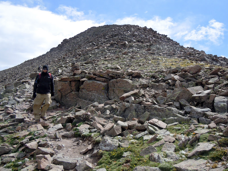
It was cool and slightly overcast and as soon as we broke out of the trees near the lakes the wind kicked up very stiff and cold. Stupidly, I didn't don a jacket. We continued up through the meadow with great views of Broken Hand Peak, Crestone Needle, and Crestone Peak. If it wasn't so cold and windy, it would have been a great place to hang out. You spend what seems like a mile in the shadow of Humboldt peak traversing across the base of the mountain to get to the back side. Once the ridge pitch comes into view, you realize that the fun really hasn't started yet. Gaining the ridge proved to be the hardest part of the hike, and you finally achieve it at ~13,200. The views are spectacular from this point on.
The cold wind continued as we headed up the exposed ridge. It's rocky and steep and you are right on the ridge crest as you ascend. We had little shelter from the wind as we climbed up. Looking up to the summit, the true summit is visible at the saddle and most of the way up. Eventually as you near the false summit you lose sight of the top. Once the false summit is gained all the hard work is behind you and you can enjoy a nice exposed walk along the ridge or play it safer and take the trail. At the end we opted for some brief class 3 climbing to gain the summit.
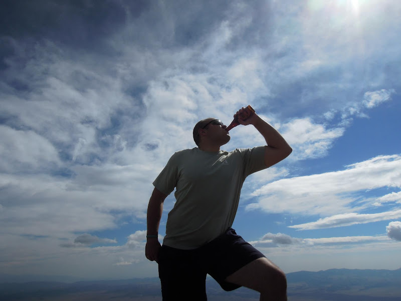
The weather cleared out and the wind relaxed a little. As is becoming tradition for us, I enjoyed my "beer summit" which this time was New Belgium Trippel in a glass bottle. I usually cannot finish the whole 12 oz after such a climb, and I enlisted the help of a nice gentleman who ran up to finish off the bottle. Beer really does taste better when you've earned it!
From the top of the mountain there are truly amazing views in every direction. It was a relatively clear day with clouds to the west coming in slowly.
On the way back I was struck by 3 things- this basin is beautiful, the Crestones look scary and amazing from this side, and the final 2 miles seemed to take forever!
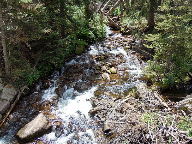
This little stream is a welcome sight!
Overall, this is a new favorite of mine, my gut tells me I'll be back soon to tackle the Needle. We met some nice friendly people at the top, it was more challenging than anticipated, and the views were outstanding.
On the way back down we found a weary hiker who had the misfortune of parking at the lower lot and had completed over 16 miles already. We gave him a ride back to his car, for which he was grateful!
the last two miles do seem to take forever. That area is absolutely breathtaking with the view of the Crestones and Broken Hand Pass, the Colony Lakes and the wildlife...this is probably one of my favorite hikes so far. Enjoyed your report.
Caution: The information contained in this report may not be accurate and should not be the only resource used in preparation for your climb. Failure to have the necessary experience, physical conditioning, supplies or equipment can result in injury or death. 14ers.com and the author(s) of this report provide no warranties, either express or implied, that the information provided is accurate or reliable. By using the information provided, you agree to indemnify and hold harmless 14ers.com and the report author(s) with respect to any claims and demands against them, including any attorney fees and expenses. Please read the 14ers.com Safety and Disclaimer pages for more information.
Please respect private property: 14ers.com supports the rights of private landowners to determine how and by whom their land will be used. In Colorado, it is your responsibility to determine if land is private and to obtain the appropriate permission before entering the property.