Download Agreement, Release, and Acknowledgement of Risk:
You (the person requesting this file download) fully understand mountain climbing ("Activity") involves risks and dangers of serious bodily injury, including permanent disability, paralysis, and death ("Risks") and you fully accept and assume all such risks and all responsibility for losses, costs, and damages you incur as a result of your participation in this Activity.
You acknowledge that information in the file you have chosen to download may not be accurate and may contain errors. You agree to assume all risks when using this information and agree to release and discharge 14ers.com, 14ers Inc. and the author(s) of such information (collectively, the "Released Parties").
You hereby discharge the Released Parties from all damages, actions, claims and liabilities of any nature, specifically including, but not limited to, damages, actions, claims and liabilities arising from or related to the negligence of the Released Parties. You further agree to indemnify, hold harmless and defend 14ers.com, 14ers Inc. and each of the other Released Parties from and against any loss, damage, liability and expense, including costs and attorney fees, incurred by 14ers.com, 14ers Inc. or any of the other Released Parties as a result of you using information provided on the 14ers.com or 14ers Inc. websites.
You have read this agreement, fully understand its terms and intend it to be a complete and unconditional release of all liability to the greatest extent allowed by law and agree that if any portion of this agreement is held to be invalid the balance, notwithstanding, shall continue in full force and effect.
By clicking "OK" you agree to these terms. If you DO NOT agree, click "Cancel"...
Well I decided to take my brother and try Hesperus mountain. He is trying to better his life and we are trying to help him. So I figured this would help. So he says he loved it but anyhow back to the trip report.
We started off driving from Durango. Leave Durango on hwy 160 and head towards Mancos/Cortez. Once you reach Mancos take a right at the light and another right about a 1/4 mile down the road. There will be a forest sign for jackson lake. The road to the Trailhead is clearly marked and road numbers are marked as well. It is 17 miles from the winter turn around. You will want to stay on the roads marked for Sharktooth trailhead (this is not the trail you take but same parking area.) Well marked signs.
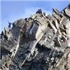
Once you reach the parking area you will take the trail that goes straight towards the great eye appealing Hesperus Mountain. The trail is Mancos Trail 621 Looking back at the parking area.Hesperus Mountain 13,232ft.
Follow this trail down you will lose some elevation. After you cross the small wooden log bridge go about a halfmile down the trail and choose your way straight up through the brush to the mountain.The wooden bridge.My Brother standing as we walk thru the brush.Cool tree that fell over and the stump made a little shelter.
From this point its pretty much pick and choose on your route up the mountain. You want to try to get up to the west ridge we took a steep gully which at the time had very icy rocks and a couple inches of snow on the ground. Looking up at the route we are about to take.Looking down.
Once we reached the mid way flat area my brother decided to hangout there as he didnt feel confident going higher or coming down. So I gave him some extra warmth and food as I trecked off for the summit. My brother with the Wilsons group in the Back.Looking strait up twords the summit.
As you go from the flat area and get up to the west ridge you climb up this little bit of rock. When I climbed it was very icy so I had to take it slow and watch my footing. Climbing up the west ridge on the icy rocks. Up close on the icy rock.
After this I dropped down from the ridge and traversed around gradually climbing up the snow paths for more sure footing. Part of the ridge and going up.The traverse around
As I started getting closer to the summit I walked up on the back side of the summit as it was less steep. Looking at the Summit. (Hoof prints in the snow)My poles that saved me due to lack of correct gear.
On the way down I looked over the far side of the mountain and scoped out another route down due to my brother not wanting to return the way we came. So I had him climb up to the saddle and we decided to climb down the back side and walk around the mountain as best we could to a non snowy and easier route. The way off the backside we took.
So after we walked a bit extra we came around to the ridge line of the mountain on the far west side and decided to do a fun Scree ski down the hill (possibly the best part of the trip) The scree ski hill.We ended up on the far right side of this ridge.
After this and the long walk through a rock field we ventured back through the brush straight down until we reached the Mancos trail again and climbed our way out. For a side note the Mancos trail runs along the river all the way down so you can just hike straight down and run into it sooner or later.
And here is just some extra pretty pictures. Sunrise
Side note, I learned my lesson on having correct gear. We hiked up and I gave him my Sweater, Neckwarmer/beanie, and the poles for the hike up. I had tennis shoes and my climbing pants waterproof pants and synthetic longsleeve shirt on. I realize this was an easier climb but also could have gone bad not having correct gear for shoes and warmth. My bad and wont happen again.
Thumbnails for uploaded photos (click to open slideshow):
That's got to be one of my favorite peaks in Colorado - just beautiful, isn't it? And a lot harder than it looks, especially as you get near the summit! Glad you got up and down safely, and looked out for your bro, too - maybe after he gets a little more experience you both can head back up on a nice, dry day!
I hiked up Hesperus on 9/11/11, and boy was it loose! Quite a bit of bushwacking and route finding as well. You should check out Lavender Peak sometime, one of my favorite summits!
Yea I really enjoyed this hike. I was going to do the ridge to lavender then moss but with my brother sitting back down close to the saddle I didn't want to leave him to go back by himself. It is on my to do list with it only being 45 minutes from home. Thanks for feedback gl on future climbs.
is one cool looking mountain. I can see why it's one of the Navajo's sacred mountains. Had hoped to do this over Labor Day week, but weather kind of messed with that plan. Great report, thanks!
Caution: The information contained in this report may not be accurate and should not be the only resource used in preparation for your climb. Failure to have the necessary experience, physical conditioning, supplies or equipment can result in injury or death. 14ers.com and the author(s) of this report provide no warranties, either express or implied, that the information provided is accurate or reliable. By using the information provided, you agree to indemnify and hold harmless 14ers.com and the report author(s) with respect to any claims and demands against them, including any attorney fees and expenses. Please read the 14ers.com Safety and Disclaimer pages for more information.
Please respect private property: 14ers.com supports the rights of private landowners to determine how and by whom their land will be used. In Colorado, it is your responsibility to determine if land is private and to obtain the appropriate permission before entering the property.


")


 Hesperus Mountain 13,232ft.")
 Well marked signs.")
 The wooden bridge.")
 Looking back at the parking area.")
 My Brother standing as we walk thru the brush.")
 Cool tree that fell over and the stump made a little shelter.")
 Looking up at the route we are about to take.")
 Looking down.")
 My brother with the Wilsons group in the Back.")
 Looking strait up twords the summit.")
 Climbing up the west ridge on the icy rocks.")
 Up close on the icy rock.")
 Part of the ridge and going up.")
 The traverse around")
")
")
 Looking at the Summit. (Hoof prints in the snow)")
 My poles that saved me due to lack of correct gear.")
 The way off the backside we took.")
 The scree ski hill.")
 We ended up on the far right side of this ridge.")
 Sunrise")
")
")
")
 Me and my older brother (I shouldnt have shaved)")