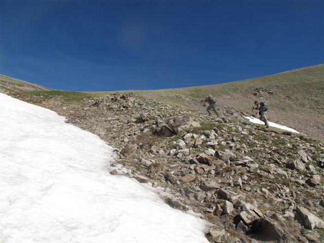
West Face of McClellan Mountain
Forum rules
- This is a mountaineering forum, so please keep your posts on-topic. Posts do not all have to be related to the 14ers but should at least be mountaineering-related.
- Personal attacks and confrontational behavior will result in removal from the forum at the discretion of the administrators.
- Do not use this forum to advertise, sell photos or other products or promote a commercial website.
- Posts will be removed at the discretion of the site administrator or moderator(s), including: Troll posts, posts pushing political views or religious beliefs, and posts with the purpose of instigating conflict within the forum.
For more details, please see the Terms of Use you agreed to when joining the forum.
-
metalmountain

- Posts: 847
- Joined: 12/17/2009
- 14ers: 42 1 2
- 13ers: 26
- Trip Reports (1)
West Face of McClellan Mountain
Does anyone have some info on a route (if one even exists) up the west face of McClellan? I searched around and couldn't find much. So if anyone has been up (or down) it and wants to share some info that would be greatly appreciated! 
"I found that nothing truly matters, that you cannot find for free." - The Gaslight Anthem
-
SnowAlien

- Posts: 1758
- Joined: 11/3/2010
- 14ers: 58 57 58
- 13ers: 653 119 15
- Trip Reports (111)
- Contact:
Re: West Face of McClellan Mountain
It is a round lump with some mining roads and ruins. Yaaawn. 
-
metalmountain
- Posts: 847
- Joined: 12/17/2009
- 14ers: 42 1 2
- 13ers: 26
- Trip Reports (1)
Re: West Face of McClellan Mountain
Haha well yes it very much looks like a rather boring lump of a mountain. But I was curious as to how one could get down from it back to Gray's Peak TH without becoming part of an unfortunate rock-a-lanche.nkan02 wrote:It is a round lump with some mining roads and ruins. Yaaawn.
"I found that nothing truly matters, that you cannot find for free." - The Gaslight Anthem
-
SeracZack
- Posts: 281
- Joined: 10/24/2011
- Trip Reports (0)
Re: West Face of McClellan Mountain
Looks like there is a possibility of a West Face ascent route. Not much listed on Summit Post about it though.
http://www.summitpost.org/mcclellan-mountain/338016
I am of no use other than that.
http://www.summitpost.org/mcclellan-mountain/338016
I am of no use other than that.
Security is mostly a superstition. It does not exist in nature, nor do the children of men as a whole experience it. Avoiding danger is no safer in the long run than outright exposure. Life is either a daring adventure, or nothing.
-Helen Keller
-Helen Keller
-
Mark A Steiner

- Posts: 1006
- Joined: 4/14/2008
- 14ers: 3
- 13ers: 11
- Trip Reports (0)
Re: West Face of McClellan Mountain
I guess McClellan is significant because of its place in Colorado history rather than its unique mountaineering opportunites. Still I won't complain because I worked my way up the east side from Waldorf, ran into a delightful goat family photo op, and still enjoyed the view from the summit. No thoughts about the west face, though.
A man named Wilcox constructed a narrow-gauge RR up the east side in the first decade of the 20th Century to a point about 500 feet from the summit - Mount Wilcox is named for him.
A man named Wilcox constructed a narrow-gauge RR up the east side in the first decade of the 20th Century to a point about 500 feet from the summit - Mount Wilcox is named for him.
Not that I speak in respect of want: for I have learned, in whatever state I am, therewith to be content - Paul the Apostle.
Like it or not, I am a slow driver. Putt ... putt ... putt ...
Good day.
Like it or not, I am a slow driver. Putt ... putt ... putt ...
Good day.
-
SnowAlien
- Posts: 1758
- Joined: 11/3/2010
- 14ers: 58 57 58
- 13ers: 653 119 15
- Trip Reports (111)
- Contact:
Re: West Face of McClellan Mountain
You take the ridge (I haven't done the section between Grays & Edwards - so you may want to get more input on that - but I've read it is supposed to be Class 2+/3 - with what looked like significant elevation gain/loss). It is barely Class 2 between McClellan & Edwards (in summer conditions, of course)metalmountain wrote:.. I was curious as to how one could get down from it back to Gray's Peak TH without becoming part of an unfortunate rock-a-lanche.

Here is the way more interesting way to do it
http://www.14ers.com/php14ers/triprepor ... ki=Include" onclick="window.open(this.href);return false;
Last edited by SnowAlien on Mon Aug 06, 2012 9:57 am, edited 1 time in total.

Re: West Face of McClellan Mountain
The ridge from Grays to Edwards is 2+. I did it this past spring and even with snow there were many options. you can spice it up a bit if you want, but nothing too outrageous. It does take a bit longer to get to Edwards from Greys then would appear.nkan02 wrote:You take the ridge (I haven't done the section between Grays & Edwards - so you may want to get more input on that - but I've read it is supposed to be Class 2+/3 with what looked like significant elevation gain/loss). It is barely Class 2 between McClellan & Edwards (in summer conditions, of course)
Once you leave Edwards and head towards McClellan there is really no 2+
I ran the ridge all the way back down to I 70. Starting from Torreys, this makes for a super fun loop (Though you should come in from Ruby of course
You can touch the void, just don't fall into it.
I fly a starship across the universe divide....and when I reach the other side...I'll find a place to rest my spirit if I can. Perhaps I may become a Mountain Man again.
I fly a starship across the universe divide....and when I reach the other side...I'll find a place to rest my spirit if I can. Perhaps I may become a Mountain Man again.

Re: West Face of McClellan Mountain
To get back to the upper lot, descend McClellan north for a ways to about 12750ish (right above the mining road switchback on the east) and then follow the prominent, tailings-filled gully between two subpoints down west to intersect the Grays Peak road around 11,200 (near a nice cabin, I think) a few minutes walk back up to the lot. Don't cut down a gully too early or the descent will be more miserable. It will still be loose and crummy, but lower angle and manageable.
"The road to alpine climbing is pocked and poorly marked, ending at an unexpectedly closed gate 5 miles from the trailhead." - MP user Beckerich
-
metalmountain
- Posts: 847
- Joined: 12/17/2009
- 14ers: 42 1 2
- 13ers: 26
- Trip Reports (1)
Re: West Face of McClellan Mountain
Nice, thanks for the info guys! I was knocking around the idea of doing a complete circuit around the area, starting with Kelso Ridge/Torreys/Grays/Edwards/McClellan. While its a long day all the climbing/hiking up high is doable, its just getting back to my car at the end of the day that I am trying to figure out the logistics of.
"I found that nothing truly matters, that you cannot find for free." - The Gaslight Anthem
-
metalmountain
- Posts: 847
- Joined: 12/17/2009
- 14ers: 42 1 2
- 13ers: 26
- Trip Reports (1)
Re: West Face of McClellan Mountain
Thanks!!! Just what I needed.Monster5 wrote:To get back to the upper lot, descend McClellan north for a ways to about 12750ish (right above the mining road switchback on the east) and then follow the prominent, tailings-filled gully between two subpoints down west to intersect the Grays Peak road around 11,200 (near a nice cabin, I think) a few minutes walk back up to the lot. Don't cut down a gully too early or the descent will be more miserable. It will still be loose and crummy, but lower angle and manageable.
"I found that nothing truly matters, that you cannot find for free." - The Gaslight Anthem

Re: West Face of McClellan Mountain
Metal,
Descending the West Face of McClellan is a nightmare...but it is expedient.
We did it about four years ago after a complete circuit of Steven's Gulch.
The gullies which, I believe Dawson refers to as, 'The Remarkables' are a nightmarishly loose
rubble strewn face of gullies.
We descended going one at a time to sheltered areas until everyone
was down safely. They're 'San Juan loose'. Even the rock attached to the crags we used while descending
down the sides of the gully crumbled away in our hands. Be careful man.
It's not something I would do again.
I suppose you could continue on McClellan's ridge over to Ganley Mountain but than you've got
the damn forest to contend with on the descent.
There is a dirt gully at the low point (saddle) between Edwards and Grays that would make for a decent and much
safer descent route. Fact, that whole ridge between Edwards & Grays is no more than easy class-3.
-
metalmountain
- Posts: 847
- Joined: 12/17/2009
- 14ers: 42 1 2
- 13ers: 26
- Trip Reports (1)
Re: West Face of McClellan Mountain
I actually stumbled across that TR a little earlier after more Googling sessions. I think the gully Monster5 is talking about is a bit further north than where you guys descended. None of them sounded like fun though. I was thinking about just heading back over Edwards after McClellan and descending from that saddle if things looked awful. I would prefer that my way down not be overly "expedient".Kiefer wrote:Metal,
Descending the West Face of McClellan is a nightmare...but it is expedient.
We did it about four years ago after a complete circuit of Steven's Gulch.
The gullies which, I believe Dawson refers to as, 'The Remarkables' are a nightmarishly loose
rubble strewn face of gullies.
We descended going one at a time to sheltered areas until everyone
was down safely. They're 'San Juan loose'. Even the rock attached to the crags we used while descending
down the sides of the gully crumbled away in our hands. Be careful man.
It's not something I would do again.
I suppose you could continue on McClellan's ridge over to Ganley Mountain but than you've got
the damn forest to contend with on the descent.
There is a dirt gully at the low point (saddle) between Edwards and Grays that would make for a decent and much
safer descent route. Fact, that whole ridge between Edwards & Grays is no more than easy class-3.
"I found that nothing truly matters, that you cannot find for free." - The Gaslight Anthem

