Colorado peak questions, condition requests and other info.
Forum rules
This is a mountaineering forum, so please keep your posts on-topic. Posts do not all have to be related to the 14ers but should at least be mountaineering-related.
Personal attacks and confrontational behavior will result in removal from the forum at the discretion of the administrators.
Do not use this forum to advertise, sell photos or other products or promote a commercial website.
Posts will be removed at the discretion of the site administrator or moderator(s), including: Troll posts, posts pushing political views or religious beliefs, and posts with the purpose of instigating conflict within the forum.
For more details, please see the Terms of Use you agreed to when joining the forum.
susanjoypaul wrote:
...and I'm not going back up there to find out
-Susan
That makes two of us!
spiderman wrote:I brought a Trimble surveying GPS up to the Mesa Peaks. The bump to the east of the pipeline road was a bit higher than the western candidate (1-2', if my memory is correct). It isn't much, but it was reliable beyond the 95% confidence level. I'm glad that it wasn't the other way around or else Chris would have to go back to tag the true summit
Very glad to hear, hehe...I'd normally tag both, but 1. the east bump seemed higher enough by visual inspection alone (ie, the other point didn't even look "as high" from the summit), and 2. I was already well past my limit of slogging through deep snow all day!
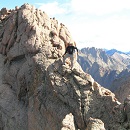
Funny enough, for such a dramatic peak, Fishers Peak proper has a very flat, indistinct summit area. I wandered the best I could to tag high ground but didn't stick around for long (it was already 3-something in the afternoon in April and I was definitely looking at at least some hiking back in the dark).
"If trees could scream, would we be so cavalier about cutting them down? We might, if they screamed all the time, for no good reason."
— Jack Handy
Proud to see this. My son had worked at Fisher Peak State Park with the Mile High Youth Corps this last summer. Lots of hard work. They spent about a month removing, and hauling off old barbed wire fence lines. Lots of cuts and torn up clothing! I'm wondering if that summit trail is runnable?
Last edited by jrs1965 on Mon Nov 27, 2023 1:40 pm, edited 1 time in total.
That's cool, Joe! I respect his hard work... I've done some bushwhacking in that area, and it's rough stuff. Lots of thorns and thistles in some places, especially older burn areas.
Trail running - I found a good phase 1 trail map and edited my original post. Looks like a decent amount of switchbacks and shallower grades on the multi-use sections 2 and 3, so that's a definite possibility! The blue section one part might be a slog up to the junction. The last 1.5 miles is harder to say. There's at least one class 2+/class 3 section to gain the summit block, but the rest might not be too bad.
The Osita Point spur (section 7) might be a cool add-on, especially if it has good views.
Any ideas about how much snow to expect down there? I would think not much at low elevation down south, but only guessing.
"Eventually, all things merge into one, and a river runs through it. The river was cut by the world's great flood and runs over rocks from the basement of time. On some of the rocks are timeless raindrops. Under the rocks are the words, and some of the words are theirs. I am haunted by waters." - Norman Maclean
wineguy wrote: ↑Mon Nov 27, 2023 6:39 pm
Any ideas about how much snow to expect down there? I would think not much at low elevation down south, but only guessing.
Based on the Snow Depth map link, it looks pretty dry!
Climbed Fishers Peak today. Get up there soon if you want a summer-like hike. Just a little snow where the trail traverses the north side of the peak, but not enough for spikes. Nice views of Spanish Peaks and southern Sangres from the trail. Felt a little guilty given how hard Susan and ChrisinZ worked to get this peak. Trail is a cruiser, about 15 miles and 3400 vertical round trip.
SpanishPeaks.jpg (439.67 KiB) Viewed 2273 times
Attachments
FishersPeak.jpg (417.67 KiB) Viewed 2273 times
"Eventually, all things merge into one, and a river runs through it. The river was cut by the world's great flood and runs over rocks from the basement of time. On some of the rocks are timeless raindrops. Under the rocks are the words, and some of the words are theirs. I am haunted by waters." - Norman Maclean
wineguy wrote: ↑Wed Dec 06, 2023 6:11 pm
Climbed Fishers Peak today. Get up there soon if you want a summer-like hike. Just a little snow where the trail traverses the north side of the peak, but not enough for spikes. Nice views of Spanish Peaks and southern Sangres from the trail. Felt a little guilty given how hard Susan and ChrisinZ worked to get this peak. Trail is a cruiser, about 15 miles and 3400 vertical round trip.
Aw, don't feel too bad...I also got Fishers Peak Mesa (ranked 9er) going the long way. Did unranked Little Fishers Peak Mesa on a separate recon trip a week earlier.
Good job getting up there! That route's on my list for next year.
Here's a shot of the old "trail" for comparison:
Attachments
FishersPeak-Small.jpg (255.61 KiB) Viewed 2175 times
wineguy wrote: ↑Wed Dec 06, 2023 6:11 pm
Climbed Fishers Peak today. Get up there soon if you want a summer-like hike. Just a little snow where the trail traverses the north side of the peak, but not enough for spikes. Nice views of Spanish Peaks and southern Sangres from the trail. Felt a little guilty given how hard Susan and ChrisinZ worked to get this peak. Trail is a cruiser, about 15 miles and 3400 vertical round trip.
Talk about timing - I did Fishers on Tuesday the 5th so if you saw any fresh footprints, they were mine. I was thinking of doing a TR on it but I literally have the same two pix you took among the ones I took. It was a fun, fun hike!
Jay521 wrote: ↑Thu Dec 07, 2023 8:25 am
I was thinking of doing a TR
Yes, TR please. How can you resist being the first to TR a new route?
"Eventually, all things merge into one, and a river runs through it. The river was cut by the world's great flood and runs over rocks from the basement of time. On some of the rocks are timeless raindrops. Under the rocks are the words, and some of the words are theirs. I am haunted by waters." - Norman Maclean